State Highway 1 (New Zealand)
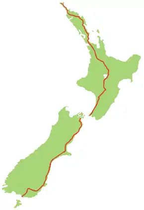
State Highway 1 (SH 1) is the longest and most significant road in the New Zealand road network, running the length of both main islands. It appears on road maps as SH 1 and on road signs as a white number 1 on a red shield, but it has the official designations SH 1N in the North Island, SH 1S in the South Island.
| ||||
|---|---|---|---|---|
 | ||||
| Route information | ||||
| Maintained by NZ Transport Agency | ||||
| Length | 2,033 km (1,263 mi) | |||
| Tourist routes | Twin Coast Discovery Highway Thermal Explorer Highway Classic New Zealand Wine Trail Alpine Pacific Triangle Southern Scenic Route | |||
| North Island (SH 1N) | ||||
| Length | 1,081 km (672 mi) | |||
| North end | Cape Reinga | |||
| Major junctions | ||||
| South end | ||||
| South Island (SH 1S) | ||||
| Length | 952 km (592 mi) | |||
| North end | ||||
| Major junctions | ||||
| South end | Bluff (Stirling Point) | |||
| Location | ||||
| Primary destinations | Whangārei, North Shore, Auckland, Manukau, Hamilton, Taupō, Porirua, Wellington, Picton, Blenheim, Christchurch, Ashburton, Timaru, Oamaru, Dunedin, Gore, Invercargill | |||
| Highway system | ||||
| ||||

SH 1 is 2,033 kilometres (1,263 mi) long, 1,081 km (672 mi) in the North Island and 952 km (592 mi) in the South Island. For the majority of its length it is a two-lane single carriageway, with at-grade intersections and property accesses, in both rural and urban areas. These sections have some passing lanes. Around 226 km (140 mi) of SH 1 is of motorway or expressway standard as of October 2017: 197 km (122 mi) in the North Island and 28 km (17 mi) in the South Island. Current road construction will see an extra 96 km (60 mi) in the North Island and 6 km (4 mi) in the South Island upgraded to motorway or expressway standard by 2022.
Route
North Island (SH 1N)
SH 1 starts at Cape Reinga, at the northwestern tip of the Aupouri Peninsula, and since April 2010 has been sealed (mainly with either chipseal or asphalt) for its entire length.[1] From Waitiki Landing south of Cape Reinga, SH 1 travels down the central-eastern side of the peninsula to Kaitaia, New Zealand's northernmost town, before turning south-east across the Northland Peninsula on to Kawakawa in the Bay of Islands where the roadway is shared by the Bay of Islands Vintage Railway track, and then south to the city of Whangārei, the largest urban area in Northland.
SH 1 then skirts the south-western Whangārei Harbour, nearing the coast briefly at Ruakākā, before proceeding down to wind through the Brynderwyn Hills before approaching the upper reaches of the Kaipara Harbour. The highway crosses into the Auckland Region, and passes through Wellsford and Warkworth, again heading for the east coast.
Near Puhoi, on the Hibiscus Coast, SH 1 widens to a four-lane motorway known as the Auckland Northern Motorway. The first 7.5 km (4.7 mi) of the motorway is an automated toll road. At Orewa, the motorway becomes toll-free, crossing farmland to the North Shore of Auckland. The road crosses through suburbs to the Waitematā Harbour, which it briefly follows before crossing it by the Auckland Harbour Bridge. The motorway comes off the bridge into Auckland's city centre, and forms its western boundary as SH 1 proceeds to the Central Motorway Junction.
At this junction, SH 1 becomes the Auckland Southern Motorway, and, after sweeping around the southern end of central Auckland, proceeds in a south-easterly direction. The motorway continues in a broadly southeast direction across the Auckland isthmus, then through Manukau and Papakura to the top of the Bombay Hills, just short of the Auckland/Waikato boundary.
At Bombay, SH 1 becomes the Waikato Expressway, a four-lane dual-carriageway expressway. The expressway takes the highway down the Bombay Hills to Mercer, where SH 1 meets the Waikato River, which it broadly follows for the next 220 km (140 mi). The Waikato Expressway ends in north-western Hamilton. The highway bypasses the city centre to the west, before crossing to the east side and proceeding south-east out of the city. The expressway resumes at Tamahere, bypassing Cambridge to the north before reverting to a single carriageway east of the town. The highway continues eastward to the town of Tīrau, where it turns south to pass through Putāruru and Tokoroa and the surrounding exotic pine plantation forest area.
At Wairakei, SH 1 takes an eastern route to bypass Taupō and meet the Lake Taupo shoreline south of the town near the airport. SH 1 follows the eastern shore of the lake for 50 km (31 mi) to Tūrangi, at the southern end of the lake.
Turning southwards again, SH 1 leaves Tūrangi and ascends onto the North Island Volcanic Plateau, passing through the fringes of the Tongariro National Park and into the Rangipo Desert, passing the volcanoes of Ruapehu, Ngauruhoe and Tongariro. The road between Rangipo (10 km (6.2 mi) south of Tūrangi) and Waiouru is commonly known as the Desert Road. SH 1 enters the Manawatū-Whanganui Region, and descends through an army training area to the end of the Desert Road at Waiouru.
From Waiouru, the highway follows tributaries of the Rangitikei River through Taihape to meet the main river at Utiku. It then follows the western bank of the Rangitikei through Ohingaiti and Hunterville to Bulls. At Bulls, SH 1 turns southeast to cross the river, turning southwest again 5 km (3.1 mi) down the road at Sanson. SH 1 crosses the Manawatu Plain, passing the city of Palmerston North about 20 km (12 mi) west of it. It passes through Foxton, before reaching the end of the plain at Levin.
.jpg.webp)
From Levin, SH 1 follows the narrowing western coastal plain southwards. The highway crosses into the Wellington Region 15 km (9 mi) south of Levin, before passing through Ōtaki. At Peka Peka, SH 1 widens to a four-lane dual carriageway known as the Kapiti Expressway. The highway bypasses the Kapiti conurbation of Waikanae, Paraparaumu and Raumati, narrowing again to a two-lane single carriageway south of Mackays Crossing and passing through Paekākāriki.
Between Paekākāriki and Pukerua Bay, SH 1 and the North Island Main Trunk rail line travel along a narrow strip of land between the hills and the sea. The Centennial Highway, as it is known, is a narrow two-lane road that was highly accident prone until a centreline wire rope crash barrier was installed. Travelling through Pukerua Bay, the road becomes dual carriageway once more to Plimmerton, narrowing to single carriageway through the northern suburbs of Porirua to Paremata. The route will be diverted east in 2020 upon the opening of the Transmission Gully Motorway.
_Gorge_Road%252C_January_1912_ATLIB_337837.png.webp)
At Paremata, SH 1 resumes as dual carriageway along the edge of the Porirua Harbour to Porirua city centre. At Porirua, the highway becomes the Johnsonville-Porirua Motorway, and travels into the northern suburbs of Wellington, New Zealand's capital city. The motorway ends at Johnsonville, and SH 1 as a six-lane arterial road descends through the Ngauranga Gorge to the Ngauranga Interchange, on the shore of Wellington Harbour.
At Ngauranga, SH 1 becomes the Wellington Urban Motorway, skirting the shore of the harbour then passing the city centre to the west. The motorway ends at Te Aro, where a one-way system takes traffic to the Basin Reserve. Northbound traffic uses the Wellington Inner City Bypass (opened 2007), while southbound traffic uses Vivian Street. From the Basin Reserve, SH 1 travels through the Mount Victoria Tunnel to Wellington's eastern suburbs and Wellington International Airport. SH 1 ends at a roundabout at the entrance to the airport.
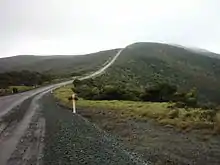 SH 1 near Cape Reinga. Sealing of this section was completed in April 2010.
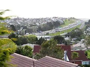 SH 1 as the Auckland Northern Motorway, looking north from Forrest Hill, North Shore.
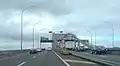 SH 1 crossing the Auckland Harbour Bridge.
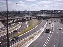 SH 1 through the Central Motorway Junction ("Spaghetti Junction").
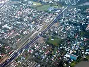 SH 1, as the Southern Motorway, in Otahuhu, Auckland
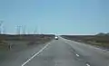 Travelling north on SH 1 through the Rangipo Desert. This section is known as the Desert Road, and is frequently closed by snow in winter.
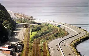 SH 1 as the Wellington Urban Motorway, running beside Wellington Harbour.
South Island (SH 1S)
The South Island section of SH 1 starts in Picton, adjacent to the railway station. Leaving Picton, SH 1 rises steeply to cross the Elevation saddle into the valley of the Tuamarina River. It descends alongside this river and across the Wairau Plain before reaching Blenheim. SH 1 passes through Weld Pass and Dashwood Pass to enter the Awatere Valley, then countiuses southward before passing Lake Grassmere. From the small town of Ward the highway heads to the coast and follows it to Kaikōura. After passing Kaikōura, it veers inland, twisting tortuously through the Hundalee Ranges before emerging at the northern end of the Canterbury Plains.
The section of highway between the Clarence River and Hapuku Rivers north of Kaikōura was closed from 14 November 2016 to 15 December 2017, due to damage from the 2016 Kaikoura earthquake.[2][3]
SH 1 passes through Amberley and Woodend before becoming the Christchurch Northern Motorway and bypassing Kaiapoi to the west. At The Groynes west of Belfast, the motorway narrows to a four-lane divided arterial. SH 1 continues around the north-western urban fringe of Christchurch, passing just east of Christchurch International Airport. At Hornby, the highway turns south-west, narrows to a two-lane undivided road and passes through Templeton. It then merges onto the Christchurch Southern Motorway where the highway becomes expressway standard until it approaches Rolleston.
South of Rolleston, SH 1 becomes virtually straight as it crosses the wide fan of the Canterbury plains, crossing the country's longest road bridge at Rakaia before reaching Ashburton, and then veering back towards the coast, which it reaches at Timaru. Between Ashburton and Timaru it crosses Rangitata Island in the Rangitata River.
South of Timaru, the road again passes through gentle hill country, staying close to the coast but largely out of sight of it. The road veers inland briefly, bypassing Waimate as it reaches the plains around the mouth of the Waitaki River, which it crosses to enter Otago. It passes through Oamaru, from where it turns inland briefly, crossing undulating hill country before again reaching the coast at Moeraki. From here the road again hugs the coast along Katiki Beach, remaining closer to the ocean than at any point since Kaikōura. The highway turns inland at Shag Point, passing through Palmerston and Waikouaiti.
South of Waikouaiti the road again becomes steep, rising sharply over the Kilmog hill before dropping down to the coast at Blueskin Bay, then rising again via Dunedin-Waitati Highway (a two- to four-lane carriageway which used to be designated a motorway) to the northern outskirts of Dunedin. From here it descends a steep, twisting stretch of Pine Hill Road through Pine Hill, before passing the University of Otago and heading through the city centre. For much of its route through Central Dunedin the highway is split into two separate northbound and southbound roads, part of the city's one-way street system. These roads traverse the central city 2–3 blocks southeast of the heart of the CBD. At the southern end of central Dunedin, the highway becomes the Caversham By-pass, which rises along the Caversham Valley before again becoming a motorway at the saddle of Lookout Point.
The four-lane motorway (Dunedin Southern Motorway) runs through Dunedin's southern suburbs until the interchange with SH 87 at Mosgiel. SH 1 then heads southwest across the Taieri Plains. The area between the Taieri and Waipori Rivers is flood-prone, and the highway crosses this on a major embankment known colloquially as the flood-free highway. SH 1 continues through gentle hill country and along the shore of Lake Waihola, then crosses the Tokomairiro Plains into Milton. South of Milton is a major junction with SH 8 at Clarksville Junction. SH 1 continues to cross rolling hill country to reach Balclutha.
From Balclutha, the highway turns west, veering briefly north as it heads inland to avoid the rough hills of The Catlins. It passes through the small town of Clinton before reaching the major provincial town of Gore. Because of the names of these two towns, this stretch of the highway was christened "The Presidential Highway" during the time of the Clinton-Gore administration in the United States. At Gore the highway crosses the Mataura River; from here the road again turns south to roughly follow the river. The highway passes through Mataura before turning west at Edendale. Many travellers choose to turn onto SH 93 at Clinton, as this route offers a shorter journey between Clinton and Mataura and bypasses Gore. Over its last stretch the road veers southwest before reaching the city of Invercargill. In central Invercargill it meets the southern end of SH 6 and turns due south, skirting the estuary of the New River and Bluff Harbour. It passes through the small town of Bluff before reaching its terminus at Stirling Point, a kilometre south of Bluff. A commemorative signpost at Stirling Point indicates distances to major world centres and to the start of the highway at Picton.
 SH 1 passing through the North Canterbury town of Cheviot
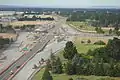 Four-laning of SH1 in Harewood, Christchurch and grade-separating at Memorial Avenue is under construction
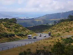 Dunedin-Waitati Hwy looking north from near the Pigeon Flat Overbridge. Blueskin Bay is visible in the background
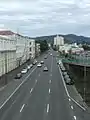 In Dunedin, the highway forms a pair multi-lane one-way streets. Cumberland Street, 1 km south of the city centre.
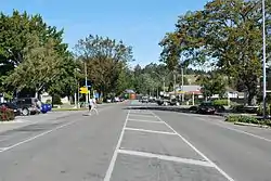
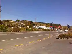 SH 1 in the Otago town of Waihola.
 Signpost at Stirling Point, Bluff.
Spur sections
| |
|---|---|
| Location | SH 1 at Taupiri – SH 1 at Cambridge |
| Length | 41.9 km (26.0 mi) |
SH 1N has one spur, SH 1B from SH 1N at Taupiri to SH 1N at Cambridge. Gazetted in 1999 it provides an eastern bypass of Hamilton.[4] The highway, at just under 42 km long, utilises many roads which were previously under the administration of the Waikato District Council. Part of the highway also shares a concurrency with SH 26. Recent progress of construction of the Waikato Expressway at Ngāruawāhia and Cambridge have also resulted in the curtailment of SH 1B at both the northern and southern termini. SH 1B is to be handed back to the Waikato District Council after the completion of the Hamilton section of the Waikato Expressway in 2020. Because it was not intended to be a permanent state highway there are intersections where the state highway gives priority to local roads in several places.[5]
SH 1K is a temporary spur assigned to the former SH 1N route between Peka Peka and Raumati via central Waikanae and Paraparaumu, bypassed by Kapiti Expressway in February 2017. The road will be transferred to the Kapiti Coast District Council in early 2019, once the NZTA has undertaken physical works to make the route fit-for-purpose as a local arterial road.
Road conditions
SH 1 has varied road conditions. For most of its length it is a two-lane single carriageway road with at-grade intersections and access, sealed with chipseal in rural areas or asphalt in urban and high-traffic areas. The highway has frequent passing lanes on these sections, to allow traffic to pass other vehicles safely. Parts of the road are steep by international standards. Most steep sections having a combination of passing lanes (uphill), and crawler lanes or stopping bays (downhill) to allow heavy and slow vehicles to pull out of the way to let other vehicles pass.
The New Zealand Transport Agency (NZTA) classifies the most part of State Highway 1 as a national strategic road. The exceptions are between Kawakawa and Whangārei and south of Mosgiel, where the SH 1 is classified as a regional strategic road, and north of Kawakawa where SH 1 is classified as a primary collector road. The sections between Wellsford and Wairakei, between Ohau and Wellington Airport, and between Woodend and Rolleston are classified as high volume roads.[6][7] The section from the Central Motorway Junction and the Newmarket Viaduct, 3 km (1.9 mi) to the south, is the country's busiest section of road, with more than 200,000 vehicle movements a day between Khyber Pass Road and Gillies Ave.[8]
NZTA announced in September 2010 that it was replacing the last three fords on SH 1S. The shingle fan fords are near Kaikōura, and while generally being dry, on about 28 days a year state highway traffic used to detour around them due to high water levels on old single-lane bridges, leading to delays on a major freight route. With the detour bridges reaching the end of their lifespan, NZTA replaced the fords with culverts.[9]
Route changes
Motorway and expressway upgrades
Construction of motorways and expressways has diverted the route of State Highway 1 in many places.
The opening of the Auckland Harbour Bridge and the Auckland Northern Motorway between Northcote Road and Fanshawe Street in May 1959 saw State Highway 1 diverted from its former route around the Waitematā Harbour. Northern extensions of the motorway in 1969 (to Tristram Avenue), 1979 (to Sunset Road) and 1984 (to Dairy Flat Highway via Greville Road) diverted State Highway 1 off Wairau Road and Albany Highway. A motorway extension from Greville Road to Silverdale in 1999 bypassed Dairy Flat Highway, which was re-designated State Highway 17. In 2009, the Northern Motorway was extended to Puhoi, bypassing Hibiscus Coast Highway through Orewa which was re-designated part of SH 17.[10] However, SH 17 was short lived, being revoked in September 2012 and reverting to a local arterial road.[11]
The Auckland Southern Motorway was built between 1953 and 1978, bypassing the former route via Great South Road. The construction of the Central Motorway Junction between 1973 and 1978 connected the Northern and Southern Motorways, taking State Highway 1 off inner Auckland streets.[10]
The Waikato Expressway north of Te Kauwhata has largely been built on the existing line of SH 1N, although at Pōkeno the highway was diverted to bypass the town to the east. South of Te Kauwhata, most of the expressway has been built on a new line bypassing the towns of Ohinewai, Ngāruawāhia, Te Rapa and Cambridge, with old sections of SH 1N reverting to local arterial roads. The former route between Taupiri and Horotiu via Ngāruawāhia was temporarily re-designated State Highway 1G before it could be transferred to the Waikato District Council.
The Wellington Urban Motorway was constructed between 1969 and 1978, but was originally part of State Highway 2 as it could only be accessed from the Hutt Valley. The construction of the Ngauranga Interchange flyovers in 1984 allowed SH 1 to be diverted onto the motorway, bypassing central Wellington streets.
The Christchurch Northern Motorway opened in 1967 between Pineacres and Belfast, bypassing the former route through Kaiapoi and providing a second road crossing of the Waimakariri River. The Western Belfast Bypass spur opened on 31 October 2017, extending the motorway southwest to The Groynes, allowing SH 1 traffic to bypass Belfast.[12]
The extension of the Dunedin Southern Motorway has also seen changes in the highway, notably to bypass the suburbs of Fairfield and Sunnyvale.
Realignments
In Hamilton, SH 1N originally ran through the city centre rather than via Frankton. The original route was via Te Rapa Road, Ulster Street (first agreed as an alternative to the northern end of Victoria St in 1930),[13] Victoria Street, Bridge Street and Cobham Drive, which is now Hamilton Urban Route 4. The current highway was diverted via Avalon Drive, Greenwood Street, Kahikatea Drive and Normandy Avenue in 1992.[14]
The route north of Wellington known as the Centennial Highway from Ngauranga to Paekākāriki was started in 1936 and opened on 4 November 1939.[15] The Centennial Highway project involved an upgrade of the Ngauranga Gorge road and provided a new route from Paremata to Paekākāriki, bypassing the winding road along the southern harbour edge from Paremata to Pāuatahanui and the tortuous narrow winding Paekakariki Hill Road between Pāuatahanui and Paekākāriki. It followed a new route, bridging the narrow channel between Paremata and the Mana isthmus and following the eastern edge of the Taupō swamp north of Plimmerton before climbing to the Pukerua Bay saddle and descending to follow the coastline to Paekākāriki.[16]
In Porirua city, in the 1990s, the road was four-laned and realigned to ease curves from just south of Pukerua Bay to Mana. In 2005–2006, SH1 through Mana was upgraded with extra lanes to provide dual carriageways through Mana during peak periods and the installation of traffic lights to regulate cross traffic. A second bridge was added to four-lane the connection of the Mana isthmus to Paremata.
In Christchurch, SH 1S originally ran via the city centre rather than around the outskirts via Harewood. The original route was via Main North Road, Cranford Street, Sherborne Street, Bealey Avenue, Madras and Gasson Streets (north)/Barbadoes Street and Waltham Road (south), Brougham Street, the Christchurch Southern Arterial Motorway, Curletts Road, Blenheim Road, and Main South Road. The section from the Queen Elizabeth II Drive to Brougham Street is now a local road, while the remainder of the route forms parts of SH 74 and 76.
Re-routing also occurred in Whangarei and Timaru, removing SH 1 from their city centres. The original route through Whangārei via Kamo Road, Bank Street, Water Street and Maunu Road was diverted via Western Hills Drive, while the original route through Timaru via Stafford and King Streets was diverted via Theodosia Street and Craigie Avenue.
Most recently, the Taupō Bypass was constructed shifting the original SH 1 from the township and lakeside to the eastern outskirts of Taupō. The bypass starts at Wairakei near the existing SH 1/SH 5 intersection and finishes to the north of Taupo Airport. The concurrency with SH 5 also follows part of the bypass.
In the southern South Island, several particularly twisting sections of SH 1S have been rebuilt to remove sharp bends and to generally improve road conditions. These include stretches at Normanby, near Timaru; Waianakarua; two stretches at Flag Swamp and Tumai between Palmerston and Waikouaiti[17]; and on the Dunedin Northern Motorway near Waitati.[18] An extensive section between Allanton and the Taieri River was realigned during the 1970s.
Former spurs
SH 1A ran from Orewa to Silverdale. When the Northern Gateway Toll Road opened, part of SH 1A was incorporated into SH 1N and the rest had its highway status revoked.
SH 1F was the name previously given to the northernmost section of SH 1N – between Cape Reinga and the junction with SH 10. This section is no longer a spur and is now part of SH 1N.
Where SH 1 has moved onto a bypass, sometimes the former route is designated a spur until such time as the road can be transferred to the local council. All these routes are unsigned and appear as local arterial roads on maps.
- SH 1D was assigned to the former SH 1S route between Abbotsford and Saddle Hill in southern Dunedin, via the suburbs of Sunnyvale and Fairfield. The route was the bypassed Fairfield section of the Dunedin Southern Motorway in 2003.
- SH 1G was assigned to the former SH 1N route between Taupiri and Horotiu via Ngāruawāhia. This section was bypassed by Waikato Expressway in December 2013.
Future improvements
State Highway 1 has been earmarked for several motorway projects most of which have surfaced from the National government's Roads of National Significance package announced in 2009.
Northland
The section of Marsden Point to Whangārei is to be upgraded to four lanes as part of the New Zealand Upgrade Programme.[19]
Auckland
The Puhoi to Wellsford motorway (Ara Tūhono) is one of the projects of the Roads of National Significance. This planned new road is also referred to as the "Holiday Highway" as the current SH 1 becomes heavily congested in holiday periods from holidaymakers travelling to and from Auckland in the summer holiday season and public holiday weekends.[20] Construction of the 18.5 km (11.5 mi) Puhoi to Warkworth section began on 8 December 2016 with the official sod-turning. The motorway will run west of the current SH 1 alignment, starting at the end of the existing Auckland Northern Motorway and terminating onto the existing highway at Kaipara Flats Road, north of Warkworth township. The new motorway is expected to open in May 2022.[21] The NZTA released its preferred alignment for the Warkworth to Wellsford section for consultation in February 2017. The motorway will run from the Puhoi to Warkworth section west of Warkworth northward, passing east of Wellsford and Te Hana to terminate onto the existing highway at Mangawhai Road, just short of the Auckland/Northland boundary.[22]
Many ideas have come forth to create a Second Harbour Crossing over Waitematā Harbour to complement the aging Auckland Harbour Bridge.[23] These include ideas for a second bridge, or a second tunnel with capacity for rail. At this stage, any meaningful progress is unlikely until at least 2025.[24]
Waikato Expressway
The Waikato Expressway from Bombay to south of Cambridge has been under construction since 1995. As of March 2020, the last section of the expressway is under construction. Upon the completion of the expressway in 2020, the entire 186 km (116 mi) route from Puhoi to Cambridge will be motorway or expressway standard.
The 22 km (14 mi) Hamilton section began construction in 2016. It is a new off-line expressway between the existing expressway at Lake Road, north of Horotiu, to the existing expressway terminus at Tamahere. It will both bypass Hamilton and replace the existing State Highway 1B route. Works are expected to be completed in late 2021.[25]
As of October 2017, the NZTA is investigating extending the Waikato Expressway south of Cambridge 16 km (9.9 mi) to the SH 1/SH 29 intersection at Piarere, bypassing the existing highway around the shores of Lake Karapiro.[26]
Levin to Wellington Airport
Construction on the Peka Peka to Ōtaki extension to the Kapiti Expressway began in mid 2017, with the road expected to open in 2021. The project involves building a 13 km (8 mi) expressway adjacent to the existing State Highway 1, from end of the existing Kapiti Expressway at Peka Peka to Taylors Road north of Ōtaki.[27]
As of February 2018, NZTA is investigating extending the Kapiti Expressway northward approximately 23 km (14 mi) to just north of Levin, bypassing Levin and the villages of Ohau and Manakau.[28][29] In December 2018, the NZTA selected its preferred corridor for a new road bypassing Levin to the east alongside part of SH 57.[30] Funding was approved by the government in January 2020.[31]
The highly controversial Transmission Gully Motorway will connect the Kapiti Expressway at Mackays Crossing to the Johnsonville-Porirua Motorway at Linden, bypassing much of Porirua City, and is due to open in November 2020. Due to the recent COVID-19 pandemic and lockdown this opening has been delayed by up to a year.[32]
Many inner city Wellington projects are also planned for SH 1 including duplication of the Terrace Tunnel and Mt Victoria tunnels. However these projects look uncertain as another planned project, the Basin Reserve Flyover failed to obtain the necessary resource consents and an appeal was rejected in the High Court.[33]
Canterbury
NZTA are investigating extending the Christchurch Northern Motorway so that it bypasses the town of Woodend.[34]
Other improvements
Several smaller projects are being undertaken to improve sections of SH 1. These include:
- Widening the Southern Motorway between Papakura and Drury South from four to six lanes.[19]
- Widening the Waimakariri River bridges on the Christchurch Northern Motorway from four to six lanes.[35]
- Raising the highway and installing culverts in flood-prone areas between Oamaru and the Kakanui River bridge.[36]
Major junctions
North Island (SH 1N)
| Territorial authority | Location | Km | Jct | Destinations | Notes |
|---|---|---|---|---|---|
| Far North District | Cape Reinga | 0 | SH 1 begins 34°25′45″S 172°40′54″E | ||
| Awanui | 104 | SH 1/Twin Coast Discovery Highway concurrency begins. Originally the start of SH 1. The highway north of here was SH 1F. | |||
| Kaitaia | 112 | Twin Coast Discovery Highway (South Road) – Town Centre, Ahipara | SH 1/Twin Coast Discovery Highway concurrency ends | ||
| Ōkaihau | 184 | ||||
| Ohaeawai | 190 | ||||
| Pakaraka | 198 | ||||
| Kawakawa | 211 | SH 1/Twin Coast Discovery Highway concurrency begins | |||
| Whangarei District | Whangārei | 266 | |||
| Otaika | 272 | SH 1/SH 15 concurrency begins | |||
| Ruakākā | 292 | SH 1/SH 15 concurrency ends | |||
| Waipu | 303 | Twin Coast Discovery Highway (Nova Scotia Drive) – Waipu, Mangawhai Heads | SH 1/Twin Coast Discovery Highway concurrency ends | ||
| Kaipara District | Brynderwyn | 319 | SH 1/Twin Coast Discovery Highway concurrency begins | ||
| Auckland | Te Hana | 339 | Twin Coast Discovery Highway (Mangawhai Road) – Tomarata, Mangawhai | ||
| Wellsford | 346 | ||||
| Puhoi | 388 | Twin Coast Discovery Highway – Auckland (via Waiwera) | Formerly SH 17. Toll-free route south SH 1/Twin Coast Discovery Highway concurrency ends | ||
| Orewa | 393 | Toll point | |||
| Silverdale | 398 | (Hibiscus Coast Highway) | Formerly SH 17. Toll-free route north | ||
| Albany | 412 | Greville Road – Browns Bay, Massey University, Albany | Formerly SH 17 | ||
| Unsworth Heights | 414 | ||||
| Northcote Point | 423 | Auckland Harbour Bridge (Waitematā Harbour) | |||
| Auckland CBD | 426 | Southbound exit and northbound entrance Auckland Northern Motorway becomes Auckland Southern Motorway | |||
| 428 | Northbound exit and southbound entrance | ||||
| 429 | Northbound exit and southbound entrance | ||||
| Manukau CBD | 449 | ||||
| Drury | 461 | ||||
| Bombay | 471 | (Mill Road) – Bombay, Pukekohe | Auckland Southern Motorway becomes | ||
| Waikato District | Pōkeno | 477 | 37°13′49″S 175°00′57″E | ||
| Taupiri | 527 | ||||
| Horotiu | 538 | Te Rehu O Waikato Bridge (Waikato River) | |||
| 542 | |||||
| Hamilton City | Rotokauri | 546 | (Wairere Drive) – Te Rapa, Chartwell | Northbound exit and southbound entrance only Waikato Expressway ends | |
| Frankton | 551 | ||||
| Melville | 553 | 37°48′30″S 175°16′50″E | |||
| 555 | Cobham Bridge (Waikato River) | ||||
| Riverlea | 556 | ||||
| Waikato District | Tamahere | 559 | (Bollard Road) | Waikato Expressway resumes | |
| 560 | |||||
| Waipa District | Cambridge | 572 | |||
| 577 | (Tirau Road) – Cambridge, Te Awamutu | Waikato Expressway ends | |||
| Matamata-Piako District | District contains no major junctions | ||||
| Piarere | 594 | Intersection lies on the border between the two districts | |||
| South Waikato District | |||||
| Tīrau | 605 | ||||
| 607 | SH 1/Thermal Explorer Highway concurrency ends 37°59′06″S 175°46′04″E | ||||
| Putāruru | 613 | ||||
| Tokoroa | 638 | ||||
| Upper Atiamuri | 657 | SH 1/SH 30 concurrency begins | |||
| Atiamuri | 663 | SH 1/SH 30 concurrency ends | |||
| Waikato River | |||||
| Taupo District | |||||
| Wairakei | 695 | (Wairakei Drive) – Taupō | SH 1/SH 5/Thermal Explorer Highway concurrency begins 38°37′24″S 176°05′59″E | ||
| Taupō | 696 | Waikato River | |||
| 706 | (Napier Road) – Taupō | SH 1/SH 5/Thermal Explorer Highway concurrency ends 38°42′16″S 176°06′43″E | |||
| Tūrangi | 753 | ||||
| Rangipo | 763 | Desert Road begins | |||
| Desert Road | 794 | Desert Road Summit 1,074 m (3,524 ft) | 39°18′10″S 175°44′28″E | ||
| Ruapehu District | |||||
| Waiouru | 815 | Desert Road ends | |||
| Rangitikei District | Vinegar Hill | 885 | |||
| Bulls | 925 | SH 1/SH 3 concurrency begins 40°10′28″S 175°23′04″E | |||
| 927 | Rangitikei River | ||||
| Manawatu District | Sanson | 931 | SH 1/SH 3 concurrency ends 40°13′13″S 175°25′27″E | ||
| Horowhenua District | 966 | Manawatu River | |||
| Ohau | 985 | ||||
| Kapiti Coast District | Peka Peka | 1012 | (Peka Peka Road) – Peka Peka, Waikanae | SH 1 becomes | |
| Mackays Crossing | 1030 | (Whareroa Road) – Queen Elizabeth Park | Kapiti Expressway ends | ||
| Porirua City | Paremata | 1050 | |||
| Porirua CBD | 1055 | (Mungavin Avenue) – Porirua, Titahi Bay, Tawa | |||
| Wellington City | Johnsonville | 1065 | (Johnsonville Road) – Johnsonville | Johnsonville-Porirua Motorway ends | |
| Ngauranga | 1068 | 41°14′49″S 174°48′52″E | |||
| Te Aro | 1075 | Willis Street | Wellington Urban Motorway ends | ||
| Rongotai | 1081 | (Broadway) – Strathmore, Seatoun (Stewart Duff Drive) – Airport | SH 1 ends 41°19′33″S 174°48′35″E | ||
South Island (SH 1S)
| Territorial authority | Location | Km | Jct | Destinations | Notes |
|---|---|---|---|---|---|
| Marlborough District | Picton | 0 | SH 1 and SH 1/Classic New Zealand Wine Trail concurrency begins | ||
| 1 | |||||
| Tuamarina | 20 | Wairau River | |||
| Spring Creek | 23 | ||||
| Blenheim | 28 | ||||
| 29 | Park Terrace Redwood Street – Redwoodtown Main Street – Town Centre Main North Line | Rail line bisects roundabout Classic NZ Wine Trail and SH 1/Classic NZ Wine Trail concurrency ends. | |||
| Seddon | 50 | Awatere River | |||
| Kaikoura District | Kowhai | 163 | SH 1/Alpine Pacific Triangle concurrency begins | ||
| Hurunui District | Ethelton | 247 | Hurunui River | Only remaining one-lane bridge on SH 1S | |
| Waipara | 284 | ||||
| Amberley | 291 | Alpine Pacific Triangle ends. SH 1/Alpine Pacific Triangle concurrency ends. | |||
| Waimakariri District | Pineacres | William Street | |||
| Kaiapoi | 323 | ||||
| Chaneys | 328 | Waimakariri River | |||
| Christchurch City | |||||
| 329 | Christchurch Northern Motorway diverges from SH 1 Western Belfast Bypass begins | ||||
| Belfast | 330 | Main North Road – Belfast, City Centre, Lyttelton | |||
| 334 | Johns Road – Belfast | Western Belfast Bypass ends | |||
| Harewood | 341 | ||||
| Masham | 344 | ||||
| Hornby | 347 | Main South Road – City Centre, Lyttelton, Akaroa | Formerly SH 73A | ||
| Selwyn District | Templeton | 354 | |||
| Rolleston | 358 | Weedons Road – Rolleston, Lincoln Weedons Ross Road – West Melton | Christchurch Southern Motorway ends | ||
| Rakaia | 400 | Rakaia Bridge (Rakaia River) 1.76 km (1.09 mi) | Longest road bridge in New Zealand | ||
| Ashburton District | |||||
| Ashburton | 430 | ||||
| Timaru District | Rangitata | 465 | |||
| Winchester | 481 | ||||
| Washdyke | 501 | ||||
| Timaru | 506 | ||||
| Waimate District | Makikihi | 543 | |||
| Glenavy | 569 | Waitaki River | |||
| Waitaki District | |||||
| Pukeuri Junction | 583 | ||||
| Palmerston | 651 | ||||
| Dunedin City | Dunedin Central | 706 | |||
| Caversham | 709 | ||||
| Lookout Point | 710 | (Main South Road) | SH 1 becomes | ||
| Mosgiel | 720 | ||||
| 721 | (Braeside) | Dunedin Southern Motorway ends | |||
| Allanton | 729 | ||||
| 736 | Taieri River | ||||
| Clutha District | Waihola | 746 | SH 1/Southern Scenic Route concurrency begins | ||
| Clarksville | 765 | ||||
| Balclutha | 786 | Balclutha Bridge (Clutha River) | |||
| 787 | SH 1/Southern Scenic Route concurrency ends | ||||
| Clinton | 817 | ||||
| Gore District | McNab | 854 | |||
| Gore | 858 | Mataura River | |||
| Mataura | 870 | ||||
| 872 | |||||
| Southland District | Dacre | 900 | Alternative route to SH 6 and SH 99, bypassing Invercargill | ||
| Invercargill City | Invercargill City Centre | 922 | SH 1/Southern Scenic Route concurrency begins | ||
| 923 | SH 1/Southern Scenic Route concurrency ends | ||||
| Bluff | 952 | SH 1 ends | |||
SH 1B
| Territorial authority | Location | Km | Jct | Destinations | Notes |
|---|---|---|---|---|---|
| Waikato District | Taupiri | 0 | SH 1B begins | ||
| Newstead | 27 | SH 1B/SH 26 concurrency begins | |||
| 28 | SH 1B/SH 26 concurrency ends | ||||
| Waipa District | Cambridge | 42 | SH 1B ends | ||
| (Victoria Road) – Cambridge |
See also
- List of New Zealand state highways
- List of roads and highways, for notable or famous roads worldwide
References
| Wikimedia Commons has media related to State Highway 1 (New Zealand). |
- "Final few metres of SH1 sealed". The New Zealand Herald. 22 April 2010. Retrieved 21 September 2010.
- "Rail near Kaikoura likely out for a year, 'unprecedented' damage to highway". Stuff.co.nz. 19 November 2016. Retrieved 17 December 2016.
- "Kaikoura Earthquake Response". NZ Transport Agency. Retrieved 12 August 2018.
- "Declaring New Sections of State Highway: State Highway No. 1B and State Highway No. 39". NZ Gazette. 16 December 1999. Retrieved 11 May 2017.
- "Improving the safety of State Highway 1B". NZ Transport Agency. 8 May 2017. Retrieved 11 May 2017.
- "One Network Road Classification: North Island State Highways" (PDF). New Zealand Transport Agency. Retrieved 9 February 2016.
- "One Network Road Classification: South Island State Highways" (PDF). New Zealand Transport Agency. Retrieved 9 February 2016.
- "State highway frequently asked questions". NZTA.
- "End of the road for last traffic fords left on State Highway 1". Media statement. NZTA, Christchurch Regional Office. 27 September 2010. Retrieved 29 September 2010.
- "Auckland Motorways 2008" (PDF). New Zealand Transport Agency. Retrieved 21 January 2017.
- Matthews, Martin (27 September 2012). "Revoking Sections of State Highway and Declaring Sections of State Highway-State Highways 16, 17, 18, 18A and 20, Auckland". New Zealand Gazette. New Zealand Government. 2012 (120): 3428. Retrieved 22 January 2017.
- Northcott, Maddison (31 October 2017). "Christchurch's Western Belfast Bypass opening to traffic". Stuff.co.nz. Retrieved 31 October 2017.
- Zealand, National Library of New. "TOO MANY ACCIDENTS. (New Zealand Herald, 1930-06-20)". paperspast.natlib.govt.nz. Retrieved 24 July 2016.
- "SH1 Avalon Drive Bypass". www.nzta.govt.nz. NZ Transport Agency. Retrieved 1 November 2017.
- Reilly, Helen (2013). Pauatahanui: A local history. Wellington: Pauatahanui Residents Association. pp. 128–129. ISBN 978-0-473-25439-1.
- Centennial Highway, State Highway 1 (Ngauranga Gorge to Paekakariki), ENGINEERING HERITAGE NEW ZEALAND, IPENZ, accessed 6 October 2016
- Google maps view showing the highway at Flag Swamp and its former route immediately to the west
- Google maps view showing the highway and its former S-shaped route above Waitati
- Coughlan, Thomas (29 January 2020). "Government announces billions of infrastructure spending, with roads the big winner". Stuff. Retrieved 2 February 2020.
- "'Holiday Highway' approved". Stuff.co.nz. 25 July 2014. Retrieved 12 January 2017.
- Clayton, Renee (9 December 2017). "The sod has been turned to kick off the construction of the Puhoi to Warkworth motorway". Rodney Times (via Stuff.co.nz). Retrieved 15 February 2017.
- Graaf, Peter de (15 February 2017). "Motorway route bypasses Wellsford, Dome Valley" – via New Zealand Herald.
- "SH1 Additional Waitematā Harbour Crossing project". Nzta.govt.nz.
- "Plan to 'future-proof' second Waitematā Harbour crossing". The New Zealand Herald. 16 March 2015.
- "Hamilton". Nzta.govt.nz.
- "Short-list of options for key State Highway 1 route through Waikato released". NZTA. 20 October 2017.
- "Peka Peka to Ōtaki Expressway". Nzta.govt.nz.
- "Ōtaki to north of Levin". New Zealand Transport Agency. Retrieved 6 February 2018.
- "Last pieces of $2 billion roading puzzle shock some affected residents". The Dominion Post. 5 February 2018. Retrieved 6 February 2018.
- "NZTA announces selection of Ōtaki to north of Levin corridor". Nzta.govt.nz. 12 December 2018. Retrieved 3 January 2019.
- Small, Zane (29 January 2020). "New Zealand Upgrade Programme: A closer look at the $8 billion transport spend". Newshub. Retrieved 2 February 2020.
- "Transmission Gully Motorway". Nzta.govt.nz.
- "Basin Reserve flyover project killed off by the High Court". Stuff.co.nz. Retrieved 21 August 2015.
- "Woodend Corridor Improvements; NZ Transport Agency". Nzta.govt.nz.
- "Significant upgrade coming to Waimakariri bridges". Stuff. Retrieved 20 February 2020.
- "$23m infrastructure boost for South". Otago Daily Times Online News. 28 February 2020. Retrieved 28 February 2020.
| National | ||
|---|---|---|
| North Island |
| |
| South Island | ||
| Former state highways | ||
| Touring routes |
| |