Častá
Častá (Hungarian: Cseszte, German: Schattmannsdorf) is a village and municipality in western Slovakia in Pezinok District in the Bratislava Region, on the foothills of the Little Carpathians. The village is best known for the Červený Kameň Castle, which is above the village.
Častá
Cseszte | |
|---|---|
Village | |
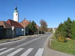 Main street in Častá | |
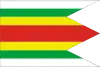 Flag  Coat of arms | |
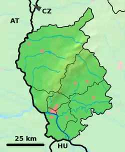 Častá Location of Častá in the Bratislava Region  Častá Častá (Slovakia) | |
| Coordinates: 48°23′00″N 17°22′00″E | |
| Country | Slovakia |
| Region | Bratislava |
| District | Pezinok |
| First mentioned | 1240 |
| Government | |
| • Mayor | Mgr. Robert Lederleitner (independent) |
| Area | |
| • Total | 35.352 km2 (13.649 sq mi) |
| Elevation | 245 m (804 ft) |
| Population (2005) | |
| • Total | 2,078 |
| • Density | 59/km2 (150/sq mi) |
| Postal code | 900 89 |
| Area code(s) | +421-33 |
| Car plate | PK |
| Website | www.casta.sk |
History
The village was first mentioned in 1296, when it was established as a settlement under the Červený Kameň Castle. From 1944 to 1953, Častá had the village of Píla as its part.
Geography
The village lies at an altitude of 245 meters and covers an area of 35.24 km². It has population of 2,078 people.
Events
Hiking: “Častá's Fifty” (Častovská pädesiatka). Every year on the 8th of May a day hike takes place crossing the Little Carpathians to Záhorie and back usually starting at the gas station in Častá (6:00-9:30am) finishing on Častá's football field restaurant. You can choose 50-, 35-, 25-, or 12-km trails.
Famous people
- Juraj Fándly, writer
References
Genealogical resources
The records for genealogical research are available at the state archive "Statny Archiv in Bratislava, Slovakia"
- Roman Catholic church records (births/marriages/deaths): 1639-1896 (parish A)
External links
![]() Media related to Častá at Wikimedia Commons
Media related to Častá at Wikimedia Commons
- Municipal website (in Slovak)
- Surnames of living people in Casta
Municipalities of Pezinok District | ||
|---|---|---|
| Authority control |
|---|