Đáy River
The Day River (Vietnamese: Sông Đáy) is a river in Vietnam. It was formerly known as Sông Hát or Hát Giang. The river is a distributary of the Red River, draining into the Gulf of Tonkin.
| Hát Giang, sông Gián Khẩu | |
|---|---|
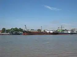 Day River through Ninh Phúc Port | |
| Location | |
| Country | Vietnam |
| Region | Hà Nội, Hòa Bình, Hà Nam, Ninh Bình and Nam Định |
| Physical characteristics | |
| Source | |
| • location | Geladaindong Peak, Tanggula Mountains, Qinghai (Đan Phượng) |
| • elevation | 5,042 m (16,542 ft) |
| Mouth | |
• location | Đáy Mouth, Kim Sơn |
• elevation | 0 m (0 ft) |
| Length | 240 km (150 mi) |
The river has a length of 240 km[1] and has a drainage basin of more than 7,500 km²,[2] flowing through Hanoi, and the provinces of Hòa Bình, Hà Nam, Ninh Bình and Nam Định.
See also
References
This article is issued from Wikipedia. The text is licensed under Creative Commons - Attribution - Sharealike. Additional terms may apply for the media files.