Hòa Bình Province
Hòa Bình (Vietnamese: [hʷâː ɓîŋ̟] (![]() listen)) is a mountainous province of Vietnam, located in the nation's Northwest region. It borders Phú Thọ Province and Sơn La Province to the northwest, Hanoi to the northeast, Hà Nam Province to the east, Ninh Bình Province to the southeast and Thanh Hóa Province to the south. In 2004, the GDP per capita of the province was estimated to be $228 (equivalent to 3.6 million Vietnamese đồng).
listen)) is a mountainous province of Vietnam, located in the nation's Northwest region. It borders Phú Thọ Province and Sơn La Province to the northwest, Hanoi to the northeast, Hà Nam Province to the east, Ninh Bình Province to the southeast and Thanh Hóa Province to the south. In 2004, the GDP per capita of the province was estimated to be $228 (equivalent to 3.6 million Vietnamese đồng).
Hòa Bình Province
Tỉnh Hòa Bình | |
|---|---|
 | |
 Seal | |
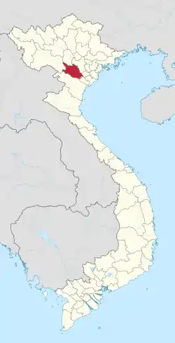 Location of Hòa Bình within Vietnam | |
| Coordinates: 20°20′N 105°15′E | |
| Country | |
| Region | Northwest |
| Capital | Hòa Bình |
| Government | |
| • People's Council Chair | Nguyễn Văn Quang |
| • People's Committee Chair | Bùi Văn Tỉnh |
| Area | |
| • Total | 4,662.5 km2 (1,800.2 sq mi) |
| Population (2019) | |
| • Total | 854,131 |
| • Density | 180/km2 (470/sq mi) |
| Demographics | |
| • Ethnicities | Vietnamese, Mường, Tày and other Tai peoples, Dao |
| Time zone | UTC+7 (ICT) |
| Area codes | 218 |
| ISO 3166 code | VN-14 |
| Website | www |
Administrative divisions
Hòa Bình is subdivided into 10 district-level sub-divisions:
| Second Tier subdivisions |
Area (km²) |
Third Tier subdivisions | ||
|---|---|---|---|---|
| Wards | Townships | Communes | ||
| Hòa Bình city | 344.10 | 9 | 1 | 16 |
| Cao Phong District | 254.37 | 1 | 12 | |
| Đà Bắc District | 779.04 | 1 | 19 | |
| Kim Bôi District | 549.50 | 1 | 27 | |
| Lạc Sơn District | 581.00 | 1 | 28 | |
| Lạc Thủy District | 293.00 | 1 | 13 | |
| Lương Sơn District | 369.85 | 1 | 19 | |
| Mai Châu District | 564.54 | 1 | 22 | |
| Tân Lạc District | 523.00 | 1 | 23 | |
| Yên Thủy District | 282.00 | 1 | 12 | |
They are further subdivided into 11 commune-level towns (or townlets), 191 communes, and eight wards. Among them, Mai Châu district is the region with the most potential for economic and tourism development of Hòa Bình province.[1]
The People's Council of Hòa Bình Province decided in February 2006 to make Hòa Bình the capital of the province.
History
Hòa Bình Province was created on June 22, 1886, following the decree of Tonkin with the name "Mường Province", splitting Mường majority areas from Hưng Hóa Province, Sơn Tây Province, Hanoi and Ninh Bình Province. Its name derives from the Sino-Vietnamese 和平, meaning "peace."
The province was administered from Chợ Bờ (in Đà Bắc District), hence it was also known as "Chợ Bờ Province", until in November of the same year, it was relocated to Phương Lâm District (today in Bất Bạt District, Hà Tây Province). In April 1888 it was renamed "Phương Lâm Province" by the French colonial authorities.
On March 18, 1891, the Governor-General of French Indochina decreed that the name of the province would change to Hòa Bình Province with six districts: Lương Sơn, Kỳ Sơn, Lạc Sơn, Lạc Thủy, Mai Châu and Đà Bắc.
On October 15, 1957, Tân Lạc District was formed from a portion of Lạc Sơn District.
On April 17, 1959, Kim Bôi District was formed from a portion of Lương Sơn District.
On August 17, 1964, Yên Thủy District was formed from a portion of Lạc Thủy District.
On December 12, 2001, Cao Phong District was formed from a portion of Kỳ Sơn District.
On December 17, 2019, Kỳ Sơn District was annexed by the city of Hòa Bình.
Demographics
Mường (63.4%) is the major ethnic group of Hòa Bình Province, followed by Kinh (27.7%).[2]
References
- "Mai Chau - A beautiful destination". Retrieved 3 October 2019.
- "Archived copy". Archived from the original on 2014-02-02. Retrieved 2014-02-01.CS1 maint: archived copy as title (link)
External links
- Official website
- http://tinhuyhoabinh.vn/chuyenmuc/tabid/235/cMenu1/20/cMenu0/155/TopMenuId/155/cMenu/155/stParentMenuId/20/Default.aspx
![]() Media related to Hoa Binh at Wikimedia Commons
Media related to Hoa Binh at Wikimedia Commons
Places adjacent to Hòa Bình Province | ||||||||||
|---|---|---|---|---|---|---|---|---|---|---|
| ||||||||||