1942 Ecuador earthquake
The 1942 Ecuador earthquake which occurred on 13 May at 9:13 pm ECT with a moment magnitude of 7.8 struck the coastal regions of Ecuador, causing damage mainly to cities like Guayaquil, Portoviejo and Guaranda.[1] An estimated 200 people lost their lives and the total damage cost about US$2.5 million (1942 rate) as a result.[2]
 | |
| UTC time | 1942-05-14 02:13:27 |
|---|---|
| ISC event | 900274 |
| USGS-ANSS | ComCat |
| Local date | 13 May 1942 |
| Magnitude | 7.8 Mw 7.9-8.3 Ms 7.7 mb |
| Depth | 20.0 km |
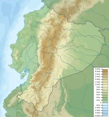
| Epicenter | 0.025°N 79.955°W |
| Type | Thrust |
| Areas affected | Ecuador |
| Total damage | $40 million (2021 rate) |
| Max. intensity | IX (Violent) |
| Casualties | 200+ dead |
Earthquake
The Nazca Plate dives beneath the South American Plate along a convergent plate boundary stretching from Colombia to Chile. This plate boundary occasionally produces large megathrust earthquakes along the west coast of South America. The Ecuador–Colombia subduction zone is occupies part of this plate boundary, where the convergence rate is between 5 and 8 cm/yr.[3]
The earthquake which was remains of the largest in the country had ruptured a section of the subduction zone that was involved in the 1906 event which broke the fault for approximately 500 km. It was the first event in a sequence of quakes that would re-rupture the subduction zone with subsequent events in 1958, 1979 and 1998, while the 2016 event was a repeat of the 1942 earthquake.[4][5][6] This was similar to what was seen in Sumatra in the beginning of the 21st century with multiple earthquakes rupturing the subduction zone rather than in one large event.[7]
Effects
Ecuador's largest city Guayaquil suffered the worst during the earthquake, with an more than 100 lives lost, and numerous high rise collapses. Moderate to high damage was reported in the city, at least 250 km from the earthquake. In the commercial center, the earthquake had a maximum intensity of IX (Violent) to VIII (Severe) on the Mercalli intensity scale, while the rest of the city and surrounding towns were exposed to intensity VII (Very strong) to VI (Strong).[8] In this zone of high intensity, one reinforced concrete building completely collapsed while another was almost completely destroyed. Another three structures had beams in their first floors so badly rendered that supports had to be installed immediately before they could be repaired or demolished. The location where the strongest intensity was felt in Guayaquil is just west of the Guayas River, and south of Cerro Del Carmen. The reason for the sudden violent shaking in this part of the city was attributed to its location—the city is built on water-saturated clay and alluvium deposited by the Guayas River.[8] This local geological setting amplified the seismic waves which worsened the strength of ground motion in the city.
References
- "Seismic Hazard Assessment for Guayaquil City (Ecuador): Insights from Quaternary Geological Data" (PDF). Final Meeting of the Dark Nature Project: 55–56.
- "Significant Earthquake Information ECUADOR: GUAYAQUIL". NGDC. Retrieved 19 January 2021.
- Yamanaka, Y., Tanioka, Y. & Shiina, T. (2017). "A long source area of the 1906 Colombia–Ecuador earthquake estimated from observed tsunami waveforms". Earth Planets Space. 69: 163. doi:10.1186/s40623-017-0750-z.CS1 maint: multiple names: authors list (link)
- "CUATRO AÑOS DESPUÉS DEL TERREMOTO DE PEDERNALES: UN TESTIMONIO SOBRE EL PELIGRO SÍSMICO EN EL ECUADOR". Instituto Geofisico. 16 April 2020. Retrieved 19 January 2021.
- Lingling Ye, Hiroo Kanamori, Jean-Philippe Avouac, Linyan Li, Kwok Fai Cheung, Thorne Lay (2016). "The 16 April 2016, MW 7.8 (MS 7.5) Ecuador earthquake: A quasi-repeat of the 1942 MS 7.5 earthquake and partial re-rupture of the 1906 MS 8.6 Colombia–Ecuador earthquake" (PDF). Earth and Planetary Science Letters.CS1 maint: multiple names: authors list (link)
- "M 7.2 - near the coast of Ecuador". USGS-ANSS. Retrieved 19 January 2021.
- B. Gombert, Z. Duputel, R. Jolivet, M. Simons, J. Jiang, C. Liang, E.J. Fielding, L. Rivera (2018). "Strain budget of the Ecuador–Colombia subduction zone: A stochastic view". Earth and Planetary Science Letters. 498: 288–299. doi:10.1016/j.epsl.2018.06.046. ISSN 0012-821X.CS1 maint: multiple names: authors list (link)
- Villacres, Alex (1996). "The 1942 Guayaquil earthquake, recent evidences" (PDF). Eleventh World Conference on Earthquake Engineering. 131. ISBN 0 08 042822 3 – via Elsevier.