Aborrebjerg
Aborrebjerg is a hill on the Danish island of Møn.
| Aborrebjerg | |
|---|---|
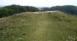 Aborrebjerg summit | |
| Highest point | |
| Elevation | 143 m (469 ft) [1] |
| Prominence | 143 m (469 ft) [2] |
| Coordinates | 54°58′53″N 12°31′47″E |
| Geography | |
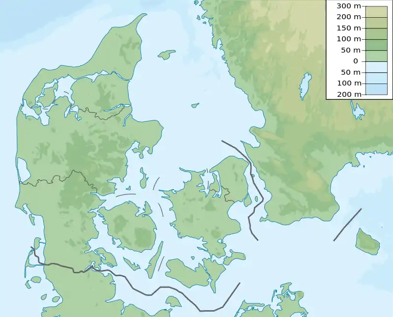 Aborrebjerg Location of Aborrebjerg in Denmark | |
| Location | Møn, Denmark |
| Geology | |
| Mountain type | Sedimentary rocks (chalk) |
| Climbing | |
| Easiest route | Hike |
Geography
The hill stands at 143 m (469 ft) and is the highest point in Møn island and the eighth in Denmark,[3] very close to Møns Klint.
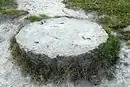
Aborrebjerg is mainly covered by wood and shrubs like junipers; behind it some ponds are located.[4] The summit is marked with a circular stone.
Geology
As well as the neighbouring cliffs Aborrebjerg bedrock is chalk, which originated during the Cretaceous and was later lifted to its present location by tectonic movements following the ice ages.[5]
Access to the summit
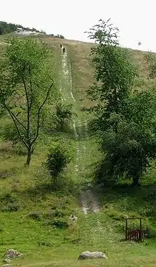
The can be easily reached through a waymarked foothpath. From the summit there is a good view. With good weather looking west both Farøbroerne and Queen Alexandrine Bridge can be seen, while looking north one can see up to Stevns.[6]
References
- "Aborrebjerg 143m" (in Danish). Retrieved 2016-12-27.
- "Aborrebjerg, Denmark". Peakbagger.com. Retrieved 2016-12-27.
- "The highest peaks of Denmark". Retrieved 2016-12-27.
- Denmark. Nagel. 1956. p. 63.
- Stig A. Schack Pedersen, Peter Gravesen. Structural development of Maglevandsfald: a key to understanding the glaciotectonic architecture of Møns Klint, SE Denmark (PDF). Archived from the original (PDF) on 2016-12-27. Retrieved 2016-12-27.
- Møns Klint and Klintholm (PDF). Danish Ministry of the Environment. Retrieved 2016-12-27.
External links
- Hiking guide: "Klinteskov und Jydelejet".
![]() Media related to Aborrebjerg at Wikimedia Commons
Media related to Aborrebjerg at Wikimedia Commons
