Abu Rummaneh
Abu Rummaneh (Arabic: أبو رمانة) is an upscale neighborhood and district of the Muhajirin municipality in western Damascus, Syria. It had a population of 6,421 in the 2004 census.[1] The quarter is centered on the palm-tree-lined Abu Rummaneh Boulevard, known officially as al-Jalaa Boulevard, named for the evacuation of French mandate troops from Syria. The neighborhood serves as Damascus' diplomatic quarter, also housing the Arab Cultural Center and the French Institute for Arab Studies (IFEAD). The smaller streets on either side of the boulevard are lined by expensive, old-money apartment buildings, owned by wealthy Damascenes.[2]
Abu Rummaneh
أبو رمانة | |
|---|---|
Neighborhood | |
 Abu Rummaneh skyline, 1959 | |
 Abu Rummaneh Location in Syria | |
| Coordinates: 33°31′22″N 36°16′54″E | |
| Country | |
| Governorate | Damascus Governorate |
| Subdistrict | Damascus |
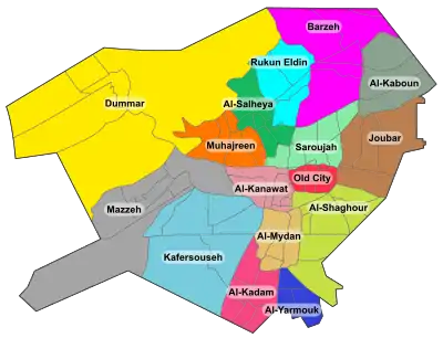
| Municipality | Qanawat |
| Population (2004) | |
| • Total | 6,421 |
References
- "Damascus Governorate Population 2004 Census". Archived from the original on 2012-08-01. Retrieved 2016-04-08.
- Salamandra, Christa (2004). A new old Damascus: authenticity and distinction in urban Syria. Indiana University Press. p. 38. ISBN 0-253-21722-9.
|   | |||||||
|
| ||||||||
| ||||||||
| ||||||||
| ||||||||
| ||||||||
| ||||||||
| ||||||||
| ||||||||
| ||||||||
| ||||||||
| ||||||||
| ||||||||
| ||||||||
| ||||||||
This article is issued from Wikipedia. The text is licensed under Creative Commons - Attribution - Sharealike. Additional terms may apply for the media files.