Acultzingo
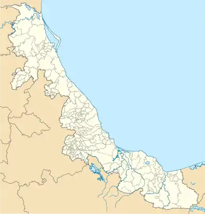
Acultzingo Municipality is a municipality in Veracruz, Mexico. It is located about 220 km from state capital Xalapa to the south-west.
Acultzingo | |
|---|---|
Ciy and Municipality | |
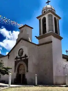 Church of San Juan Bautista | |
 Acultzingo Acultzingo | |
| Coordinates: 18°43′N 97°19′W | |
| Country | |
| State | Veracruz |
| Municipality | Acultzingo |
| Government | |
| • Municipal President | René Medel Carrera (PES) |
| Area | |
| • Total | 167.89 km2 (64.82 sq mi) |
| Population (2010) Municipality | |
| • Total | 20,973 |
| • Density | 120/km2 (320/sq mi) |
| Demonym(s) | Acultzinguense |
| Time zone | UTC−06:00 (Central) |
| • Summer (DST) | UTC-5:00 |
| LADA | 272 |
| Website | www |
Borders
Acultzingo Municipality is delimited to the east by Soledad Atzompan Municipality, to the south and the west by the Puebla State and to the north by Aquila Municipality.[1]
Climate
| Climate data for Acultzingo | |||||||||||||
|---|---|---|---|---|---|---|---|---|---|---|---|---|---|
| Month | Jan | Feb | Mar | Apr | May | Jun | Jul | Aug | Sep | Oct | Nov | Dec | Year |
| Average high °C (°F) | 20.5 (68.9) |
21.9 (71.4) |
26.0 (78.8) |
28.1 (82.6) |
27.5 (81.5) |
26.0 (78.8) |
24.8 (76.6) |
25.1 (77.2) |
24.7 (76.5) |
23.6 (74.5) |
22.3 (72.1) |
20.3 (68.5) |
24.2 (75.6) |
| Average low °C (°F) | 6.9 (44.4) |
8 (46) |
10.4 (50.7) |
12.6 (54.7) |
13.1 (55.6) |
13.4 (56.1) |
12.4 (54.3) |
12.3 (54.1) |
12.9 (55.2) |
11.4 (52.5) |
9.1 (48.4) |
7.9 (46.2) |
10.9 (51.6) |
| Average precipitation mm (inches) | 7.6 (0.3) |
5.1 (0.2) |
10 (0.4) |
20 (0.8) |
46 (1.8) |
110 (4.4) |
110 (4.4) |
100 (4) |
110 (4.2) |
30 (1.2) |
15 (0.6) |
13 (0.5) |
580 (22.8) |
| Source: Weatherbase [2] | |||||||||||||
References
- "Enciclopedia de los Municipios de México: Acultzingo" (in Spanish). Gobierno Estatal. Archived from the original on 2006-10-26. Retrieved 2009-05-20.
- "Weatherbase: Historical Weather for Acultzingo, Veracruz". Weatherbase. 2011. Retrieved on November 24, 2011.
External links
This article is issued from Wikipedia. The text is licensed under Creative Commons - Attribution - Sharealike. Additional terms may apply for the media files.
