Adi Quala
Adi Quala (Tigrinya: ዓዲ ዃላ Tigrinya pronunciation: [ʕadi xʷala]) is a market town in southern (Debub) part of Eritrea. It is located 32 km south of Mendefera nearly 25 km from the Ethiopian border, over 2,000m above sea level.
Adi Quala
ዓዲ ዃላ | |
|---|---|
Town | |
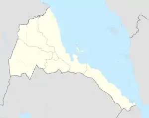 Adi Quala Location in Eritrea | |
| Coordinates: 14°38′N 38°50′E | |
| Country | |
| Region | Debub |
| District | Adi Quala |
| Government | |
| Climate | Cwb |
Overview
Adi Quala is known for its tukul (hut) church St Marry church with its frescoes and its mausoleum for the Italian Army soldiers who died at the Battle of Adwa and Gundet. The town has a population of more than 30.000 people. The language that is spoken in the town of Adi Quala is Tigrinya. The population is pre-dominantly more than 99% Tigrinya.
Religion
Adi Quala's population are 94.5% Orthodox Christian and 5% are Muslims. There are some Roman Catholics and Protestants about 1% of the total population. There are two Orthodox churches, one Roman Catholic church and one mosque.
Writing in the 1890s, Augustus B. Wylde described the market in Adi Quala, held on Mondays, as medium in size.[1]
Climate
| Climate data for Adi Quala | |||||||||||||
|---|---|---|---|---|---|---|---|---|---|---|---|---|---|
| Month | Jan | Feb | Mar | Apr | May | Jun | Jul | Aug | Sep | Oct | Nov | Dec | Year |
| Average high °C (°F) | 26.4 (79.5) |
27.3 (81.1) |
29.3 (84.7) |
29.0 (84.2) |
28.6 (83.5) |
27.6 (81.7) |
22.9 (73.2) |
22.4 (72.3) |
25.9 (78.6) |
26.6 (79.9) |
26.2 (79.2) |
25.6 (78.1) |
26.5 (79.7) |
| Average low °C (°F) | 7.2 (45.0) |
8.2 (46.8) |
10.8 (51.4) |
11.6 (52.9) |
12.1 (53.8) |
12.3 (54.1) |
11.7 (53.1) |
12.3 (54.1) |
11.1 (52.0) |
9.1 (48.4) |
7.8 (46.0) |
6.9 (44.4) |
10.1 (50.2) |
| Average rainfall mm (inches) | 0 (0) |
3 (0.1) |
9 (0.4) |
28 (1.1) |
40 (1.6) |
68 (2.7) |
224 (8.8) |
198 (7.8) |
57 (2.2) |
11 (0.4) |
12 (0.5) |
2 (0.1) |
652 (25.7) |
| Source: Climate-Data[2] | |||||||||||||
References
- Augustus B. Wylde, Modern Abyssinia (London: Methuen, 1901), p. 494
- "Climate-Data : Eritrea". Retrieved 15 July 2015.