Agbe
Agbe is a tabia or municipality in the Abergele (woreda) of the Tigray Region of Ethiopia. The tabia centre is in Sele town.
Agbe
Sele | |
|---|---|
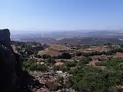 View from Debre Sema'it to Agbe lowlands | |
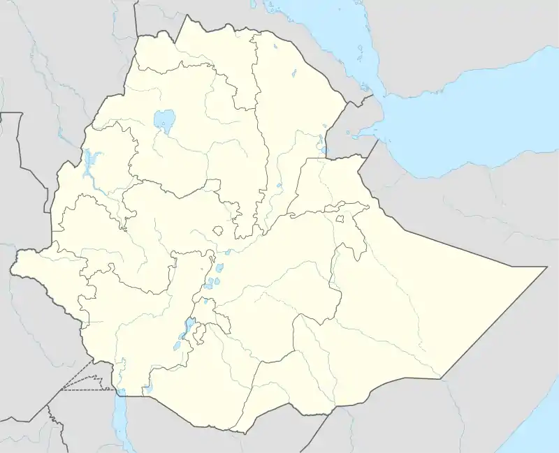 Agbe Location within Ethiopia | |
| Coordinates: 13°33′N 39°3′E | |
| Country | Ethiopia |
| Region | Tigray |
| Zone | Debub Misraqawi (Southeastern) |
| Woreda | Abergele (woreda) |
| Elevation | 1,650 m (5,410 ft) |
| Time zone | UTC+3 (EAT) |
Geography
The tabia occupies the southwestern footslopes of the Degua Tembien massif.
Geology
From the higher to the lower locations, the following geological formations are present:[1]
Springs
As there are no permanent rivers, the presence of springs is of utmost importance for the local people. The main springs in the tabia is Agbe.[2]
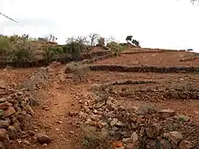
Agriculture and livelihood
The population lives essentially from crop farming, supplemented with off-season work in nearby towns. The farmers have adapted their cropping systems to the spatio-temporal variability in rainfall.[4]
History and culture
History
The history of the tabia is strongly confounded with the history of Tembien.
Religion and churches
Most inhabitants are Orthodox Christians. The main church of the tabia is Sele Gebriel.
Roads and communication
The main road Mekelle – Hagere Selam – Abiy Addi runs through the centre of the tabia. There are regular bus services to these towns.
Tourism
Its mountainous nature and proximity to Mekelle makes the tabia fit for tourism.[5]
Trekking routes
Trekking routes have been established in this tabia.[6] The tracks are not marked on the ground but can be followed using downloaded .GPX files.[7]
- Trek 8, is from Agbe to Kemishana, and further across May Selelo and Zikuli Rivers, along gorges and Zeyi cave to Inda Maryam Qorar
- Trek 19, from Sele to Debre Sema'it, and then it continues to Inda Maryam Qorar
Both treks involve a vertical interval of more than one kilometer and require good physical conditions.
Accommodation and facilities
Though facilities are basic, the inhabitants are hospitable.[8]
See also
References
- Sembroni, A.; Molin, P.; Dramis, F. (2019). Regional geology of the Dogu'a Tembien massif. In: Geo-trekking in Ethiopia's Tropical Mountains - The Dogu'a Tembien District. SpringerNature. ISBN 978-3-030-04954-6.
- What do we hear from the farmers in Dogu'a Tembien? [in Tigrinya]. Hagere Selam, Ethiopia. 2016. p. 100.
- Jacob, M. and colleagues (2019). Geo-trekking map of Dogu'a Tembien (1:50,000). In: Geo-trekking in Ethiopia's Tropical Mountains - The Dogu'a Tembien District. SpringerNature. ISBN 978-3-030-04954-6.
- Frankl, A. and colleagues (2013). "The effect of rainfall on spatio‐temporal variability in cropping systems and duration of crop cover in the Northern Ethiopian Highlands". Soil Use and Management. 29 (3): 374–383. doi:10.1111/sum.12041.
- Geo-trekking in Ethiopia's Tropical Mountains - The Dogu'a Tembien District. SpringerNature. 2019. ISBN 978-3-030-04954-6.
- Description of trekking routes in Dogu'a Tembien. In: Geo-trekking in Ethiopia's Tropical Mountains - The Dogu'a Tembien District. SpringerNature. 2019. ISBN 978-3-030-04954-6.
- https://www.openstreetmap.org/traces/tag/nyssen-jacob-frankl
- Nyssen, Jan (2019). "Logistics for the Trekker in a Rural Mountain District of Northern Ethiopia". Geo-trekking in Ethiopia's Tropical Mountains. GeoGuide. Springer-Nature. pp. 537–556. doi:10.1007/978-3-030-04955-3_37. ISBN 978-3-030-04954-6.