Tigray Region
The Tigray Region (Tigrinya: ክልል ትግራይ; Amharic: ትግራይ ክልል, kilil Tigrāy; official name: Tigrinya: ብሔራዊ ክልላዊ መንግስቲ ትግራይ, Bəh̩erawi Kəllelawi Mängəśti Təgray, English: Tigray National Regional State") is the northernmost region of Ethiopia. Tigray is the homeland of the Tigrayan, Irob and Kunama peoples. Tigray is also known as Region 1 according to the federal constitution. Its capital and largest city is Mekelle. Tigray is the 5th largest by area, the 5th most populous, and the 5th most densely populated of the 10 Regional States.
Tigray
ትግራይ | |
|---|---|
| Tigray Region | |
.jpg.webp) | |
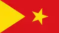 Flag  Seal | |
| Nickname(s): The birthplace of Ethiopian civilization | |
| Anthem: ዘይንድይቦ ጎቦ There are no mountains we would not climb | |
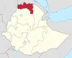 Map of Ethiopia showing Tigray | |
| Country | Ethiopia |
| Official language | Tigrinya |
| Other languages | Saho, Kunama, Xamtanga (Agaw), Amharic, Oromo |
| Demonym | Tigrayan |
| Capital | Mekelle |
| Government | |
| • Chief Executive | Debretsion Gebremichael |
| Area | |
| • Total | 50,079 km2 (19,336 sq mi) |
| [1] | |
| Population (2020)[2] | |
| • Total | 7,070,260 |
| • Rank | 5th |
| • Density | 140/km2 (370/sq mi) |
| Time zone | UTC+3 (EAT) |
| ISO 3166 code | ET-TI |
| HDI (2018) | 0.491 [3] low · 5th |
| Website | www.tig-gpr.org |
Tigray's official language is Tigrigna (also spelled Tigrinya). The total population (Based on 2020 Census, CSA) is 7,070,260. The greatest part of the population (c. 80%) are agriculturalists, contributing 46% to the regional gross domestic product (2002/2003). The highlands have the highest population density, specially in eastern and central Tigray. The much less densely populated lowlands comprise 48% of Tigray.
Tigray is bordered by Eritrea to the north, Sudan to the west, the Amhara Region to the south and the Afar Region to the east and south east.[4] Besides Mekelle, major cities include Adigrat, Aksum, Shire, Humera, Adwa, Adi Remets, Alamata, Wukro, Maychew, Sheraro, Abiy Adi, Korem, Qwiha, Atsbi, Hawzen, Mekoni, Dansha and Zalambessa. There is also the historically significant town of Yeha.
The government of Tigray is composed of the executive branch, led by the President; the legislative branch, which comprises the State Council; and the judicial branch, which is led by the state Supreme Court.
In early November 2020, the region and the Ethiopian federal government entered into conflict, which rapidly escalated into an outright war.[5]
History
3rd millennium to 5th century BC
Given the presence of a large temple complex and fertile surroundings, the capital of Dʿmt may have been present day Yeha, in Tigray, Ethiopia.[6]
The kingdom developed irrigation schemes, used plows, grew millet, and made iron tools and weapons.
Some modern historians including Stuart Munro-Hay, Rodolfo Fattovich, Ayele Bekerie, Cain Felder, and Ephraim Isaac consider this civilization to be indigenous, although Sabaean-influenced due to the latter's dominance of the Red Sea, while others like Joseph Michels, Henri de Contenson, Tekletsadik Mekuria, and Stanley Burstein have viewed Dʿmt as the result of a mixture of Sabaeans and indigenous peoples.[7][8] The most recent research, however, shows that Ge'ez, the ancient Semitic language spoken in Eritrea and northern Ethiopia in ancient times, is not derived from Sabaean.[9] There is evidence of a Semitic-speaking presence in Eritrea and northern Ethiopia at least as early as 2000 BC.[8][10] It is now believed that Sabaean influence was minor, limited to a few localities, and disappeared after a few decades or a century, perhaps representing a trading or military colony in some sort of symbiosis or military alliance with the civilization of Dʿmt or some other proto-Aksumite state.[11][12]
After the fall of Dʿmt in the 5th century BC, the plateau came to be dominated by smaller unknown successor kingdoms. This lasted until the rise of one of these polities during the first century BC, the Aksumite Kingdom. The ancestor of medieval and modern Eritrea and Ethiopia, Aksum was able to reunite the area.[13]
1st to 10th century AD
The Kingdom of Aksum was a trading empire centered in Eritrea and northern Ethiopia.[14] It existed from approximately 100–940 AD, growing from the proto-Aksumite Iron Age period c. 4th century BC to achieve prominence by the 1st century AD.
According to the Book of Aksum, Aksum's first capital, Mazaber, was built by Itiyopis, son of Cush.[15] The capital was later moved to Aksum in northern Ethiopia. The Kingdom used the name "Ethiopia" as early as the 4th century.[16][17]
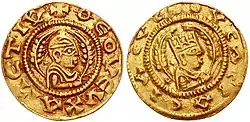
The Empire of Aksum at its height at times extended across most of present-day Eritrea, Ethiopia, Djibouti, Sudan, Yemen and Saudi Arabia. The capital city of the empire was Aksum, now in northern Ethiopia. Today a smaller community, the city of Aksum was once a bustling metropolis, cultural and economic center. Two hills and two streams lie on the east and west expanses of the city; perhaps providing the initial impetus for settling this area. Along the hills and plain outside the city, the Aksumites had cemeteries with elaborate grave stones called stelae, or obelisks. Other important cities included Yeha, Hawulti-Melazo, Matara, Adulis, and Qohaito, the last three of which are now in Eritrea. By the reign of Endubis in the late 3rd century, it had begun minting its own currency and was named by Mani as one of the four great powers of his time along with Persia, Rome, and China. It converted to Christianity in 325 or 328 under King Ezana and was the first state ever to use the image of the cross on its coins.[18][19]
11th to 19th century AD
In the 14th century the Tigrinya-speaking lands (Tigray-Mereb Melash) were divided into two provinces, separated by the Mereb River by the newly enthroned Amhara Emperors. The governor of the northern province received the title Bahre Negash (Ruler of the sea), whereas the governor of the southern province was given the title of Tigray Mekonen (Lord of Tigray). The Portuguese Jesuit, Emanuele Baradas' work titled "Do reino de Tigr" and written in 1633–34 states that the "reino de Tigr" extended from Hamasien to Temben, from the borders of Dankel to the Adwa mountain. He also stated that Tigray-Mereb Melash was divided into twenty-four smaller political units (principalities), twelve of which were located south of the Mereb and governed by the Tigray Mekonen based in Enderta.[20] The other twelve were located north of the Mereb under the authority of the Bahre Negash, based in the district of Serae.[20]
The Book of Aksum, written and compiled probably before the 15th century, shows a traditional schematic map of Tigray with the city of Aksum at its center surrounded by the 13 principal provinces: "Tembien, Shire, Serae, Hamasien, Bur, Sam’a, Agame, Amba Senayt, Garalta, Enderta, Sahart and Abergele."[21]
During the Middle Ages, the position of Tigray Mekonnen ("Governor of Tigray") was established to rule over the area. Other districts included Akele Guzay (now part of Eritrea), and the kingdom of the Bahr negus, who ruled much of what is now Eritrea and Shire district and town in Western Tigray. At the time when Tigray Mekonnen existed simultaneously with that of Bahr negus, their frontier seems to have been the Mareb River, which is currently constitutes the border between the Ethiopian province of Tigray and Eritrea.
After the loss of power of the Bahr negus in the aftermath of Bahr negus Yeshaq's rebellions, the title of Tigray mekonnen gained power in relation to the Bahr negus and at times included ruling over parts of what is now Eritrea, especially in the 19th century.[22] By the unsettled Zemene Mesafint period ("Era of the Princes"), both titles had sunken to little more than empty titles, and the Lord who in his turn dominated the region, used (and received from Emperor) the title of either Ras or Dejazmach, beginning with Ras Mikael Sehul. Rulers of Tigray such as Ras Wolde Selassie alternated with others, chiefly those of Begemder or Yejju, as warlords to rule in fact the Ethiopian monarchy during the Zemene Mesafint.
In the mid-19th century, the lords of Tembien and Enderta managed to create an overlordship of Tigray to their dynasty. One of its members, Dejazmach Kahsay Mercha, ascended the imperial throne in 1872 under the name Yohannes IV. Following his death in the Battle of Metemma in 1889, the Ethiopian throne came under the control of the king of Shewa, and the center of power shifted south and away from Tigray.
20th century
In 1943, open resistance broke out all over southern and eastern Tigray under the slogan, "there is no government; let's organize and govern ourselves". Throughout Enderta awraja, including Mekelle, Didibadergiajen, Hintalo, Saharti, Samre and Wajirat, Raya awraja, Kilte-Awlaelo awraja and Tembien awraja, local assemblies, called gerreb, were formed. The gerren sent representatives to a central congress, called the shengo, which elected leaders and established a military command system. Although the Woyane rebellion of 1943 had shortcomings as a prototype revolution, historians agree that it involved a fairly high level of spontaneity and peasant initiative. It demonstrated considerable popular participation and reflected widely shared grievances. The uprising was specifically directed against the central Shoan Amhara regime of Haile Selassie I, rather than the Tigrayan imperial elite.
Ethiopian Civil War
After the February 1974 popular revolution, the first signal of any mass uprising was the actions of the soldiers of the 4th Brigade of the 4th Army Division in Nagelle in southern Ethiopia. The Coordinating Committee of the Armed Forces, Police, and Territorial Army, or the Derg (Ge'ez "Committee"), was officially announced 28 June 1974 by a group of military officers. The committee elected Major Mengistu Haile Mariam as its chairman and Major Atnafu Abate as its vice-chairman. In July 1974, the Derg obtained key concessions from the emperor, Haile Selassie, which included the power to arrest not only military officers but government officials at every level. Soon both former Prime Ministers Tsehafi Taezaz Aklilu Habte-Wold and Endalkachew Makonnen, along with most of their cabinets, most regional governors, many senior military officers and officials of the Imperial court were imprisoned. In August 1974, after a proposed constitution creating a constitutional monarchy was presented to the emperor, the Derg began a program of dismantling the imperial government in order to forestall further developments in that direction. The Derg deposed and imprisoned the emperor on 12 September 1974.
In addition, the Derg in 1975 nationalized most industries and private and somewhat secure urban real-estate holdings. But mismanagement, corruption, and general hostility to the Derg's violent rule, coupled with the draining effects of constant warfare with the separatist guerrilla movements in Tigray, led to a drastic fall in general productivity of food and cash crops. In October 1978, the Derg announced the National Revolutionary Development Campaign to mobilize human and material resources to transform the economy, which led to a Ten-Year Plan (1984/1985-1993/1994) to expand agricultural and industrial output, forecasting a 6.5% growth in GDP and a 3.6% rise in per capita income. Instead per capita income declined 0.8% over this period. Famine scholar Alex de Waal observes that while the famine that struck the country in the mid-1980s is usually ascribed to drought, "closer investigation shows that widespread drought occurred only some months after the famine was already under way". Hundreds of thousands fled economic misery, conscription, and political repression, and went to live in neighboring countries and all over the Western world, creating an Ethiopian diaspora. A civil war took place that left many dead.
Toward the end of January 1991, a coalition of rebel forces, the Ethiopian People's Revolutionary Democratic Front (EPRDF) captured Gondar, the ancient capital city, Bahar Dar, and Dessie.
Postwar
Following the conclusion of the Ethiopian Civil War in 1991, although the area which became the Tigray Region was thought by the rest of Ethiopia to be the beneficiaries of substantial funding from an Ethiopian People's Revolutionary Democratic Front (EPRDF) government dominated by fellow Tigrayans, in reality the beneficiaries are mostly the members of the Tigray People Liberation Front (TPLF). John Young, who visited the area several times in the early 1990s, attributes this delay in part to "central budget restraint, structural readjustment, and lack of awareness by government bureaucrats in Addis Ababa of conditions in the province", but notes "an equally significant obstacle was posed by an entrenched, and largely Amhara-dominated, central bureaucracy which used its power to block government-authorised funds from reaching Tigray".[23] At the same time, a growing urban middle class of traders, businessmen and government officials emerged that was suspicious of and distant from the victorious EPRDF. The ruling party attempted to address these challenges in forums with its middle-class critics, as well as by establishing a number of charitable non-governmental organizations controlled by the EPRDF, including the Endowment Fund for the Rehabilitation of Tigray, Relief Society of Tigray, and Tigray Development Association.
In 1998, war erupted between Eritrea and Ethiopia over a portion of territory that had been administered as part of Tigray, which included the town of Badme. Following a 2002 United Nations decision, much of this land was awarded to Eritrea, but so far Ethiopia has refused to implement the final and binding ruling, and as a result relations with Eritrea are very tense. From 1991 to 2001, the president of Tigray was Gebru Asrat.
21st century
From 2001 to 2010 the president was Tsegay Berhe.
Following the 2020 Tigray regional election, in November 2020, the region entered into conflict with the Ethiopian federal government,[24] with the Ethiopian, as well as Amhara troops advancing along main roads. Administration of the conquered parts of Western Tigray is taken over by officials from Amhara Region.[25]
Warfare, the COVID-19 pandemic in Ethiopia, and a locust outbreak all contributed to an emergency food situation in the region in January 2021. Two million people faced food shortages; the situation was particularly dire in Shire Inda Selassie where there are 100,000 refugees. The Famine Early Warning Systems Network said parts of central and eastern Tigray are likely in Emergency Phase 4, a step below famine.[26]
Geography
Location and size
Tigray is situated between 12° – 15°N and 36° 30' – 40° 30'E.
A 2006 national statistics report stated the land area as 50,079 km2 (19,336 sq mi).[1] The 2011 National Statistics gave an area of 41,410 km2 (15,990 sq mi), but the sum of the figures it gave for the Tigray zones was substantially different,[27] rendering the 2011 report internally inconsistent. The figure of 50,079 km2 is supported by the Google Maps area calculator.
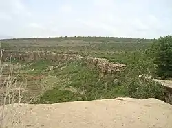
Overview
The East African Orogeny led to the growth of a mountain chain in the Precambrian (up to 800 million years ago or Ma), that was largely eroded afterwards.[28][29][30] Around 600 Ma, the Gondwana break-up led to the presence of tectonic structures and a Palaeozoic planation surface, that extents to the north and west of the Dogu'a Tembien massif.[31]
Subsequently, there was the deposition of sedimentary and volcanic formations, from older (at the foot of the massif) to younger, near the summits. From Palaeozoic to Triassic, Tigray was located near the South Pole. The (reactivate) Precambrian extensional faults guided the deposition of glacial sediments (Edaga Arbi Glacials and Enticho Sandstone). Later alluvial plain sediments were deposited (Adigrat Sandstone). The break-up of Gondwana (Late Palaeozoic to Early Triassic) led to an extensional tectonic phase, what caused the lowering of large parts of the Horn of Africa. As a consequence a marine transgression occurred, leading to the deposition of marine sediments (Antalo Limestone and Agula Shale).[32]
At the end of the Mesozoic tectonic phase, a new (Cretaceous) planation took place. After that, the deposition of continental sediments (Amba Aradam Formation) indicates the presence of less shallow seas, what was probably caused by a regional uplift. In the beginning of the Caenozoic, there was a relative tectonic quiescence, during which the Amba Aradam Sandstones were partially eroded what led to the formation of a new planation surface.[33]
In the Eocene, the Afar plume a broad regional uplift deformed the lithosphere, leading to the eruption of flood basalts. Three major formations may be distinguished: lower basalts, interbedded lacustrine deposits and upper basalts.[34] Almost at the same time, the Mekelle Dolerite intruded the Mesozoic sediments following joints and faults.[35]
A new magma intrusion occurred in the Early Miocene, what gave rise to phonolite plugs, mainly in the Adwa area and also in Dogu’a Tembien.[34] The present geomorphology is marked by deep valleys, eroded as a result of the regional uplift. Throughout the Quaternary deposition of alluvium and freshwater tufa occurred in the valley bottoms.[36]
Fossils
In Tigray, there are two main fossil-bearing geological units. The Antalo Limestone (upper Jurassic) is the largest. Its marine deposits comprise mainly benthic marine invertebrates. Also, the Tertiary lacustrine deposits, interbedded in the basalt formations, contain a range of silicified mollusc fossils.[37]
In the Antalo Limestone: large Paracenoceratidae cephalopods (nautilus); Nerineidae indet.; sea urchins; Rhynchonellid brachiopod; crustaceans; coral colonies; crinoid stems.[38][37]
In the Tertiary silicified lacustrine deposits: Pila (gastropod); Lanistes sp.; Pirenella conica; and land snails (Achatinidae indet.).[37][39]
All snail shells, both fossil and recent, are called t’uyo in Tigrinya language, which means ‘helicoidal’.
Traditional uses of rock
As Tigray holds a wide variety of rock types, there is expectedly a varied use of rock.
- Natural stone masonry. Preferentially, the easier shaped limestone and sandstone are used to build homesteads and churches, but particularly in the upland areas, basalt is also used. Traditionally, fermented mud will be used as mortar
- Fencing of homesteads, generally in dry stones
- Church bells, generally three elongated plates in phonolite or clinkstone, with different tonalities
- Milling stone: for this purpose plucked-bedrock pits, small rock-cut basins that naturally occur in rivers with kolks, are excavated from the river bed and further shaped. Milling is done at home using an elongated small boulder[40][41]
- Door and window lintels, prepared from rock types that frequently have an elongated shape (sandstone, phonolite, limestone), or that are easily shaped (tufa)
- Troughs for livestock watering and feeding, generally hewn from tufa
- Footpath paving, generally done as community work. Some very ancient paved footpaths occur on major communication lines dating back to the period before the introduction of the automobile
- Heaped stones, in direct view of a church, where foot travellers stop, pray and put an additional stone
- Stones collected from farmlands in order to free space for the crop, and heaped in typical rounded metres-high heaps, called zala
- Contour bunding or gedeba: terrace walls in dry stone, typically laid out along the contour for sake of soil conservation
- Check dams or qetri in gullies for sake of gully erosion control
- Cobble stones, used for paving secondary streets in the towns. Generally limestone is used.
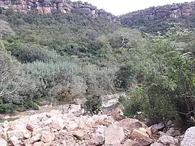
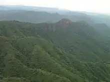
Major mountains
- Ferrah Imba, 3939 metres, summit of the Tsibet massif in Endamekoni woreda (12°50′34″N 39°31′03″E), and highest peak of Tigray
- Imba Alaje, 3438 metres, in Alaje woreda (12°59′39″N 39°30′13″E)
- Mugulat, 3263 metres, in Ganta Afeshum woreda (14°16′N 39°25′E); one of its spurs is crossed by the Siqurto foot tunnel
- Upper plateaus of the Atsbi Horst at 3057 metres in Atsbi Wenberta woreda (14°03′N 39°43′E)
- Imba Tsion, 2917 metres, in Hawzen woreda (14°06′N 39°26′E)
- Ekli Imba, 2799 metres, summit of the Arebay massif in Degua Tembien woreda (13°43′N 39°16′E)
- Imba Aradom – sometimes transliterated as Amba Aradam, 2756 metres, in Hintalo Wajirat woreda (13°20′N 39°31′E)
- Soloda, 2436 metres, part of the Adwa plugs in Adwa woreda (14°11′N 38°54′E)
- Imba Neway, 2388 metres, in Abergele (woreda)(13°16′N 38°57′E)
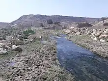
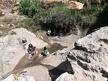
Water challenge
Overall, the region is semi-arid. The rainy season lasts only for a couple of months. The farmers are adapted to this, but the problem arises when rains are less than normal. Another major challenge is providing water to urban areas. Smaller towns, but particularly Mekelle, face endemic water shortages. Reservoirs have been built, but their management is sub-optimal.
Major cities
Mekelle (home of Mekelle University, Mekelle Institute of Technology, Microlink College, Nile College, and Mekelle College of Teacher Education) is the capital of Tigray, near the geographic center of the state.
Other Tigray cities functioning as centers of Ethiopian metropolitan areas include:
- Adigrat (home of Adigrat University, Debre Damo monastery and Addis Pharmaceuticals)
- Adwa (home of Adwa Pan African University,)
- Axum (home of Aksum University,)
- Maychew (home of Raya University)
Of the 10 largest cities in Tigray, Maychew has the highest elevation at 2479 meter above sealevel. Plenty of smaller towns, like Atsbi and Edaga Hamus are located at even higher elevations. Of the large cities, Humera is located at the lowest altitude (585 m).
Demographics
The population pyramid has a wide base, similar to most other low-income countries. However, the two lower age groups show that the pyramid base has stopped widening; this is particularly true of the group of 0–9 years old, with an even more pronounced effect in the group of 0–4 years old, thus indicating a timid onset of a demographic transition. This may be related to the improved health services and a changing position of women in the society. Indeed, a revised Family Code came into effect in 2000, advocating the principles of gender equality. This raised the minimum age of marriage from 15 to 18 years old and established women rights in terms of sharing any assets the household has accumulated. The Ethiopian penal code states that it is a crime to beat one's wife, and harmful traditional practices such as early marriage, abduction and female genital mutilation are now also considered to be a crime. Nowadays, almost all children are going to school but girls frequently drop out when they reach the age of 13 to 15 years: schools have no facilities for menstrual hygiene management and this is a major reason to interrupt schooling.[43]
Based on the 2007 census conducted by the Central Statistical Agency of Ethiopia (CSA), the Tigray Region has a population of 4,316,988, of whom 2,126,465 are men and 2,190,523 women; urban inhabitants number 844,040 or 19.55% of the population. With an estimated area of 84,722 km2, the region had an estimated density of 51 people per km2. In the entire region 992,635 households were counted, for an average of 4.4 people per household, with urban households having on average 3.4 and rural households 4.6.[44]
In the previous census, conducted in 1994, the region's population was 3,136,267, of whom 1,542,165 were men and 1,594,102 women; urban inhabitants numbered 621,210, or 14% of the population.
According to the CSA, as of 2004, 53.99% of the total population had access to safe drinking water, of whom 42.68% were rural inhabitants and 97.28% were urban.[45] Values for other reported common indicators of the standard of living for Tigray as of 2005 include: 31.6% of the inhabitants fall into the lowest wealth quintile; adult literacy for men is 67.5% and for women 33.7%; and the infant mortality rate is 67 infant deaths per 1,000 live births, less than the national average of 77; at least half of these deaths occurred in the infants' first month of life.[46]
| Year | Pop. | ±% |
|---|---|---|
| 1994 | 3,136,267 | — |
| 2007 | 4,316,988 | +37.6% |
| source:[47] | ||
Ethnicity
.jpg.webp)
With 96.55% of the local population, the region is predominantly inhabited by the Tigrinya-speaking Tigrayan people. The Tigrinya language belongs to the Semitic branch of the Afro-Asiatic family of languages. Most other residents hail from other Afro-Asiatic-speaking communities, including the Amhara, Irob, Afar, Agaw and Oromo. Partly assimilated Oromo live in remoter villages in Raya Azebo and Alamata (woreda),[48] whereas there are Agaw in Abergele (woreda).[49] There are also Nilo-Saharan-speaking Kunama.
| Ethnic group |
1994 Census | 2007 Census [50] |
|---|---|---|
| Tigrayan | 94.98% | 96.55% |
| Amhara | 2.60% | 1.63% |
| Irob | 0.70% | 0.71% |
| Afar | – | 0.29% |
| Agaw | – | 0.19% |
| Oromo | – | 0.17% |
| Kunama | 0.05% | 0.07% |
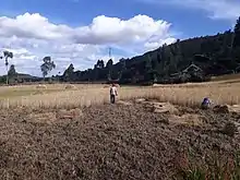
Agriculture
Terracing and dam construction
An important aspect of the agricultural work in Tigray after the end of the 1991 civil war was to minimize the problems of drought. In the past, the Tigray was covered with forests and had a micro-climate that favored the rains. Subsequently, the forests were cut down, usually to impoverish the population during the wars. Consequently, the Tigray achieved a fair amount of rainfall during the rainy season, from August to September, but quickly lost these waters downstream. In the process the fertile soil of the fields eroded. After a few weeks of rain, the country again dried up.
The government undertook two projects in Tigray. The first was the construction of terraces which, with the agreement and help of local communities, go up to the tops of the mountains at 2,500 metres. The goal was to prevent the rainfall flowing away immediately so that it could be conserved for the agricultural season. On the highest terraces were planted trees, mainly eucalyptus, the dominant tree in Ethiopia and native to Australia. These plants created a new microclimate.[53] The terracing method was very simple but required good organization. Long stretches of the fields were terraced by the villagers using stone walls from stones that erosion had brought to light. The rains eroding the still non-terraced ground formed mudslides that were held by the topmost walls, which permitted construction of a new terrace field and another wall with uncovered stones, creating new ground terraced farmland every year. Four or five years after the project commenced, almost all of Tigray, with an area only slightly less than Italy's, was terraced.
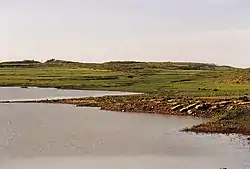
Another endeavour involved the construction of small reservoirs for local irrigation. As rains last only for a couple of months per year, reservoirs of different sizes allow harvesting runoff from the rainy season for further use in the dry season. The dams needed to create these basins are typically an embankment of a few hundreds of meters, closing off one part of a valley, with a maximum height of 20 metres. Each took months of work, in which people carried earth on their back, and with assistance of donkeys. Generally 2,000–3,000 people — men, women and children — carried the earth in simple baskets.
The small reservoirs in Tigray include:
- Addi Abagiè
- Addi Akhor
- Addi Amharay
- May Leiba
- Hiza'iti Wedi Cheber
- Addi Asme'e
- Chini
- Addi Gela
- Addi Hilo
- Addi Qenafiz
Overall, these reservoirs suffer from rapid siltation.[54][55] Part of the water that could be used for irrigation is lost through seepage; the positive side-effect is that this contributes to groundwater recharge.[56]
Vegetation and exclosures
Tigray holds numerous exclosures, areas that are set aside for regreening.[57] Wood harvesting and livestock range are not allowed there. Besides effects on biodiversity,[58][59][60] water infiltration, protection from flooding, sediment deposition,[61] carbon sequestration,[62] people commonly have economic benefits from these exclosures through grass harvesting, beekeeping and other non-timber forest products.[63] The local inhabitants also consider it as "land set aside for future generations".[64] In Dogu'a Tembien, several exclosures are managed by the EthioTrees project. They have as an additional benefit that the villagers receive carbon credits for the sequestered CO2,[65] as part of a carbon offset programme.[66] The revenues are then reinvested in the villages, according to the priorities of the communities;[67] it may be for an additional class in the village school, a water pond, conservation in the exclosures, or a store for incense.[68]
Livestock
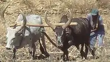
The CSA estimated in 2005 that farmers in Tigray had a total of 2,713,750 cattle (representing 7.0% of Ethiopia's total cattle), 72,640 sheep (0.42%), 208,970 goats (1.61%), 1,200 horses (less than 0.1%), 9,190 mules (6.24%), 386,600 asses (15.43%), 32,650 camels (7.15%), 3,180,240 poultry of all species (10.3%), and 20,480 beehives (0.47%).[69] Cattle are an essential component in the dominant grain-plough agricultural system. In the rainy season, a large part of the cattle herds are in transhumance.[70][71]
Mainly used for draught, there are several cattle landraces in Tigray:[72][73]
- Arado cattle, the dominant variety
- Raya cattle, long horned, especially raised in Southern Tigray and traded widely as plough oxen
- Irob cattle, particularly in the Irob woreda[74]
- Abergele cattle, particularly in Abergele (woreda) and on the southwestern slopes of Dogu’a Tembien
- Begayt cattle, in western Tigray. They are known for better milk production
- In small towns: Cross-bred Arado x Begayt, and Arado x Holstein-Friesian milk cows
Wildlife
Large mammals
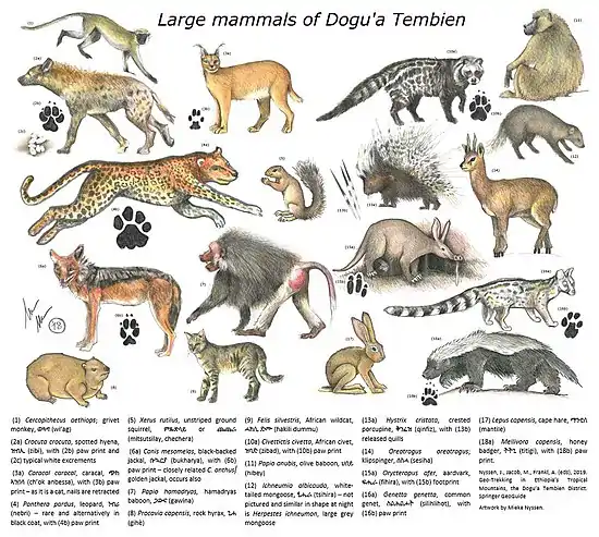
Besides elephants in Western Tigray and the endemic gelada baboon on the highest mountains, large mammals in the region, with scientific (italics), English and Tigrinya language names, are:[75] - Cercopithecus aethiops; grivet monkey, ወዓግ (wi’ag) - Crocuta crocuta, spotted hyena, ዝብኢ (zibi) - Caracal caracal, caracal, ጭክ ኣንበሳ (ch’ok anbessa) – Panthera pardus, leopard, ነብሪ (nebri)[76] - Xerus rutilus, unstriped ground squirrel, ምጹጽላይ or ጨጨራ (mitsutsilay, chechera) - Canis mesomelas, black-backed jackal, ቡኳርያ (bukharya) - Canis anthus, golden jackal, ቡኳርያ (bukharya) - Papio hamadryas, hamadryas baboon, ጋውና (gawina) – Procavia capensis, rock hyrax, ጊሐ (gihè) – Felis silvestris, African wildcat, ሓክሊ ድሙ (hakili dummu) – Civettictis civetta, African civet, ዝባድ (zibad) – Papio anubis, olive baboon, ህበይ (hibey) – Ichneumia albicauda, white-tailed mongoose, ፂሒራ (tsihira) – Herpestes ichneumon, large grey mongoose, ፂሒራ (tsihira) – Hystrix cristata, crested porcupine, ቅንፈዝ (qinfiz) – Oreotragus oreotragus; klipspringer, ሰስሓ (sesiha) – Orycteropus afer, aardvark, ፍሒራ (fihira) – Genetta genetta, common genet, ስልሕልሖት (silihlihot) – Lepus capensis, cape hare, ማንቲለ (mantile) – Mellivora capensis, honey badger, ትትጊ (titigi)
Small rodents
The most common pest rodents with widespread distribution in agricultural fields and storage areas are three Ethiopian endemic species: the Dembea grass rat (Arvicanthis dembeensis, sometimes considered a subspecies of Arvicanthis niloticus), Ethiopian white-footed rat (Stenocephalemys albipes), and Awash multimammate mouse (Mastomys awashensis).[77]
Bats
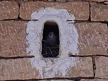
Bats occur in natural caves, church buildings and abandoned homesteads. The large colony of bats that roosts in Zeyi cave comprises Hipposideros megalotis (Ethiopian large-eared roundleaf bat), Hipposideros tephrus, and Rhinolophus blasii (Blasius's horseshoe bat).[78]
Birds
With its numerous exclosures, forest fragments and church forests, Tigray is a birdwatcher's paradise. Detailed inventories[58][79] list at least 170 bird species, including numerous endemic species. Species belonging to the Afrotropical Highland Biome occur in the dry evergreen montane forests of the highland plateau but can also occupy other habitats. Wattled Ibis can be found feeding in wet grassland and open woodland. Black-winged Lovebird, Banded Barbet, Golden-mantled or Abyssinian Woodpecker, Montane White-eye, Rüppell's Robin-chat, Abyssinian Slaty Flycatcher and Tacazze Sunbird are found in evergreen forest, mountain woodlands and areas with scattered trees including fig trees, Euphorbia abyssinica and Juniperus procera. Erckel's spurfowl, Dusky Turtle Dove, Swainson's or Grey-headed Sparrow, Baglafecht Weaver, African Citril, Brown-rumped Seedeater and Streaky Seedeater are common Afrotropical breeding residents of woodland edges, scrubland and forest edges. White-billed Starling and Little Rock Thrush can be found on steep cliffs; Speckled or African rock pigeon and White-collared Pigeon in gorges and rocky places but also in towns and villages.[58]
Species belonging to the Somali-Masai Biome. Hemprich's Hornbill and White-rumped Babbler are found in bushland, scrubland and dense secondary forest, often near cliffs, gorges or water. Chestnut-Winged or Somali Starling and Rüppell's Weaver are found in bushy and shrubby areas. Black-billed wood hoopoe has some red at the base of the bill or an entirely red bill in this area.[58]
Species belonging to the Sudan-Guinea Savanna Biome: Green-backed eremomela and Chestnut-crowned Sparrow-Weaver.[58]
Species that are neither endemic nor biome-restricted but that have restricted ranges or that can be more easily seen in Ethiopia than elsewhere in their range: Abyssinian Roller is an Ethiopian relative of Lilac-breasted Roller, which is an intra-tropical breeding migrant of south and east Africa, and of European Roller, an uncommon Palearctic passage migrant. Black-billed Barbet, Yellow-breasted Barbet and Grey-headed Batis are species from the Sahel and Northern Africa but also occur in Acacia woodlands in the area.[58]
The most regularly observed raptor birds in crop fields in Tigray are Augur buzzard (Buteo augur), Common Buzzard (Buteo buteo), Steppe Eagle (Aquila nipalensis), Lanner falcon (Falco biarmicus), Black kite (Milvus migrans), Yellow-billed kite (Milvus aegyptius) and Barn owl (Tyto alba).[80]
Birdwatching can be done particularly in exclosures and forests. Eighteen bird-watching sites have been inventoried in Enderta and Degua Tembien[58] and mapped.[81]
Landmarks
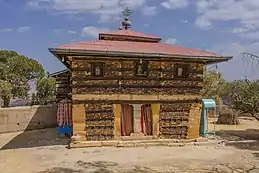
A distinctive feature of Tigray are its rock-hewn churches. Similar in design to those of Lalibela in the Amhara Region, these churches are found in four or five clusters – Gheralta, Teka-Tesfay, Atsbi and Tembien – with Wukro sometimes included. Some of the churches are considered earlier than those of Lalibela, perhaps dating from the eighth century. Mostly monolithic, with designs partly inspired by classical architecture, they are often located at the top of cliffs or steep hills, for security. For example, Tigray's ancient Debre Damo monastery is accessible only by climbing a rope 25 metres up a sheer cliff.
Looting has become a major issue in the Tigray Region, as archaeological sites have become sources for construction materials and ancient artifacts used for everyday purposes by local populations.[82]
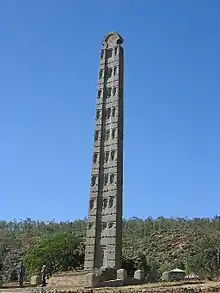
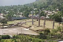
The area is famous for a single rock sculptured 23 meter long obelisk in Axum as well as for other fallen obelisks. The Axum treasure site of ancient Tigrayan history is a major landmark. Yeha is another important local landmark that is little-known outside the region.
Transportation
Ground travel
A major north–south transportation corridor goes through Tigray. This is facilitated by the Highway 2 which goes from Adigrat to Addis Ababa and Highway 3 which goes from Shire to Addis Ababa.
Air travel
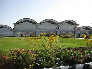
Tigray has one international airport and four commercial airports. The international airport is Alula Aba Nega Airport (MQX). The 4 commercial airports are Shire Airport (SHC), Humera Airport (HUE), Dansha Airport, and Emperor Yohannes IV Airport (AXU).
Law and government
Executive branch
The executive branch is headed by the President of Tigray. The current president is Debretsion Gebremichael, a TPLF member, elected in 2018.[83] A Vice President of Tigray succeeds the president in the event of any removal from office, and performs any duties assigned by the president.[84] The current vice president is Dr. Addis Alem Balema.[85] The other elected constitutional offices in the executive branch are the Regional Health Bureau (Ato Hagos Godefy),[86] Educational Bureau (Ato Gebre'egziabher),[87] Auditor General (Ato Alemseged Kebedew),[88] and 12 other officials.[89]
Judicial branch
There are three levels of the Tigray state judiciary. The lowest level is the court of common pleas: each woreda maintains its own constitutionally mandated court of common pleas, which maintain jurisdiction over all justiciable matters.[90] The intermediate-level court system is the district court system. Four courts of appeals exist, each retaining jurisdiction over appeals from common pleas, municipal, and county courts in an administrative zone. A case heard in this system is decided by a three-judge panel, and each judge is elected.
The highest-ranking court, the Tigray Supreme Court, is Tigray's "court of last resort".[91] A seven-justice panel composes the court, which, by its own discretion, hears appeals from the courts of appeals, and retains original jurisdiction over limited matters. The chief judge is called the President of Tigray Supreme Court (W/ro Hirity Miheretab).
Legislative branch
The State Council, which is the highest administrative body of the state, is made up of 152 members.[89]
National politics
Tigray is represented by 38 representatives in the Federal Democratic Republic of Ethiopia House of Peoples' Representatives. But currently after the illegitimate postponement of the national election of Ethiopia Tigray has pulled it representative from the House of House of Peoples' Representatives and has no representation in the Federal parliament .
Administrative zones and districts
Like other Regions in Ethiopia, Tigray is subdivided into administrative zones, and further into woredas or districts:
- Central Tigray
- East Tigray
- North West Tigray
- South Tigray
- South East Tigray
- West Tigray
- Mekelle (special zone)
Sport
Mekelle 70 Enderta F.C. (Amharic: መቐለ 70 እንደርታ, Tigrigna: ጋንታ መቐለ 70 እንደርታ) is an Ethiopian football club based in Mekelle, Tigray. They are a member of the Ethiopian Football Federation and currently play in the top division of Ethiopian football, the Ethiopian Premier League. They are known by the nickname the lion of Judah (ምዓም ኣንበሳ /ምዓም አናብስት/ኣናብስቶቹ). The club won its first Ethiopian Premier League title in the 2018–2019 Ethiopian Premier League Season.
Shire Endaselassie F.C. (Amharic:ሽረ እንዳሥላሴ, Tigrigna: ጋንታ ስሑል ሽረ, also known as Sihul Shire FC) is an Ethiopian football club based in Shire, Tigray. They are a member of the Ethiopian Football Federation and play in the Ethiopian Premier League, the first division of football in Ethiopia. Tigrayan are known for there good performance in circus and having professional road cyclist.For many years cyclist from this region have been dominant in Ethiopia cycle championship. Tsgabu Gebremaryam Grmay is one of the best Ethiopian cyclist and the first Ethiopian to participate in Tour de France.
Education
At the regional level, the Tigray Education Bureau governs primary and secondary educational institutions. At the municipal level, there are approximately 300 school districts region-wide.
Colleges and universities
- Adigrat University
- Axum University
- Adwa Pan-African University
- Ethio-lmage College
- Greenwich College
- Hasenge College
- Mars Engineering College
- Mekelle University
- Mekelle Institute of Technology
- New Millennium College
- Nile College
- Raya University
- Sehba Info Tech & Business College
- Signal College
- St. Mary's University College
- Winner college Axum
Libraries
Tigray is home to Ethiopia's most extensive church libraries that are found in the eastern and central zones of the region. There are several ongoing digitization projects to preserve previous historical texts.
- Axum Heritage Foundation
- Romanat Qeddus Mika'el Church
- Gunda Gunde Monastery
- Agwaza Monastery
- Debre Damo Monastery
References
- "National Statistics: Section-B Population" (PDF). Central Statistical Agency. 2006. Archived from the original (PDF) on 21 February 2007.
- Population Projection of Ethiopia for All Regions At Wereda Level from 2014 – 2017. Federal Democratic Republic of Ethiopia Central Statistical Agency. Retrieved 4 June 2018.
- "Sub-national HDI – Area Database – Global Data Lab". hdi.globaldatalab.org. Retrieved 10 September 2020.
- Eritrea and Ethiopia (Map). 1:5,000,000. Central Intelligence Agency. 2009. Map #803395.
- https://www.bbc.com/news/world-africa-54805088
- Shaw, Thurstan (1995), The Archaeology of Africa: Food, Metals and Towns, Routledge, p. 612, ISBN 978-0-415-11585-8
- Stuart Munro-Hay, Aksum: An African Civilization of Late Antiquity, Edinburgh: University Press, 1991, p. 57
- Nadia Durrani, The Tihamah Coastal Plain of South-West Arabia in its Regional context c. 6000 BC – AD 600 (Society for Arabian Studies Monographs No. 4), Oxford: Archaeopress, 2005, p. 121
- Kitchen, Andrew, Christopher Ehret, et al., 2009, "Bayesian phylogenetic analysis of Semitic languages identifies an Early Bronze Age origin of Semitic in the Near East", Proceedings of the Royal Society B: Biological Sciences 276 no. 1665 (June 22)
- Herausgegeben von Uhlig, Siegbert; Encyclopaedia Aethiopica, "Ge'ez", Wiesbaden: Harrassowitz Verlag, 2005, pp. 732
- Munro-Hay, Aksum, p. 57
- Phillipson, "The First Millennium BC in the Highlands of Northern Ethiopia and South–Central Eritrea: A Reassessment of Cultural and Political Development", African Archaeological Review (2009), 26:257–274
- Pankhurst, Richard K.P.; Addis Tribune, "Let's Look Across the Red Sea I", 17 January 2003 (archive.org mirror copy)
- Phillipson, David (2012). Neil Asher Silberman (ed.). The Oxford Companion to Archaeology. Oxford University Press. p. 48.
- Africa Geoscience Review. Rock View International. 1 January 2003. p. 366.
- Stuart Munro-Hay (1991). Aksum: An African Civilization of Late Antiquity (PDF). Edinburgh: University Press. p. 57. Retrieved 1 February 2013.
- Henze, Paul B. (2005) Layers of Time: A History of Ethiopia, ISBN 1-85065-522-7
- "Aksum". UNESCO World Heritage Centre.
- "Mountain Constantines: The Christianization of Aksum and Iberia1" (PDF). users.clas.ufl.edu.
- Richard M. Trivelli, Afrika spectrum 33(1998) 3: pg 259
- Richard Pankhurst, History of Ethiopian Towns (Wiesbaden; Franz Steiner Verlag, 1982), vol. 1 p. 201
- Richard Pankhurst, An Introduction to the Economic History of Ethiopia (London: Lalibela House, 1962), p. 328
- Young, John (2006). Peasant Revolution in Ethiopia: The Tigray People's Liberation Front, 1975–1991. Cambridge University Press. p. 197. ISBN 9780521026062.
- "Tigray crisis: Ethiopia orders military response after army base seized". BBC News. 4 November 2020. Retrieved 5 November 2020.
- "Inside Humera, a town scarred by Ethiopia's war". Reuters. 23 November 2020. Retrieved 24 November 2020.
- "'Extreme urgent need': Starvation haunts Ethiopia's Tigray". AP NEWS. 17 January 2021. Retrieved 17 January 2021.
- "2011 National Statistics" (PDF). Central Statistical Agency. Archived from the original (PDF) on 23 September 2015. Retrieved 10 December 2014.
- Sembroni, A.; Molin, P.; Dramis, F. (2019). Regional geology of the Dogu'a Tembien massif. In: Geo-trekking in Ethiopia's Tropical Mountains – The Dogu'a Tembien District. SpringerNature. ISBN 978-3-030-04954-6.
- Abbate, E; Bruni, P.; Sagri, M. (2015). Geology of Ethiopia: a review and geomorphological perspectives. In: Billi, P. (ed.), Landscapes and Landforms of Ethiopia. Springer Netherlands. pp. 33–64. doi:10.1007/978-94-017-8026-1_2.
- Swanson-Hysell, N.; Maloof, A.; Condon, D.; Jenkin, G.; Alene, M.; Tremblay, M.; Tesema, T.; Rooney, A.; Haileab, B. (2015). "Stratigraphy and geochronology of the Tambien Group, Ethiopia: Evidence for globally synchronous carbon isotope change in the Neoproterozoic" (PDF). Geology. 43 (3): 323–326. doi:10.1130/G36347.1.
- Sembroni, A.; Molin, P.; Dramis, F.; Abebe, B. (2017). "Geology of the Tekeze River basin (Northern Ethiopia)". Journal of Maps. 13 (2): 621–631. doi:10.1080/17445647.2017.1351907.
- Bosellini, A.; Russo, A.; Fantozzi, P.; Assefa, G.; Tadesse, S. (1997). "The Mesozoic succession of the Mekelle Outlier (Tigrai Province, Ethiopia)". Mem. Sci. Geol. 49: 95–116.
- Sembroni, A.; Molin, P.; Dramis, F.; Faccenna, C.; Abebe, B. (2017). "Erosion-tectonics feedbacks in shaping the landscape: An example from the Mekele Outlier (Tigray, Ethiopia)". Journal of African Earth Sciences. 129: 870–886. doi:10.1016/j.jafrearsci.2017.02.028.
- Miruts Hagos and colleagues (2019). The volcanic rock cover of the Dogu'a Tembien massif. In: Geo-Trekking in Ethiopia's Tropical Mountains, the Dogu'a Tembien District. SpringerNature. ISBN 978-3-030-04954-6.
- Tefera, M.; Chernet, T.; Haro, W. Geological Map of Ethiopia (1:2,000,000). Addis Ababa, Ethiopia: Ethiopian Institute of Geological Survey.
- Moeyersons, J. and colleagues (2006). "Age and backfill/overfill stratigraphy of two tufa dams, Tigray Highlands, Ethiopia: Evidence for Late Pleistocene and Holocene wet conditions". Palaeogeography, Palaeoclimatology, Palaeoecology. 230 (1–2): 162–178. doi:10.1016/j.palaeo.2005.07.013.
- Lerouge, F.; Aerts, R. (2019). Fossil evidence of Dogu'a Tembien's environmental past. In: Geo-Trekking in Ethiopia's Tropical Mountains, the Dogu'a Tembien District. SpringerNature. ISBN 978-3-030-04954-6.
- Kiessling, W.; Kumar, D.; Schemm-Gregory, M.; Mewis, H.; Aberhan, M (2011). "Marine benthic invertebrates from the Upper Jurassic of northern Ethiopia and their biogeographic affinities". J Afr Earth Sci. 59 (2–3): 195–214. doi:10.1016/j.jafrearsci.2010.10.006.
- Merla, G.; Minucci, E. (1938). Missione geologica nel Tigrai. Rome (Italy): R. Accad. Ital.
- Nixon-Darcus, L.A. (2014). The cultural context of food grinding equipment in Northern Ethiopia: an ethnoarchaeological approach. PhD thesis. Canada: Simon Frazer University.
- Gebre Teklu (2012). Ethnoarchaeological study of grind stones at Lakia'a in Adwa, Tigray Regional State, Ethiopia. PhD diss (PDF). Addis Ababa University.
- "Tigray (Ethiopia): State, Major Cities, Villages & Places". City Population. 19 February 2011. Retrieved 8 July 2015.
- Nyssen, J.; De Rudder, F.; Vlassenroot, K.; Fredu Nega; Azadi, Hossein (2019). Socio-demographic profile, food insecurity and food-aid based response. In: Nyssen J.; Jacob, M.; Frankl, A.; (Eds.) Geo-trekking in Ethiopia's Tropical Mountains – The Dogu'a Tembien District. SpringerNature. ISBN 978-3-030-04954-6.
- Census 2007 Tables: Tigray Region, Tables 2.1, 2.5, 3.1, 3.2, 3.4.
- "Households by sources of drinking water, safe water sources" Archived 2008-11-18 at the Wayback Machine CSA Selected Basic Welfare Indicators (accessed 21 January 2009)
- Macro International Inc. "2008. Ethiopia Atlas of Key Demographic and Health Indicators, 2005" (Calverton: Macro International, 2008), pp. 2, 3, 10 (accessed 28 January 2009)
- Tigray Region population statistics
- At the edge between Ethiopian plateau and Rift Valley
- Smidt, W. (2019). "A Short History and Ethnography of the Tembien Tigrayans". Geo-trekking in Ethiopia's Tropical Mountains. GeoGuide. Springer Nature. pp. 63–78. doi:10.1007/978-3-030-04955-3_4. ISBN 978-3-030-04954-6.
- "Population and Housing Census 2007" (PDF). Central Statistics Agency. p. 74. Retrieved 7 September 2019.
- "Census 2007", first draft, Tables 1, 4, 5, 6
- "FDRE States: Basic Information – Tigray". Population. Archived from the original on 26 September 2007. Retrieved 22 March 2006.
- "Archived copy" (PDF). Archived from the original (PDF) on 1 August 2016. Retrieved 17 April 2017.CS1 maint: archived copy as title (link)
- Vanmaercke, M. and colleagues (2019). "Sediment Yield and Reservoir Siltation in Tigray". Geo-trekking in Ethiopia's Tropical Mountains. GeoGuide. Cham (CH): Springer Nature. pp. 345–357. doi:10.1007/978-3-030-04955-3_23. ISBN 978-3-030-04954-6.
- Nigussie Haregeweyn, and colleagues (2006). "Reservoirs in Tigray: characteristics and sediment deposition problems". Land Degradation and Development. 17: 211–230. doi:10.1002/ldr.698.
- Nigussie Haregeweyn, and colleagues (2008). "Sediment yield variability in Northern Ethiopia: A quantitative analysis of its controlling factors". Catena. 75: 65–76. doi:10.1016/j.catena.2008.04.011.
- Aerts, R; Nyssen, J; Mitiku Haile (2009). "On the difference between "exclosures" and "enclosures" in ecology and the environment". Journal of Arid Environments. 73 (8): 762–763. doi:10.1016/j.jaridenv.2009.01.006.
- Aerts, R.; Lerouge, F.; November, E. (2019). Birds of forests and open woodlands in the highlands of Dogu'a Tembien. In: Geo-trekking in Ethiopia's Tropical Mountains – The Dogu'a Tembien District. Springer Nature. ISBN 978-3-030-04954-6.
- Mastewal Yami, and colleagues (2007). "Impact of Area Enclosures on Density and Diversity of Large Wild Mammals: The Case of May Ba'ati, Douga Tembien Woreda, Central Tigray, Ethiopia". East African Journal of Sciences. 1: 1–14.
- Aerts, R.; Lerouge, F.; November, E.; Lens, L.; Hermy, M.; Muys, B. (2008). "Land rehabilitation and the conservation of birds in a degraded Afromontane landscape in northern Ethiopia". Biodiversity and Conservation. 17: 53–69. doi:10.1007/s10531-007-9230-2. S2CID 37489450.
- Descheemaeker, K. and colleagues (2006). "Sediment deposition and pedogenesis in exclosures in the Tigray Highlands, Ethiopia". Geoderma. 132 (3–4): 291–314. doi:10.1016/j.geoderma.2005.04.027.
- Wolde Mekuria, and colleagues (2011). "Restoration of Ecosystem Carbon Stocks Following Exclosure Establishment in Communal Grazing Lands in Tigray, Ethiopia". Soil Science Society of America Journal. 75 (1): 246–256. doi:10.2136/sssaj2010.0176.
- Bedru Babulo, and colleagues (2006). "Economic valuation methods of forest rehabilitation in exclosures". Journal of the Drylands. 1: 165–170.
- Jacob, M. and colleagues (2019). Exclosures as Primary Option for Reforestation in Dogu'a Tembien. In: Geo-trekking in Ethiopia's Tropical Mountains – The Dogu'a Tembien District. Springer Nature. ISBN 978-3-030-04954-6.
- Reubens, B. and colleagues (2019). Research-based development projects in Dogu'a Tembien. In: Geo-trekking in Ethiopia's Tropical Mountains – The Dogu'a Tembien District. SpringerNature. ISBN 978-3-030-04954-6.
- EthioTrees on Plan Vivo website
- EthioTrees on Davines website
- Moens, T.; Lanckriet, S.; Jacob, M. (2019). "Boswellia Incense in the Giba River Gorge". Geo-trekking in Ethiopia's Tropical Mountains. GeoGuide. Springer Nature. pp. 293–300. doi:10.1007/978-3-030-04955-3_19. ISBN 978-3-030-04954-6.
- http://www.csa.gov.et/surveys/National%20statistics/national%20statistics%202005/Agriculture.pdf "CSA 2005 National Statistics"] Archived 2008-11-18 at the Wayback Machine, Tables D.4 – D.7
- Nyssen, Jan; Descheemaeker, Katrien; Zenebe, Amanuel; Poesen, Jean; Deckers, Jozef; Haile, Mitiku (2009). "Transhumance in the Tigray highlands (Ethiopia)". Mountain Research and Development. 29 (3): 255–264. doi:10.1659/mrd.00033.
- Zbelo Tesfamariam, and colleagues (2019). "Transhumance as a driving force of landscape change in the marginal grabens of northern Ethiopia". SJTG. 40 (3): 476–495. doi:10.1111/sjtg.12278.
- Merha Zerabruk; Vangen, O.; Mitiku Haile (2007). "The status of cattle genetic resources in North Ethiopia: On-farm characterization of six major cattle breeds". Animal Genetic Resources Information. 40: 15–32. doi:10.1017/S1014233900002169.
- Cattle breeds, milk production, and transhumance in Dogu'a Tembien. In: Geotrekking in Ethiopia's tropical mountains, Chapter 28. Cham: Springer Nature. 2019. doi:10.1007/978-3-030-04955-3_28.
- Merha Zerabruk; Vangen, O. (2005). "The Abergelle and Irob cattle breeds of North Ethiopia: description and on-farm characterization". Animal Genetic Resources Information Bulletin. 36: 7–20. doi:10.1017/S101423390000184X.
- Aerts, Raf (2019). Forest and woodland vegetation in the highlands of Dogu'a Tembien. In: Geo-trekking in Ethiopia's Tropical Mountains – The Dogu'a Tembien District. SpringerNature. ISBN 978-3-030-04954-6. Retrieved 18 June 2019.
- Westerberg, M.; Craig, E.; Meheretu Yonas (2018). "First record of African leopard (Panthera pardus pardus L.) in semi‐arid area of Yechilay, northern Ethiopia". African Journal of Ecology. 56 (2): 375–377. doi:10.1111/aje.12436.
- Meheretu Yonas; Kiros Welegerima; Sluydts, V; Bauer, H; Kindeya Gebrehiwot; Deckers, J; Makundi, R; Leirs, H (2015). "Reproduction and survival of rodents in crop fields: the effects of rainfall, crop stage and stone-bund density". Wildlife Research. 42 (2): 158–164. doi:10.1071/WR14121. S2CID 83510874.
- The Zeyi Cave Geosite in Northern Ethiopia
- Aerts, R; Lerouge, F; November, E; Lens, L; Hermy, M; Muys, B (2008). "Land rehabilitation and the conservation of birds in a degraded Afromontane landscape in northern Ethiopia". Biodiversity and Conservation. 17: 53–69. doi:10.1007/s10531-007-9230-2. S2CID 37489450.
- Meheretu Yonas; Leirs, H (2019). Raptor perch sites for biological control of agricultural pest rodents. In: Geo-trekking in Ethiopia's Tropical Mountains – The Dogu'a Tembien District. SpringerNature. ISBN 978-3-030-04954-6.
- Jacob, M. and colleagues (2019). Geo-trekking map of Dogu'a Tembien (1:50,000). In: Geo-trekking in Ethiopia's Tropical Mountains – The Dogu'a Tembien District. SpringerNature. ISBN 978-3-030-04954-6.
- Jacke Phillips, Tekle Hagos et alia, "Combating the destruction of Ethiopia's archaeological heritage", Antiquity 78 (December 2004)
- "Debretsion clinches top TPLF position". The Reporter. 29 November 2017. Retrieved 15 February 2018.
- Lansford, Tom (2015). Political Handbook of the World 2015. Washington, D.C., United States: CQ Press. ISBN 978-1483371559.
- Bahta, Addisu; Abaye, Isayas (25 May 2016). "Interview with Dr AddisAlem Balema". Aiga Forum. Retrieved 8 July 2017.
- "Minster of Health Visits MU's Ayder Referral Hospital". Mekelle University News. 11 October 2013. Retrieved 8 July 2017.
- "MU donates 100 computers to Tigray Education Bureau". Mekelle University News. 17 December 2013. Retrieved 8 July 2017.
- "Who is who". The National Regional State of Tigray Office of the Auditor General. 2013. Retrieved 8 July 2017.
- "Tigray Regional State". Ethiopian Government portal. 2016. Archived from the original on 8 December 2015. Retrieved 8 July 2017.
- Kiros Assefa, Simeneh (2010). Criminal Procedure Law: Principles, Rules and Practices. Bloomington, Indiana, United States: Xlibris Corporation. p. 113. ISBN 978-1450003391.
- "MOU Signing ceremony With Federal and Regional Supreme Courts of Ethiopia to Facilitate Support for Clearance of Backlog Files". Justice For All-PF Ethiopia. 14 August 2015. Archived from the original on 5 November 2017. Retrieved 8 July 2017.
External links
| Wikimedia Commons has media related to Tigray Region. |
- Tigray Region Web Portal
- Tigray Revenue Development Authority
- Tigray State Information
- FDRE States: Basic Information – Tigray
- Map of Tigray Region at UN-OCHA
- Map of Tigray Region at DPPA of Ethiopia
- Endowment Fund for the Rehabilitation of Tigray website
- Ethiopian Treasures – Queen of Sheba, Aksumite Kingdom – Aksum
- Ethiopian Treasures – Emperor Yohannes IV Castle – Mekele
- Future Observatory – Dam Building in Tigray by David Mercer
- "Tigrayans want end to border row" by Elizabeth Blunt, BBC News, 20 December 2007
- Tigray: Then and Now – the son of Mohamed Amin covers sustainable agriculture in Tigray following the Horn of Africa drought in 2011.
Zones of the Tigray Region | ||
|---|---|---|
| ||
Woredas of the Tigray Region | ||
|---|---|---|
| Central Tigray Zone | | |
| East Tigray Zone | ||
| North West Tigray Zone | ||
| South Tigray Zone | ||
| South East Tigray Zone | ||
| West Tigray Zone | ||
| Mek'ele Special Zone |
| |