Ahuriri
Ahuriri is a suburb of the city of Napier, in the Hawke's Bay region of New Zealand's eastern North Island.
Ahuriri | |
|---|---|
Suburb | |
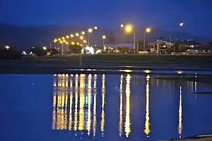 Ahuriri viewed from Westshore Beach | |

| |
| Country | New Zealand |
| Local authority | Napier |
| Electoral ward | Ahuriri |
| Population (2018)[1] | |
| • Total | 1,161 |
| Westshore | (Hawke Bay) | |
|
|
||
| Onekawa | Hospital Hill | Bluff Hill |
The area was a major site of Māori and European settlement, and the site of the Port of Napier until the 1931 Hawke's Bay earthquake. It has since been redeveloped as a mixed commercial and residential area.[2]
Demographics
| Year | Pop. | ±% p.a. |
|---|---|---|
| 2006 | 858 | — |
| 2013 | 1,089 | +3.46% |
| 2018 | 1,161 | +1.29% |
| Source: [1] | ||

Ahuriri had a population of 1,161 at the 2018 New Zealand census, an increase of 72 people (6.6%) since the 2013 census, and an increase of 303 people (35.3%) since the 2006 census. There were 510 households. There were 528 males and 630 females, giving a sex ratio of 0.84 males per female. The median age was 59.4 years (compared with 37.4 years nationally), with 108 people (9.3%) aged under 15 years, 138 (11.9%) aged 15 to 29, 432 (37.2%) aged 30 to 64, and 486 (41.9%) aged 65 or older.
Ethnicities were 92.0% European/Pākehā, 10.6% Māori, 0.8% Pacific peoples, 2.8% Asian, and 1.6% other ethnicities (totals add to more than 100% since people could identify with multiple ethnicities).
The proportion of people born overseas was 18.3%, compared with 27.1% nationally.
Although some people objected to giving their religion, 45.0% had no religion, 44.7% were Christian, 0.8% were Hindu, 0.3% were Muslim, 0.3% were Buddhist and 2.3% had other religions.
Of those at least 15 years old, 231 (21.9%) people had a bachelor or higher degree, and 195 (18.5%) people had no formal qualifications. The median income was $31,300, compared with $31,800 nationally. The employment status of those at least 15 was that 417 (39.6%) people were employed full-time, 114 (10.8%) were part-time, and 21 (2.0%) were unemployed.[1]
Education
Port Ahuriri School is co-educational Year 1-6 state primary school,[3][4] with a roll of 259 as of March 2020.[5][6]
References
- "Statistical area 1 dataset for 2018 Census". Statistics New Zealand. March 2020. Ahuriri (212900). 2018 Census place summary: Ahuriri
- "About > History". ahuriri.co.nz. Ahuriri Business Associatio.
- "Official School Website". portahuriri.school.nz.
- "Ministry of Education School Profile". educationcounts.govt.nz. Ministry of Education.
- "New Zealand Schools Directory". New Zealand Ministry of Education. Retrieved 26 April 2020.
- "Education Review Office Report". ero.govt.nz. Education Review Office.