Aist (river)
The Aist is a river system in Upper Austria, a tributary of the Danube. Via its source rivers the Feldaist and the Waldaist, and other streams, it drains an area of 647 km2 (250 sq mi).[2]
| Aist | |
|---|---|
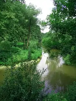 The Aist near Hohensteg (Schwertberg/Upper Austria) | |
| Location | |
| Country | Austria |
| Physical characteristics | |
| Source | |
| • coordinates | 48°19′14″N 14°33′56″E |
| Mouth | |
• location | Danube |
• coordinates | 48.2311°N 14.5648°E |
| Length | 13.7 km (8.5 mi) [1] |
| Basin features | |
| Progression | Danube→ Black Sea |
The Aist rises in Hohensteg (south of Pregarten) and flows through the protected Natura 2000 site Waldaist-Naarn (Fauna-Flora-Habitat Area) on its 14 km (8.7 mi) journey to its confluence with the Danube.
History
The name "Aist" was derived from a Slavic river designation, recorded in ancient documents such as the Wilhelmine deed. Upper Austria, as well as many other parts of Europe, were at that time inhabited by Slavic peoples. The river appeared for the first time in 853 in a deed as "Agasta". In 983 it is called "Agesta". The prefix "ag" means "drive" or "fast".[3] The name of Dietmar von Aist (1140–1171), a Minnesänger, may be related to the Aist.
In the August 2002 flood, the entire Aist area was devastated.
References
- DORIS Atlas (Upper Austria)
- XXIIIrd International Navigation Congress 1973 p19 "Similar flood protection measures were achieved by a newly founded Water Board on the river Aist, a left-bank tributary coming down from the Muhlviertel."
- Methoden der Namenforschung: Methodologie, Methodik und Praxis Arne Ziegler, Erika Windberger Heidenkummer - 2011 "Die Aist verzweigt sich bei Hohensteg in die westliche Feldaist und in die östliche Waldaist, 1131 (Kopie nach 1356) Westeragist, Waldaigst. ON. (alle im PB Perg, O.-Ö.): Aisthofen, 983-91 (Kopie 1140-50) de Agesta;"