Al-Hasakah District
Al-Hasakah District (Arabic: منطقة الحسكة, romanized: manṭiqat al-Ḥasaka) is a district of al-Hasakah Governorate in northeastern Syria. The administrative centre for the district is the city of al-Hasakah. At the 2004 census, the district had a population of 480,394.
al-Hasakah District
منطقة الحسكة | |
|---|---|
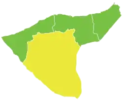 Location of al-Hasakah District within al-Hasakah Governorate | |
 al-Hasakah District Location in Syria | |
| Coordinates (al-Hasakah): 36.5°N 40.75°E | |
| Country | |
| Governorate | al-Hasakah |
| Seat | al-Hasakah |
| Subdistricts | 7 nawāḥī |
| Area | |
| • Total | 12,646.32 km2 (4,882.77 sq mi) |
| Population (2004) | 480,394 |
| Geocode | SY0800 |
Demographics
In 1939, French mandate authorities reported the following population numbers for the different ethnic and religious groups in al-Hasakah area.[1]
| District | Arab | Kurd | Christian | Armenian | Assyrian |
|---|---|---|---|---|---|
| City centre | 7133 | 360 | 5700 | 500 | |
| Tel Tamer | 8767 | ||||
| Ras al-Ayn | 2283 | 1025 | 2263 | ||
| Shaddadi | 2610 | 6 | |||
| Tel Brak | 4509 | 905 | 200 |
Subdistricts
The district of al-Hasakah is divided into seven subdistricts or nawāḥī (population as of 2004):
| PCode | Name | Area | Population | Villages | Seat |
|---|---|---|---|---|---|
| SY080000 | al-Hasakah Subdistrict | 2,509.56 km² | 251,570 | 108 | al-Hasakah |
| SY080001 | Tell Tamer Subdistrict | 1,111.89 km² | 50,982 | 13 | Tell Tamer |
| SY080002 | al-Shaddadah Subdistrict | 1,935.05 km² | 58,916 | 16 | al-Shaddadah |
| SY080003 | Markada Subdistrict | 3,383.44 km² | 34,745 | 13 | Markada |
| SY080004 | Bir al-Helou al-Wardiya Subdistrict | 915.05 km² | 38,833 | 72 | Bir al-Helou |
| SY080005 | al-Arishah Subdistrict | 1,519.41 km² | 30,544 | 20 | al-Arishah |
| SY080006 | al-Hawl Subdistrict | 1,271.92 km² | 14,804 | 22 | al-Hawl |
References
- Algun, S., 2011. Sectarianism in the Syrian Jazira: Community, land and violence in the memories of World War I and the French mandate (1915- 1939). Ph.D. Dissertation. Universiteit Utrecht, the Netherlands. Page 11. Accessed on 8 December 2019.
This article is issued from Wikipedia. The text is licensed under Creative Commons - Attribution - Sharealike. Additional terms may apply for the media files.