Alhang
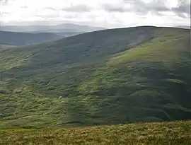
Alhang is a hill in the Carsphairn and Scaur Hills range, part of the Southern Uplands of Scotland. It is the lowest Donald hill in the range; Meikledodd Hill is 1m higher.[3] The northern slopes of the hill are the source of the River Afton.[4] It is most easily climbed from the Water of Ken to the east or as a round from Glen Afton to the north.[1]
| Alhang | |
|---|---|
 | |
| Highest point | |
| Elevation | 642 m (2,106 ft) [1] |
| Prominence | 90 m (300 ft) [1] |
| Listing | Tu,Sim, D,sHu,GT,DN[2] |
| Geography | |
| Location | Dumfries and Galloway, Scotland |
| Parent range | Carsphairn and Scaur Hills, Southern Uplands |
| OS grid | NS 64229 01026 |
| Topo map | OS Landranger 77 |
References
- "Alhang". Hill-bagging.co.uk. Retrieved 2020-04-23.
- Chris Crocker. "Database of British and Irish Hills: user guide". Hills-database.co.uk. Retrieved 2020-04-23.
- "Meikledodd Hill". Hill-bagging.co.uk. Retrieved 2020-04-23.
- "River Afton - Wikipedia". En.wikipedia.org. Retrieved 2020-04-23.
- "Alwhat". Hill-bagging.co.uk. Retrieved 2020-04-23.
This article is issued from Wikipedia. The text is licensed under Creative Commons - Attribution - Sharealike. Additional terms may apply for the media files.