Altha, Florida
Altha is a small town in Calhoun County, Florida, United States. The population was 536 at the 2010 census.[5] This is an increase from 506 as of 2000. Altha was founded in 1902.
Altha, Florida | |
|---|---|
 Town Hall of Altha, Florida; 2008. | |
 Location of Altha in Calhoun County, Florida. | |
| Coordinates: 30°34′18″N 85°7′39″W | |
| Country | |
| State | |
| County | Calhoun |
| Area | |
| • Total | 1.37 sq mi (3.54 km2) |
| • Land | 1.34 sq mi (3.46 km2) |
| • Water | 0.03 sq mi (0.08 km2) |
| Elevation | 203 ft (62 m) |
| Population (2010) | |
| • Total | 536 |
| • Estimate (2019)[2] | 492 |
| • Density | 367.99/sq mi (142.05/km2) |
| Time zone | UTC-6 (Central (CST)) |
| • Summer (DST) | UTC-5 (CDT) |
| ZIP code | 32421 |
| Area code(s) | 850 |
| FIPS code | 12-01000[3] |
| GNIS feature ID | 0277823[4] |
Geography

Altha is located at 30°34′18″N 85°7′39″W (30.571710, -85.127533).[6]
According to the United States Census Bureau, the town has a total area of 1.5 square miles (3.9 km2), of which 1.4 square miles (3.6 km2) is land and 0.04 square miles (0.10 km2) (2.72%) is water.
Altha is located in northwestern Florida, approximately 45 minutes from the Georgia state line and one hour from the Alabama state line. Altha is in a rural county, with the primary industry being agriculture. Tomatoes, watermelons, green vegetables, cucumbers, peanuts, corn, wheat, and cotton are all major crops in this farming area. The timber industry also thrives in the area, with many farmers electing to plant pine trees.
Businesses and attractions
The largest employer in Altha is Oglesby Plants International.[7] The Chipola River, about three miles west of Altha, offers swimming and fishing opportunities. The biggest restaurant in the Altha area is the Altha Diner.
Weather
Altha has an average high temperature of 76 degrees Fahrenheit, with an average low of 51 degrees Fahrenheit. Summers in this area are quite hot and humid, with afternoon showers frequently occurring during the summer months. Altha is located about 35 miles from the Gulf of Mexico, so when tropical storms or hurricanes approach the coastline, weather can become severe. In 2004, during Hurricane Ivan, dozens of homes were destroyed and four people were killed because of a severe tornado striking near the town.
The coldest part of the winter occurs during late January and early February. Temperatures at night can dip as low as the lower 20s, and in some isolated instances, even striking the mid-teens. Days can be cool during these few weeks, with temperatures sometimes struggling to reach 60 degrees Fahrenheit.
In October 2018, Altha and the surrounding areas were hit by Hurricane Michael. Hurricane Michael, listed as a category 5 hurricane, and the strongest to ever hit North West Florida, caused extensive damage to the town. The old high school building, known as the white building, and many homes were damaged and/or destroyed as a result.
Education

Altha, served by the Calhoun County School District is home to the K-12 Altha Public School, established early after the turn of the twentieth century.
Sports
The girls' volleyball team has won numerous district, region, and state semi-finals playoffs as well. Altha School runs boys' basketball, volleyball, softball, baseball, weightlifting, and a cross-country team. The girls' and boys' weightlifting teams have won several state championships.
Demographics
| Historical population | |||
|---|---|---|---|
| Census | Pop. | %± | |
| 1950 | 434 | — | |
| 1960 | 413 | −4.8% | |
| 1970 | 423 | 2.4% | |
| 1980 | 478 | 13.0% | |
| 1990 | 497 | 4.0% | |
| 2000 | 506 | 1.8% | |
| 2010 | 536 | 5.9% | |
| 2019 (est.) | 492 | [2] | −8.2% |
| U.S. Decennial Census[8] | |||
As of the census of 2010, there were 536 people and 219 households in the town. The racial makeup of the town was 99.5% Caucasian and 0.5% Asian or Hispanic/Latino. Altha previously had a segregated history but that has long since past
The population was 47 percent male and 53 percent female. Twenty-three percent of the population was under 18 and 15.5 percent was 65 or over.
References
| Wikimedia Commons has media related to Altha, Florida. |
- "2019 U.S. Gazetteer Files". United States Census Bureau. Retrieved July 2, 2020.
- "Population and Housing Unit Estimates". United States Census Bureau. May 24, 2020. Retrieved May 27, 2020.
- "U.S. Census website". United States Census Bureau. Retrieved 2008-01-31.
- "US Board on Geographic Names". United States Geological Survey. 2007-10-25. Retrieved 2008-01-31.
- US Census Archived 2012-09-01 at the Wayback Machine
- "US Gazetteer files: 2010, 2000, and 1990". United States Census Bureau. 2011-02-12. Retrieved 2011-04-23.
- "Census of Population and Housing". Census.gov. Retrieved June 4, 2015.
Municipalities and communities of Calhoun County, Florida, United States | ||
|---|---|---|
| City | 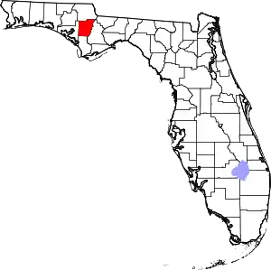 | |
| Town | ||
| Unincorporated communities | ||
| ||