Alton, Utah
Alton is a town in northwest Kane County, Utah, United States. The population was 119 at the 2010 census,[5] a decrease from the 2000 figure of 134.
Alton, Utah | |
|---|---|
Town | |
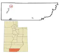 Location in Kane County and the state of Utah | |
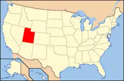 Location of Utah in the United States | |
| Coordinates: 37°26′16″N 112°28′58″W[1] | |
| Country | United States |
| State | Utah |
| County | Kane |
| Founded | 1907 |
| Incorporated | 1935 |
| Named for | Alton Fjord |
| Area | |
| • Total | 2.33 sq mi (6.02 km2) |
| • Land | 2.29 sq mi (5.93 km2) |
| • Water | 0.04 sq mi (0.10 km2) |
| Elevation | 7,041 ft (2,146 m) |
| Population (2010) | |
| • Total | 119 |
| • Estimate (2019)[3] | 120 |
| • Density | 52.45/sq mi (20.25/km2) |
| Time zone | UTC-7 (MST) |
| • Summer (DST) | UTC-6 (MDT) |
| ZIP code | 84710 |
| Area code(s) | 435 |
| FIPS code | 49-00870[4] |
| GNIS feature ID | 1438182[1] |
History
Alton was first settled by Lorenzo Wesley Roundy in 1865 and was originally called "Roundys Station".[6][7] Roundy's family was forced to leave due to conflicts with the local American Indians. The community was later called "Graham", after Graham Duncan McDonald, a local pioneer. Over the years, many names had been discussed, but a consensus could not be reached. In 1912, a drawing was held at a community event to determine the name of the community. Charles R. Pugh, who had been reading about the Alton Fjord in Norway suggested the name, and it was pulled from the hat by a two-year-old child.
Demographics
| Historical population | |||
|---|---|---|---|
| Census | Pop. | %± | |
| 1900 | 106 | — | |
| 1910 | 98 | −7.5% | |
| 1920 | 169 | 72.4% | |
| 1930 | 193 | 14.2% | |
| 1940 | 239 | 23.8% | |
| 1950 | 154 | −35.6% | |
| 1960 | 116 | −24.7% | |
| 1970 | 62 | −46.6% | |
| 1980 | 75 | 21.0% | |
| 1990 | 93 | 24.0% | |
| 2000 | 134 | 44.1% | |
| 2010 | 119 | −11.2% | |
| 2019 (est.) | 120 | [3] | 0.8% |
| U.S. Decennial Census[8] | |||
As of the census of 2010, there were 119 people in 39 households in the town. The racial makeup of the town was 89% white, 5% Hispanic or Latino, and 2.5% Native American.
The population was 45 percent male and 55 percent female. The population was 38.7 percent under the age of 18 and 20 percent 65 or over.
Geography
Alton is in northwestern Kane County, in a sloping valley known as the "Alton Amphitheater", 4 miles (6 km) east of U.S. Route 89 along Utah State Route 136. Kanab Creek flows past the east side of the community.[9]
According to the United States Census Bureau, the town has a total area of 2.1 square miles (5.5 km2), of which 0.04 square miles (0.1 km2), or 1.74%, are water.[5]
Climate
The Köppen Climate Classification subtype for this climate is "Csb" (Mediterranean climate).
| Climate data for Alton, Utah | |||||||||||||
|---|---|---|---|---|---|---|---|---|---|---|---|---|---|
| Month | Jan | Feb | Mar | Apr | May | Jun | Jul | Aug | Sep | Oct | Nov | Dec | Year |
| Average high °C (°F) | 4 (39) |
6 (42) |
9 (48) |
14 (57) |
19 (67) |
25 (77) |
28 (82) |
27 (80) |
23 (73) |
17 (63) |
10 (50) |
5 (41) |
16 (60) |
| Average low °C (°F) | −9 (15) |
−8 (18) |
−6 (22) |
−2 (28) |
2 (35) |
6 (42) |
10 (50) |
9 (49) |
6 (42) |
1 (33) |
−5 (23) |
−8 (17) |
−1 (31) |
| Average precipitation mm (inches) | 48 (1.9) |
46 (1.8) |
41 (1.6) |
28 (1.1) |
20 (0.8) |
13 (0.5) |
36 (1.4) |
43 (1.7) |
38 (1.5) |
38 (1.5) |
30 (1.2) |
43 (1.7) |
420 (16.7) |
| Source: Weatherbase [10] | |||||||||||||
See also
- List of cities and towns in Utah
References
- U.S. Geological Survey Geographic Names Information System: Alton, Utah
- "2019 U.S. Gazetteer Files". United States Census Bureau. Retrieved August 7, 2020.
- "Population and Housing Unit Estimates". United States Census Bureau. May 24, 2020. Retrieved May 27, 2020.
- "U.S. Census website". United States Census Bureau. Retrieved 2008-01-31.
- "Geographic Identifiers: 2010 Census Summary File 1 (G001), Alton town, Utah". American FactFinder. U.S. Census Bureau. Archived from the original on February 13, 2020. Retrieved May 13, 2019.
- Andrew Jenson. Encyclopedic History of the Church. (Salt Lake City: Deseret Book, 1941) p. 17
- John W. Van Cott Utah Place Names. (University of Utah Press, 2000) p. 5
- "Census of Population and Housing". Census.gov. Retrieved June 4, 2015.
- Alton, UT, 7.5 Minute Topographic Quadrangle, USGS, 1966 (1980 rev.)
- "Weatherbase.com". Weatherbase. 2013. Retrieved on August 14, 2013.
External links
![]() Media related to Alton, Utah at Wikimedia Commons
Media related to Alton, Utah at Wikimedia Commons
Municipalities and communities of Kane County, Utah, United States | ||
|---|---|---|
| City | 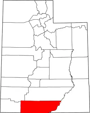 Map of Utah highlighting Kane County | |
| Towns | ||
| Unincorporated communities | ||
| Ghost towns | ||
| ||
| Authority control |
|---|