Altoona, Iowa
Altoona is a city in Polk County, Iowa, United States, and is a part of the Des Moines metropolitan area. The population was 14,541 at the 2010 census.
Altoona | |
|---|---|
 Location of Altoona, Iowa | |
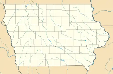 Altoona Location of Altoona, Iowa  Altoona Altoona (the United States)  Altoona Altoona (North America) | |
| Coordinates: 41°39′0″N 93°28′21″W | |
| Country | United States |
| State | Iowa |
| County | Polk |
| Area | |
| • Total | 10.92 sq mi (28.29 km2) |
| • Land | 10.91 sq mi (28.26 km2) |
| • Water | 0.01 sq mi (0.03 km2) |
| Elevation | 955 ft (291 m) |
| Population | |
| • Total | 14,541 |
| • Estimate (2019)[3] | 19,221 |
| • Rank | 26th in Iowa |
| • Density | 1,761.62/sq mi (680.19/km2) |
| Time zone | UTC-6 (Central (CST)) |
| • Summer (DST) | UTC-5 (CDT) |
| ZIP code | 50009 |
| Area code(s) | 515 |
| FIPS code | 19-01630 |
| GNIS feature ID | 0454160 |
Altoona is home of the Adventureland amusement park and Prairie Meadows horse racing track and casino.
History
Anthony Yant first settled in what is now Altoona in 1854, the same year Gilbert T. Taylor settled there. The land was originally surveyed in 1847 and put up for sale by the US government in 1848, but it took six years to sell. After many sales between different families, the Davis family ended up with the land on February 1, 1868.
The Davises hired surveyor Juian B. Bausman to lay out the city. He is also credited for giving the city the current name. Altoona is named for the Latin word for "high," altus, after surveyor Julian B. Bausman discovered Altoona was the highest point on the Des Moines Valley Railroad between Des Moines and Keokuk.[4]
The plot was recorded on July 30, 1868, and the Post office opened the next day. When the Rock Island Railroad came to Altoona in September of that year, they referred to Altoona as Yant, the city's original name.
Altoona was incorporated as a city on March 11, 1876.
In addition to serving as Altoona's first mayor, Francis English was the town doctor.[5] After the great train crash of 1877, English was the first doctor on the scene.
Altoona's second mayor was Thomas Haines, who operated the T.E. Haines tile and brick company. Haines donated land to the City of Altoona to be used as a park, now known as Haines Park.
The only other mayor of Altoona to have a park dedicated to him is Sam Wise, noted for paving the streets of Altoona, and building a sewer system that was advanced for its time and allowed for future expansion. His dedication to Altoona's parks led to the city's sports complex being named the "Sam Wise Youth Complex."
By the turn of the 20th century, Altoona could almost be classified as a coal camp. United Mine Workers of America Local 407 was organized in Altoona in 1897, and by 1902, it had 61 members. This was close to 20 percent of the town's population at the time.[6]
On May 5, 2003, the Altoona City Council recognized the Altoona Area Historical Society as the City's official organization to collect, secure, and preserve the artifacts and records of the City of Altoona and surrounding areas. In 2011 the Altoona Area Historical Society started major renovation work on the interior of Altoona's oldest building. The building is now a museum.
In 2013, construction began for a new Facebook data center. Facebook asked local company RPM Access to build and operate a wind farm that will put more energy into the system than the data center will consume.[7]
In February 2016, the Cinemark Altoona theater opened.
Geography
According to the United States Census Bureau, the city has an area of 9.35 square miles (24.22 km2), all land.[8]
Demographics
| Historical population | |||
|---|---|---|---|
| Census | Pop. | %± | |
| 1880 | 400 | — | |
| 1890 | 326 | −18.5% | |
| 1900 | 328 | 0.6% | |
| 1910 | 438 | 33.5% | |
| 1920 | 502 | 14.6% | |
| 1930 | 514 | 2.4% | |
| 1940 | 640 | 24.5% | |
| 1950 | 763 | 19.2% | |
| 1960 | 1,458 | 91.1% | |
| 1970 | 2,883 | 97.7% | |
| 1980 | 5,764 | 99.9% | |
| 1990 | 7,242 | 25.6% | |
| 2000 | 10,345 | 42.8% | |
| 2010 | 14,541 | 40.6% | |
| 2019 (est.) | 19,221 | [3] | 32.2% |
| Iowa Data Center | |||
2010 census
As of the census[2] of 2010, there were 14,541 people, 5,459 households, and 3,945 families residing in the city. The population density was 1,555.2 inhabitants per square mile (600.5/km2). There were 5,702 housing units at an average density of 609.8 per square mile (235.4/km2). The racial makeup of the city was 95.1% White, 1.1% African American, 0.1% Native American, 1.1% Asian, 0.2% Pacific Islander, 0.9% from other races, and 1.5% from two or more races. Hispanic or Latino of any race were 2.9% of the population.
There were 5,459 households, of which 42.2% had children under the age of 18 living with them, 57.1% were married couples living together, 11.6% had a female householder with no husband present, 3.6% had a male householder with no wife present, and 27.7% were non-families. 22.6% of all households were made up of individuals, and 6.6% had someone living alone who was 65 years of age or older. The average household size was 2.64 and the average family size was 3.12.
The median age in the city was 33.7 years. 30% of residents were under the age of 18; 7.4% were between the ages of 18 and 24; 30.4% were from 25 to 44; 23.1% were from 45 to 64; and 9.1% were 65 years of age or older. The gender makeup of the city was 48.9% male and 51.1% female.
2000 census
As of the census[9] of 2000, there were 10,345 people, 3,850 households, and 2,895 families residing in the city. The population density was 1,835.4 people per square mile (708.2/km2). There were 3,959 housing units at an average density of 557.3 per square mile (215.3/km2). The racial makeup of the city was 97.11% White, 0.92% African American, 0.33% Native American, 0.46% Asian, 0.41% Pacific Islander, 0.77% from other races, and 1.20% from two or more races. Hispanic or Latino of any race were 1.65% of the population.
There were 3,850 households, out of which 43.7% had children under the age of 18 living with them, 58.5% were married couples living together, 14.0% had a female householder with no husband present, and 24.8% were non-families. 19.9% of all households were made up of individuals, and 5.4% had someone living alone who was 65 years of age or older. The average household size was 2.66 and the average family size was 3.08.
Age spread: 30.6% under the age of 18, 8.1% from 18 to 24, 33.3% from 25 to 44, 20.3% from 45 to 64, and 7.7% who were 65 years of age or older. The median age was 32 years. For every 100 females, there were 91.4 males. For every 100 females age 18 and over, there were 85.9 males.
The median income for a household in the city was $50,162, and the median income for a family was $58,306. Males had a median income of $36,030 versus $28,205 for females. The per capita income for the city was $20,336. About 4.0% of families and 5.5% of the population were below the poverty line, including 7.2% of those under age 18 and 4.2% of those age 65 or over.
Education
Altoona (along with nearby Runnells, Mitchellville, and parts of Pleasant Hill and Des Moines) is part of the Southeast Polk Community School District, and its students attend Southeast Polk High School. The town is home to four of the district's eight elementary schools: Altoona, Centennial, Clay, and Willowbrook. The Altoona Elementary building also was the town's high school until it joined the Southeast Polk consolidation in 1962.
Notable people
- John Houbolt (1919-2014), Aerospace engineer promoted the lunar mission mode called LOR for going to the moon and back
- Geri Huser (born 1963), Democratic Iowa House representative
- Kyle Orton (born 1982), NFL quarterback for the Buffalo Bills
- Ed Skinner (1936-2015), Iowa lawyer and legislator
- Neal Edward Smith (born 1920), former US Representative from Iowa and an author
- Jamie Solinger, Miss Iowa Teen USA 1992, Miss Teen USA 1992, Miss Iowa USA 1998
- John Falsey (born 1951), writer, director, and producer of TV shows such as Northern Exposure
Mayors
| In office | Mayor [10] | Special note |
|---|---|---|
| 1876 | Francis Edwin English | Altoona's first mayor. |
| 1877 | Thomas Haines | |
| 1878 | William Douglas | |
| 1879 | B.W. Henry | |
| 1880 | M. Madagan | |
| 1881 | E. Chavannes | |
| 1882 | William Douglas | |
| 1883–1884 | James Porter | |
| 1885 | R.C. Lain | |
| 1886–1887 | W.H. Baker | |
| 1888–1889 | W.J. Combs | |
| 1890 | E.R. Witter | |
| 1891 | W.J. Combs | |
| 1892 | F. Henshaw | |
| 1893–1894 | Ferdinand Burkhardt | |
| 1895 | Ely Snyder | |
| 1896 | E.R. Slai | |
| 1897 | Harvey Yant | |
| 1898–1900 | I.A. Ogden | |
| 1901 | F.M. West | |
| 1902–1903 | R.G. Shipley | |
| 1904–1905 | J.P. Hewitt | |
| 1906 | M.W. Wilson | |
| 1907 | R. Madagan | |
| 1908–1909 | J.D. Williams | |
| 1910 | M.W. Wilson | |
| 1911–1913 | C.C. Lang | |
| 1914–1915 | N.B. Shaffer | |
| 1916–1917 | J.C. Jones | |
| 1918–1919 | J.O. Lee | |
| 1920 | J.C. Jones | |
| 1921 | G.A. Bonnewell | |
| 1922–1923 | A.A. Yount | |
| 1924–1925 | J.C. Jones | |
| 1926–1927 | C.W. Britton | |
| 1928–1929 | C.L. Bane | |
| 1930–1931 | Alden M. Peterson | |
| 1932–1933 | C.L. Bane | |
| 1934 | William Carpenter | |
| 1934–1935 | Wesley L. McQuerry | |
| 1936–1953 | George Heller | |
| 1954–1957 | Frank Long | |
| 1958–1959 | Paul Workman | |
| 1960–1962 | L.J. Sam Wise | |
| 1962 | Hurshel Surber | |
| 1962–1963 | Lloyd Sievers | |
| 1964–1973 | L.J. Sam Wise | |
| 1974–1979 | Lloyd Sievers | |
| 1980–1987 | L.J. Sam Wise | |
| 1988–2012 | Tim Burget | Altoona's longest-serving mayor |
| 2012–2017 | J.M. Skip Conkling | Only Altoona mayor to die in office |
| 2017 | Caryl Jean Conkling | Altoona's first female mayor, the first spouse of a former mayor to also serve |
| 2017–present | Dean O'Connor | |
References
- "2019 U.S. Gazetteer Files". United States Census Bureau. Retrieved July 17, 2020.
- "U.S. Census website". United States Census Bureau. Retrieved May 11, 2012.
- "Population and Housing Unit Estimates". United States Census Bureau. May 24, 2020. Retrieved May 27, 2020.
- Henning, Barbara Beving Long; Patrice K. Beam (2003). Des Moines and Polk County: Flag on the Prairie. Sun Valley, California: American Historical Press. ISBN 1-892724-34-0.
- Payne, Alex (2018). Rising to New Heights: 150 Years of Altoona History. Brookfield, Missouri: Donning Company Publishers. ISBN 978-1-68184-191-5.
- Trade Unions in Iowa – Table No. 1, Mine Workers of America, United, Tenth Biennial Report of the Bureau of Labor Statistics for the State of Iowa, 1901–1902, Murphy, Des Moines, 1903; page 232.
- Coldewey, Devin. "www.nbcnews.com/technology/wind-farm-meets-server-farm-latest-facebook-data-center-2D11591372". NBC News. Retrieved November 14, 2013.
- "US Gazetteer files 2010". United States Census Bureau. Archived from the original on January 12, 2012. Retrieved 2012-05-11.
- "U.S. Census website". United States Census Bureau. Retrieved 2008-01-31.
- Payne, Alex (2018). Rising to New Heights: 150 Years of Altoona History. Brookfield, Missouri: Donning Company Publishers. ISBN 978-1-68184-191-5.
External links
| Wikimedia Commons has media related to Altoona, Iowa. |
Municipalities and communities of Polk County, Iowa, United States | ||
|---|---|---|
| Cities | Map of Iowa highlighting Polk County | |
| Townships | ||
| CDP | ||
| Other communities | ||
| Ghost town | ||
| Footnotes | ‡This populated place also has portions in an adjacent county or counties | |
| ||