Ames, New York
Ames is a village in Montgomery County, New York, United States.[3] The population was 145 at the 2010 census.
Ames, New York | |
|---|---|
 Ames, New York Location within the state of New York  Ames, New York Ames, New York (the United States) | |
| Coordinates: 42°50′15″N 74°36′06″W | |
| Country | United States |
| State | New York |
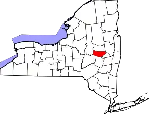
| County | Montgomery |
| Area | |
| • Total | 0.13 sq mi (0.34 km2) |
| • Land | 0.13 sq mi (0.34 km2) |
| • Water | 0.00 sq mi (0.00 km2) |
| Elevation | 705 ft (215 m) |
| Population (2010) | |
| • Total | 145 |
| • Estimate (2019)[2] | 139 |
| • Density | 1,061.07/sq mi (410.62/km2) |
| Time zone | UTC-5 (Eastern (EST)) |
| • Summer (DST) | UTC-4 (EDT) |
| ZIP code | 13317 |
| Area code(s) | 518 |
| FIPS code | 36-01737 |
| GNIS feature ID | 942431[3] |
The Village of Ames is in the south-central part of the Town of Canajoharie and is south of the Village of Canajoharie.
Ames is one of the smallest villages in New York State.
History
Unlike other communities in the region, settled by German settlers, Ames was settled by pioneers from New England around 1779. The village was incorporated in 1924.
The Ames Academy Building was listed on the National Register of Historic Places in 2002.[4]
Geography
According to the United States Census Bureau, the village has a total area of 0.1 square miles (0.26 km2), all of it land.
Ames is located on New York State Route 10, a north–south highway.
Demographics
| Historical population | |||
|---|---|---|---|
| Census | Pop. | %± | |
| 1870 | 150 | — | |
| 1880 | 148 | −1.3% | |
| 1930 | 170 | — | |
| 1940 | 180 | 5.9% | |
| 1950 | 193 | 7.2% | |
| 1960 | 162 | −16.1% | |
| 1970 | 198 | 22.2% | |
| 1980 | 224 | 13.1% | |
| 1990 | 166 | −25.9% | |
| 2000 | 173 | 4.2% | |
| 2010 | 145 | −16.2% | |
| 2019 (est.) | 139 | [2] | −4.1% |
| U.S. Decennial Census[5] | |||
As of the census[6] of 2000, there were 173 people, 68 households, and 49 families residing in the village. The population density was 1,305.7 people per square mile (513.8/km2). There were 72 housing units at an average density of 543.4 per square mile (213.8/km2). The racial makeup of the village was 99.42% White, and 0.58% from two or more races.
There were 68 households, out of which 26.5% had children under the age of 18 living with them, 66.2% were married couples living together, 4.4% had a female householder with no husband present, and 26.5% were non-families. 22.1% of all households were made up of individuals, and 8.8% had someone living alone who was 65 years of age or older. The average household size was 2.54 and the average family size was 3.02.
In the village, the population was spread out, with 26.0% under the age of 18, 5.8% from 18 to 24, 29.5% from 25 to 44, 23.1% from 45 to 64, and 15.6% who were 65 years of age or older. The median age was 36 years. For every 100 females, there were 101.2 males. For every 100 females age 18 and over, there were 103.2 males.
The median income for a household in the village was $32,500, and the median income for a family was $38,750. Males had a median income of $30,000 versus $23,750 for females. The per capita income for the village was $17,794. About 8.7% of families and 8.8% of the population were below the poverty line, including 13.2% of those under the age of eighteen and 16.7% of those sixty-five or over.
Notable people
- Alexander Randall, 6th Governor of Wisconsin.[7]
References
- "2019 U.S. Gazetteer Files". United States Census Bureau. Retrieved July 27, 2020.
- "Population and Housing Unit Estimates". United States Census Bureau. May 24, 2020. Retrieved May 27, 2020.
- U.S. Geological Survey Geographic Names Information System: Ames
- "National Register Information System". National Register of Historic Places. National Park Service. March 13, 2009.
- "Census of Population and Housing". Census.gov. Retrieved June 4, 2015.
- "U.S. Census website". United States Census Bureau. Retrieved 2008-01-31.
- "Wisconsin Governor Alexander Williams Randall". Retrieved 2013-10-15.