Andes, New York
Andes is a town in Delaware County, New York, United States. The population was 1,301 at the 2010 census.[3]
Andes, New York | |
|---|---|
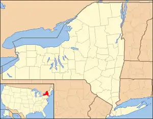 Andes Location of Andes in New York | |
| Coordinates: 42°11′20″N 74°47′09″W | |
| Country | United States |
| State | New York |
| County | Delaware |
| Government | |
| • Type | Town Council |
| • Town Supervisor | Martin A. Donnelly (R) |
| • Town Council | Members' List
|
| Area | |
| • Total | 112.36 sq mi (291.01 km2) |
| • Land | 108.66 sq mi (281.44 km2) |
| • Water | 3.69 sq mi (9.57 km2) |
| Elevation | 1,600 ft (500 m) |
| Population (2010) | |
| • Total | 1,301 |
| • Estimate (2016)[2] | 1,234 |
| • Density | 11.36/sq mi (4.38/km2) |
| Time zone | Eastern (EST) |
| ZIP code | 13731 |
| Area code(s) | 845 |
| FIPS code | 36-025-02132 |
| GNIS code | 978680 |
| Website | townofandes |
The town of Andes contains a hamlet (formerly a village) also named Andes. The town is on the southeast border of the county.
History
Settlement began in 1784. The town was formed in 1819 from the town of Middletown. Most of Delaware County, including Andes, became part of the Hardenbergh Patent, a manor which was owned by members of the Livingston family.
In 1845, in what became known as the Anti-Rent War, protesters, several hundred dressed as "Calico Indians", shot and killed Under-Sheriff Osman Steele, when he and deputies attempted to collect rent overdue to the lord of the manor of about $64. Hundreds of protesters were arrested and two were sentenced to death, but their sentences were later commuted.
On December 31, 2003, the incorporated village of Andes ceased to exist. During a special village election on June 3, 2002, the residents approved the dissolution of the village by a vote of 81 to 63.[4]
The Jackson-Aitken Farm was listed on the National Register of Historic Places in 2003.[5]
Geography
Andes is located in southeastern Delaware County on the western edge of the Catskill Mountains. The south town line is the border of Ulster County. Andes is partly in the Catskill Park.
According to the United States Census Bureau, the town has a total area of 112.7 square miles (291.8 km2), of which 108.6 square miles (281.3 km2) is land and 3.7 square miles (9.6 km2), or 3.29%, is water.[3] The Pepacton Reservoir, an impoundment on the East Branch Delaware River, crosses the south-central part of the town.
Demographics
| Historical population | |||
|---|---|---|---|
| Census | Pop. | %± | |
| 1820 | 1,378 | — | |
| 1830 | 1,859 | 34.9% | |
| 1840 | 2,176 | 17.1% | |
| 1850 | 2,672 | 22.8% | |
| 1860 | 2,990 | 11.9% | |
| 1870 | 2,840 | −5.0% | |
| 1880 | 2,639 | −7.1% | |
| 1890 | 2,264 | −14.2% | |
| 1900 | 1,927 | −14.9% | |
| 1910 | 2,007 | 4.2% | |
| 1920 | 1,922 | −4.2% | |
| 1930 | 1,899 | −1.2% | |
| 1940 | 1,687 | −11.2% | |
| 1950 | 1,665 | −1.3% | |
| 1960 | 1,274 | −23.5% | |
| 1970 | 1,193 | −6.4% | |
| 1980 | 1,312 | 10.0% | |
| 1990 | 1,291 | −1.6% | |
| 2000 | 1,356 | 5.0% | |
| 2010 | 1,301 | −4.1% | |
| 2016 (est.) | 1,234 | [2] | −5.1% |
| U.S. Decennial Census[6] | |||
As of the census[7] of 2000, there were 1,356 people, 604 households, and 381 families residing in the town. The population density was 12.4 people per square mile (4.8/km2). There were 1,326 housing units at an average density of 12.2 per square mile (4.7/km2). The racial makeup of the town was 96.90% White, 0.44% Black or African American, 0.29% Native American, 0.59% people of Asian descent, 1.03% from people descended from other races, and 0.74% from two or more races. Hispanic or Latino of any race were 1.92% of the population.
There were 604 households, out of which 20.4% had children under the age of 18 living with them, 53.3% were married couples living together, 5.8% had a female householder with no husband present, and 36.8% were non-families. 31.8% of all households were made up of individuals, and 14.6% had someone living alone who was 65 years of age or older. The average household size was 2.25 and the average family size was 2.77.
In the town, the population was spread out, with 18.4% under the age of 18, 6.3% from 18 to 24, 21.4% from 25 to 44, 32.4% from 45 to 64, and 21.6% who were 65 years of age or older. The median age was 48 years. For every 100 females, there were 104.8 males. For every 100 females age 18 and over, there were 107.7 males.
The median income for a household in the town was $35,119, and the median income for a family was $39,474. Males had a median income of $28,074 versus $22,847 for females. The per capita income for the town was $20,650. About 6.1% of families and 9.4% of the population were below the poverty line, including 14.4% of those under age 18 and 6.8% of those age 65 or over.
Communities and locations in Andes
- Andes – The hamlet of Andes, is on Route 28 in the north part of the town.
- Pepacton Reservoir – A reservoir partly inside the town.
- Union Grove – A community lost to the reservoir.
Notable residents
Notable current and former residents of Andes include Susan Dey, who moved to the area in 2007.[8]
Climate
This climatic region is typified by large seasonal temperature differences, with warm to hot (and often humid) summers and cold (sometimes severely cold) winters. According to the Köppen Climate Classification system, Andes has a humid continental climate, abbreviated "Dfb" on climate maps.[9]
References
- "2016 U.S. Gazetteer Files". United States Census Bureau. Retrieved Jul 4, 2017.
- "Population and Housing Unit Estimates". Retrieved June 9, 2017.
- "Geographic Identifiers: 2010 Demographic Profile Data (G001): Andes town, Delaware County, New York". U.S. Census Bureau, American Factfinder. Archived from the original on February 13, 2020. Retrieved November 4, 2015.
- Breakey, Patricia. "Andes residents begin life after end of village" Archived July 16, 2011, at the Wayback Machine. The Daily Star (Oneonta, New York). January 9, 2004.
- "National Register Information System". National Register of Historic Places. National Park Service. March 13, 2009.
- "Census of Population and Housing". Census.gov. Retrieved June 4, 2015.
- "U.S. Census website". US Census Bureau. Retrieved 2008-01-31.
- "Archived copy". Archived from the original on 2014-11-29. Retrieved 2014-11-15.CS1 maint: archived copy as title (link)
- Climate Summary for Andes, New York
External links
Municipalities and communities of Delaware County, New York, United States | ||
|---|---|---|
| Towns | 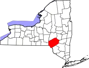 Map of New York highlighting Delaware County | |
| Villages | ||
| CDPs | ||
| Hamlets |
| |
| Footnotes | ‡This populated place also has portions in an adjacent county or counties | |
| ||
| Authority control |
|
|---|