Angas Street, Adelaide
Angas Street is a main street in the CBD of the centre of Adelaide, South Australia.[1][2] The rear of St Aloysius College faces the street, and various law courts are on the street, including the Dame Roma Mitchell Building. The South Australia Police headquarters and South Australian Metropolitan Fire Service Adelaide station are further down the street.
Angas Street | |
|---|---|
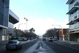 | |
Angas Street, looking east from King William St in June 2010 | |
| General information | |
| Type | Street |
| Location | Adelaide |
| Length | 1.4 km (0.9 mi) |
| Opened | 1837 |
| Major junctions | |
| Western end | King William Street/Victoria Square |
| Pulteney Street, Frome Street, Hutt Street | |
| Eastern end | East Terrace |
| Location(s) | |
| Suburb(s) | Adelaide city centre |
Angas Street runs from the southern end of Victoria Square to East Terrace, Adelaide. It is one of the intermediate-width streets of the Adelaide grid, and is 1 1⁄2 chains (99 ft; 30 m) wide.
History
The street is named after George Fife Angas in recognition of his chairmanship of the South Australian Company.[3]
Angas Street was the site of the Municipal Tramways Trust (and its successors) city depot from 1923 until 1986, on the north side not far from Victoria Square. At its largest, the depot had 19 tram tracks entering, all from facing east. There was never a tram route along Angas Street; entry and exit from the depot required shunting on a dead end stub of track in Angas Street.[4]
Notable buildings
- Arts Theatre, no. 53
- Royalty Theatre, no. 65
- Adelaide City Seventh-day Adventist Church, no. 82
- South Australia Police headquarters, no. 100
- Calvary Adelaide Hospital (under construction, completion due 2020)
- WEA building, no. 223
Junction list
| Location | km[5] | mi | Destinations | Notes | |
|---|---|---|---|---|---|
| Adelaide city centre | 0 | 0.0 | Victoria Square, King William Street | Continues as Gouger Street | |
| 0.55 | 0.34 | Pulteney Street | |||
| 0.75 | 0.47 | Frome Street / Regent Street North | |||
| 1.1 | 0.68 | Hutt Street | |||
| 1.4 | 0.87 | East Terrace | |||
| 1.000 mi = 1.609 km; 1.000 km = 0.621 mi | |||||
See also
![]() Australian Roads portal
Australian Roads portal
References
- 2003 Adelaide Street Directory, 41st Edition. UBD (A Division of Universal Press Pty Ltd). 2003. ISBN 0-7319-1441-4.
- Map of the Adelaide CBD, North Adelaide and the Adelaide Parklands.
- Pastoral Pioneers of South Australia Volume 1 (PDF). The Adelaide Stock and Station Journal. 1925. p. 9. Retrieved 22 November 2018 – via Australian National University.
- "City Depot access". Municipal Tramways Trust (MTT) electric lines. Tramway Museum, St Kilda. Retrieved 21 February 2019.
- Google (11 December 2016). "Angas Street, Adelaide" (Map). Google Maps. Google. Retrieved 11 December 2016.
Streets and squares of Adelaide city centre | |||||||||||||
|---|---|---|---|---|---|---|---|---|---|---|---|---|---|
| |||||||||||||