Angostura Reservoir
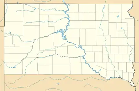
Angostura Reservoir is a reservoir on the Cheyenne River in Fall River County, South Dakota, United States. It was created after the construction of Angostura Dam in 1949 for irrigation by the U.S. Bureau of Reclamation.[2] "Angostura" means "narrows" in Spanish.[2]
| Angostura Reservoir | |
|---|---|
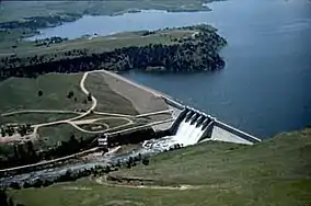 Angostura Dam | |
 Angostura Reservoir  Angostura Reservoir | |
| Location | Fall River County, South Dakota, United States. Near Hot Springs, South Dakota |
| Coordinates | 43°20′36″N 103°26′16″W |
| Type | artificial lake |
| Primary inflows | Cheyenne River Dry Creek Horsehead Creek Tepeee Creek |
| Primary outflows | Cheyenne River |
| Basin countries | United States |
| Surface area | 4,407 acres (17.83 km2) [1] |
| Max. depth | 75 ft (23 m)[2] |
| Shore length1 | 42 mi (68 km)[1] |
| Surface elevation | 3,127 ft (953 m)[3] |
| 1 Shore length is not a well-defined measure. | |
The reservoir covers an area of 4,407 acres (17.83 km2), has a surface elevation of 3,127 ft (953 m), and a maximum depth of 75 ft (23 m).[1][2]
The Angostura Recreation Area surrounds the lake and is a popular location for boating, swimming, camping, and fishing.[2] The lake supports populations of walleye, northern pike, smallmouth bass, and sunfish.[1] As one of the only large bodies of water in the area, Angostura Reservoir is also an important location for migratory birds.[1]
See also
- List of lakes in South Dakota
- U.S. Bureau of Reclamation
- Cold Brook Lake
- Cottonwood Springs Lake
External links
References
- "Angostura Reservoir". www.recreation.gov. Archived from the original on 28 May 2010. Retrieved 2010-04-26.
- "Angostura Recreation Area". South Dakota Department of Game, Fish and Parks. Archived from the original on 20 May 2010. Retrieved 2010-04-26.
- "Angostura Reservoir". Geographic Names Information System. United States Geological Survey. Retrieved Jan 16, 2021.
| Authority control |
|
|---|
