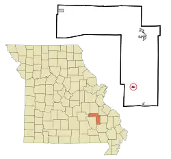
Annapolis, Missouri
Annapolis is a city located in Iron County, Missouri, United States. The population was 468 at the 2010 census.
Annapolis, Missouri | |
|---|---|
 Location of Annapolis, Missouri | |
| Coordinates: 37°21′36″N 90°41′50″W | |
| Country | United States |
| State | Missouri |
| County | Iron |
| Area | |
| • Total | 0.39 sq mi (1.00 km2) |
| • Land | 0.37 sq mi (0.97 km2) |
| • Water | 0.01 sq mi (0.03 km2) |
| Elevation | 653 ft (199 m) |
| Population | |
| • Total | 345 |
| • Estimate (2019)[3] | 343 |
| • Density | 917.11/sq mi (354.35/km2) |
| Time zone | UTC-6 (Central (CST)) |
| • Summer (DST) | UTC-5 (CDT) |
| ZIP code | 63620 |
| Area code(s) | 573 |
| FIPS code | 29-01270[4] |
| GNIS feature ID | 0713303[5] |
History
Annapolis was laid out in 1871, and according to tradition, named after Anna Allen, the wife of a railroad official.[6] The name is also said to be a transfer from Annapolis, Maryland.[7] A post office called Annapolis has been in operation since 1871.[8]
Annapolis was destroyed by the Great Tri-State Tornado of 1925.[9]
Geography
Annapolis is located at 37°21′36″N 90°41′50″W (37.359993, -90.697123).[10]
According to the United States Census Bureau, the city has a total area of 0.37 square miles (0.96 km2), of which 0.36 square miles (0.93 km2) is land and 0.01 square miles (0.03 km2) is water.[11]
Demographics
| Historical population | |||
|---|---|---|---|
| Census | Pop. | %± | |
| 1880 | 153 | — | |
| 1890 | 690 | 351.0% | |
| 1900 | 195 | −71.7% | |
| 1910 | 160 | −17.9% | |
| 1920 | 176 | 10.0% | |
| 1930 | 344 | 95.5% | |
| 1940 | 390 | 13.4% | |
| 1950 | 490 | 25.6% | |
| 1960 | 334 | −31.8% | |
| 1970 | 330 | −1.2% | |
| 1980 | 370 | 12.1% | |
| 1990 | 363 | −1.9% | |
| 2000 | 310 | −14.6% | |
| 2010 | 345 | 11.3% | |
| 2019 (est.) | 343 | [3] | −0.6% |
| U.S. Decennial Census[12] | |||
2010 census
As of the census[2] of 2010, there were 345 people, 155 households, and 85 families living in the city. The population density was 958.3 inhabitants per square mile (370.0/km2). There were 171 housing units at an average density of 475.0 per square mile (183.4/km2). The racial makeup of the city was 99.13% White, 0.29% Native American, 0.29% from other races, and 0.29% from two or more races. Hispanic or Latino of any race were 0.87% of the population.
There were 155 households, of which 30.3% had children under the age of 18 living with them, 34.8% were married couples living together, 14.2% had a female householder with no husband present, 5.8% had a male householder with no wife present, and 45.2% were non-families. 40.0% of all households were made up of individuals, and 13.6% had someone living alone who was 65 years of age or older. The average household size was 2.15 and the average family size was 2.88.
The median age in the city was 40.2 years. 24.9% of residents were under the age of 18; 8.4% were between the ages of 18 and 24; 23.4% were from 25 to 44; 24.3% were from 45 to 64; and 18.8% were 65 years of age or older. The gender makeup of the city was 45.8% male and 54.2% female.
2000 census
As of the census[4] of 2000, there were 310 people, 136 households, and 84 families living in the city. The population density was 815.5 people per square mile (315.0/km2). There were 161 housing units at an average density of 423.5 per square mile (163.6/km2). The racial makeup of the city was 99.35% White, 0.32% Native American, and 0.32% from two or more races.
There were 136 households, out of which 29.4% had children under the age of 18 living with them, 43.4% were married couples living together, 16.2% had a female householder with no husband present, and 38.2% were non-families. 38.2% of all households were made up of individuals, and 20.6% had someone living alone who was 65 years of age or older. The average household size was 2.13 and the average family size was 2.79.
In the city the population was spread out, with 22.6% under the age of 18, 8.7% from 18 to 24, 27.4% from 25 to 44, 16.8% from 45 to 64, and 24.5% who were 65 years of age or older. The median age was 39 years. For every 100 females, there were 75.1 males. For every 100 females age 18 and over, there were 71.4 males.
The median income for a household in the city was $28,389, and the median income for a family was $24,464. Males had a median income of $25,019 versus $12,746 for females. The per capita income for the city was $10,015. About 11.2% of families and 17.4.1% of the population were below the poverty line, including 9.8% of those under age 18 and 27.0% of those age 65 or over.
Education
Annapolis is home to South Iron High School, which hosts the South Iron Panthers basketball team.[13]
Annapolis has a public library, a branch of the Ozark Regional Library.[14]
Arts and culture
Annapolis is home to an event called "Freedom Fest." The festival takes place the first Saturday of every October. "Freedom Fest" consists of a parade and a local car show and many other regular carnival events.[15]
References
- "2019 U.S. Gazetteer Files". United States Census Bureau. Retrieved July 26, 2020.
- "U.S. Census website". United States Census Bureau. Retrieved 2012-07-08.
- "Population and Housing Unit Estimates". United States Census Bureau. May 24, 2020. Retrieved May 27, 2020.
- "U.S. Census website". United States Census Bureau. Retrieved 2008-01-31.
- "US Board on Geographic Names". United States Geological Survey. 2007-10-25. Retrieved 2008-01-31.
- "Iron County Place Names, 1928–1945 (archived)". The State Historical Society of Missouri. Archived from the original on 24 June 2016. Retrieved 11 October 2016.CS1 maint: bot: original URL status unknown (link)
- Eaton, David Wolfe (1916). How Missouri Counties, Towns and Streams Were Named. The State Historical Society of Missouri. pp. 176.
- "Post Offices". Jim Forte Postal History. Archived from the original on 12 October 2016. Retrieved 11 October 2016.
- Nash, Jay Robert (18 May 1976). Darkest Hours. M. Evans. p. 27. ISBN 978-1-59077-526-4.
- "US Gazetteer files: 2010, 2000, and 1990". United States Census Bureau. 2011-02-12. Retrieved 2011-04-23.
- "US Gazetteer files 2010". United States Census Bureau. Archived from the original on 2011-02-20. Retrieved 2012-07-08.
- "Census of Population and Housing". Census.gov. Retrieved June 4, 2015.
- School, website. "High School Page - home". www.sipanthers.k12.mo.us. Retrieved 19 August 2017.
- "Branches & Hours". Ozark Regional Library. Archived from the original on 17 March 2018. Retrieved 17 March 2018.
- JENKINS, KEVIN R. "Annapolis Freedom Fest returns for 29th year". Daily Journal Online. Retrieved 19 August 2017.
Municipalities and communities of Iron County, Missouri, United States | ||
|---|---|---|
| Cities | 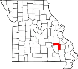 Map of Missouri highlighting Iron County | |
| Village | ||
| Townships | ||
| Unincorporated communities | ||
| Ghost towns | ||
| Footnotes | ‡This populated place also has portions in an adjacent county or counties | |
| ||