Area of Critical Environmental Concern (Massachusetts)
The Massachusetts Area of Critical Environmental Concern (ACEC) Program is a list of state-designated places within the Commonwealth that receive special attention due to their natural and cultural resources. The program was established in 1975 and includes a list of thirty ACECs covering over 268,000 acres in seventy six communities throughout the state. The ACEC Program is administered by the Department of Conservation and Recreation (DCR) on behalf of the Secretary of Energy and Environmental Affairs.[1]
List of ACECs in Massachusetts
| Ref# | ACEC Name | Image | Area (acres) | Designated | Location | Notes |
|---|---|---|---|---|---|---|
| 1 | Bourne Back River | 1,850 | 1989 | Bourne | ||
| 2 | Canoe River Aquifer and Associated Areas | 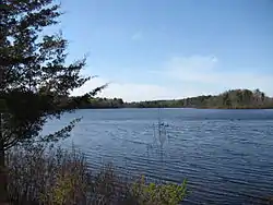 | 17,200 | 1991 | Easton, Foxborough, Mansfield, Norton, Sharon, and Taunton | Includes Watson Pond, Lake Sabbatia, and the Snake River |
| 3 | Cedar Swamp | 1,650 | 1975 | Hopkinton | ||
| 4 | Central Nashua River Valley | 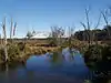 | 12,900 | 1996 | Bolton, Harvard, Lancaster, and Leominster | |
| 5 | Cranberry Brook Watershed | 1,050 | 1983 | Braintree and Holbrook | ||
| 6 | Ellisville Harbor | 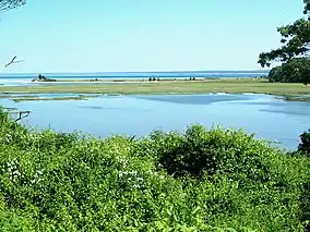 | 600 | 1980 | Plymouth | |
| 7 | Fowl Meadow and Ponkapoag Bog | 8,350 | 1992 | Boston, Canton, Dedham, Milton, Norwood, Randolph, Sharon, and Westwood | ||
| 8 | Golden Hills | 500 | 1987 | Melrose, Saugus, and Wakefield | ||
| 9 | Great Marsh | 25,500 | 1979 | Essex, Gloucester, Ipswich, Newbury, and Rowley | originally designated as Parker River/Essex Bay | |
| 10 | Herring River Watershed | 4,450 | 1991 | Bourne and Plymouth | ||
| 11 | Hinsdale Flats Watershed | 14,500 | 1992 | Dalton, Hinsdale, Peru, and Washington | ||
| 12 | Hockomock Swamp | 16,950 | 1990 | Bridgewater, Easton, Norton, Raynham, Taunton, and West Bridgewater | ||
| 13 | Inner Cape Cod Bay | 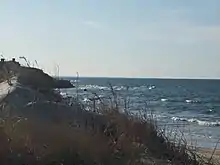 | 2,600 | 1985 | Brewster, Eastham, and Orleans | |
| 14 | Kampoosa Bog Drainage Basin | 1,350 | 1995 | Lee and Stockbridge | ||
| 15 | Karner Brook Watershed | 7,000 | 1992 | Egremont and Mount Washington | ||
| 16 | Miscoe, Warren, and Whitehall Watersheds | 8,700 | 2000 | Grafton, Hopkinton, and Upton | ||
| 17 | Neponset River Estuary | 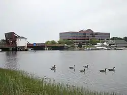 | 1,300 | 1995 | Boston, Milton, and Quincy | |
| 18 | Petapawag | 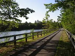 | 25,680 | 2002 | Ayer, Dunstable, Groton, Pepperell, and Tyngsborough | Lower Nashua River and Salmon Brook areas. |
| 19 | Pleasant Bay | 9,240 | 1987 | Brewster, Chatham, Harwich, and Orleans | ||
| 20 | Pocasset River | 160 | 1980 | Bourne | ||
| 21 | Rumney Marshes | 2,800 | 1988 | Boston, Lynn, Revere, Saugus, and Winthrop | ||
| 22 | Sandy Neck Barrier Beach System | 9,130 | 1978 | Barnstable and Sandwich | ||
| 23 | Schenob Brook Drainage Basin | 13,750 | 1990 | Mount Washington and Sheffield | ||
| 24 | Squannassit |  | 37,420 | 2002 | Ashby, Ayer, Groton, Harvard, Lancaster, Lunenburg, Pepperell, Shirley, and Townsend | Squannacook River and Mulpus Brook areas. |
| 25 | Three Mile River Watershed | 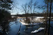 | 14,280 | 2008 | Dighton, Norton, Taunton | |
| 26 | Upper Housatonic River | 12,280 | 2009 | Lee, Lenox, Pittsfield, Washington | ||
| 27 | Waquoit Bay | 2,580 | 1979 | Falmouth and Mashpee | ||
| 28 | Weir River | 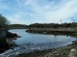 | 950 | 1986 | Cohasset, Hingham, and Hull | |
| 29 | Wellfleet Harbor | 12,480 | 1989 | Eastham, Truro, and Wellfleet | ||
| 30 | Weymouth Back River | 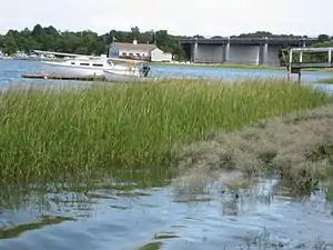 | 800 | 1982 | Hingham and Weymouth | |
References
| |||||||||||||||||
| |||||||||||||||||
| |||||||||||||||||
| |||||||||||||||||
| |||||||||||||||||
| |||||||||||||||||
| |||||||||||||||||
| |||||||||||||||||
This article is issued from Wikipedia. The text is licensed under Creative Commons - Attribution - Sharealike. Additional terms may apply for the media files.