Arizona State Route 75
State Route 75 (or SR 75) is a state highway in eastern Arizona that stretches from its junction with U.S. Route 191 and State Route 78 near Greenlee County Airport south to its junction with U.S. Route 70 in Duncan. It is primarily a shortcut for north and southbound traffic between Duncan and Clifton.
| ||||
|---|---|---|---|---|
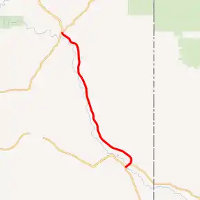
SR 75 highlighted in red | ||||
| Route information | ||||
| Maintained by ADOT | ||||
| Length | 19.39 mi[1] (31.21 km) | |||
| Existed | 1932–present | |||
| Major junctions | ||||
| South end | ||||
| North end | ||||
| Highway system | ||||
| ||||

Route description
The southern terminus of SR 75 is located at a junction with US 70 in Duncan. It initially heads northeast from this intersection but curves back towards the northwest. As it continues towards the northwest, the highway passes through the communities of Sheldon, Apache Grove and York. The northern terminus of SR 75 is located at a junction with US 191 and SR 78 in Three Way near the Greenlee County Airport.[1][2]
History
SR 75 was designated as a state highway between Duncan and Clifton in 1932.[3] By 1935, the route was still just a gravel road.[4] By 1938, the southern half had been paved, but the northern half remained a gravel road.[5] The highway was shortened to its present northern terminus when US 666 (present day US 191) was relocated to an alignment further south. The section north of the new junction with US 666 was transferred to US 666.[6]
Junction list
The entire route is in Greenlee County.
| Location | mi[1] | km | Destinations | Notes | |
|---|---|---|---|---|---|
| Duncan | 0.00 | 0.00 | Southern terminus; road continues southwest as Main Street | ||
| Virden Highway - Virden | To NM 92 | ||||
| Three Way | 19.39 | 31.21 | Northern terminus; US 191 is former US 666; road continues as US 191 north | ||
| 1.000 mi = 1.609 km; 1.000 km = 0.621 mi | |||||
References
- Roadway Inventory Management Section, Multimodal Planning Division (December 31, 2008). "2008 State Highway System Log" (PDF). Arizona Department of Transportation. Retrieved April 9, 2008.
- Google (April 23, 2008). "overview map of SR 75" (Map). Google Maps. Google. Retrieved April 23, 2008.
- Arizona State Highway Department. "ADOT Right-of-Way Resolution 1932-P-613". Retrieved May 5, 2008 – via Arizona Highway Data.
- Arizona State Highway Department (1935). State Highway Department Road Map of Arizona (PDF) (Map). 1:1,267,200. Cartography by W.M. DeMerse. Arizona Department of Transportation. Retrieved May 5, 2008.
- Road Map of Arizona and New Mexico (Map). Rand McNally. 1938. Archived from the original on May 6, 2008. Retrieved May 5, 2008.
- Arizona State Highway Department (1939). State Highway Department Road Map of Arizona (Map). 1:1,267,200. Cartography by W.M. DeMerse. Arizona Department of Transportation. Retrieved October 16, 2019 – via AARoads.