Armitage with Handsacre
Armitage with Handsacre is a civil parish[2] in the Lichfield district of Staffordshire, England. It includes the villages of Armitage and Handsacre, and in 2001 had a population of 5,181,[3] rising to 5,335 at the 2011 Census.
Armitage with Handsacre | |
|---|---|
Civil parish | |
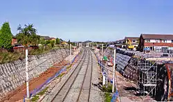 Armitage former station WCML widening geograph | |
| Coordinates: 52°44′28″N 1°52′16″W | |
| Country | England |
| Primary council | Lichfield |
| County | Staffordshire |
| Region | West Midlands |
| Status | Parish |
| Main settlements | Armitage, Handsacre |
| Government | |
| • Type | Parish Council |
| • UK Parliament | Lichfield |
| Population (2011)[1] | |
| • Total | 5,335 |
| Area code(s) | WS |
The parish's northern border is the River Trent and the town of Rugeley, south of Mavesyn Ridware. To the east it borders Kings Bromley, to the south Longdon and Lichfield to the west Brereton and Ravenhill areas of Rugeley.
There are 19 listed buildings in Armitage with Handsacre
References
- "Civil Parish population 2011". Retrieved 2 December 2015.
- "Names and codes for Administrative Geography". Office for National Statistics. 31 December 2008. Archived from the original on 3 April 2010. Retrieved 15 September 2009.
- "2001 Census: Parish headcounts". Office for National Statistics. 28 April 2004. Retrieved 30 September 2009.
This article is issued from Wikipedia. The text is licensed under Creative Commons - Attribution - Sharealike. Additional terms may apply for the media files.