Armuchee, Georgia
Armuchee (/ɑːrˈmɜːrtʃiː/ ar-MUR-chee) is an unincorporated community in both Floyd County and Chattooga County, Georgia, United States. The community is located along U.S. Route 27, 9 miles (14 km) north of Rome. Armuchee has a post office with ZIP code 30105.[2][3]
Armuchee, Georgia | |
|---|---|
 Armuchee | |
| Coordinates: 34°23′20″N 85°10′55″W | |
| Country | United States |
| State | Georgia |
| County | Floyd |
| Elevation | 623 ft (190 m) |
| Time zone | UTC-5 (Eastern (EST)) |
| • Summer (DST) | UTC-4 (EDT) |
| ZIP code | 30105 |
| Area code(s) | 706/762 |
| GNIS feature ID | 354390[1] |
History
A post office called Armuchee has been in operation since 1837.[4] The community takes its name from nearby Armuchee Creek.[5]
References
- "Armuchee". Geographic Names Information System. United States Geological Survey.
- United States Postal Service. "USPS - Look Up a ZIP Code". Retrieved May 26, 2015.
- "Postmaster Finder - Post Offices by ZIP Code". United States Postal Service. Retrieved May 26, 2015.
- "Post Offices". Jim Forte Postal History. Retrieved 1 April 2018.
- Krakow, Kenneth K. (1975). Georgia Place-Names: Their History and Origins (PDF). Macon, GA: Winship Press. p. 7. ISBN 0-915430-00-2.
Municipalities and communities of Floyd County, Georgia, United States | ||
|---|---|---|
| Cities | 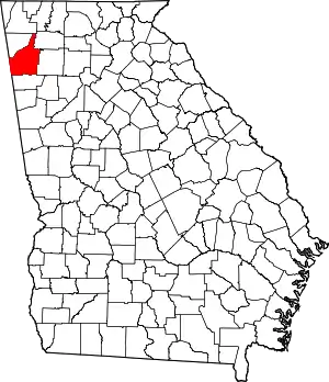 Map of Georgia highlighting Floyd County | |
| CDPs | ||
| Unincorporated communities | ||
| ||
This article is issued from Wikipedia. The text is licensed under Creative Commons - Attribution - Sharealike. Additional terms may apply for the media files.