Arnaudville, Louisiana
Arnaudville is a town in St. Landry and St. Martin parishes in the U.S. state of Louisiana. The population was 1,057 at the 2010 census.
Arnaudville, Louisiana | |
|---|---|
Town | |
| Town of Arnaudville | |
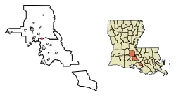 Location of Arnaudville in St. Landry Parish, Louisiana. | |
.svg.png.webp) Location of Louisiana in the United States | |
| Coordinates: 30°24′06″N 91°55′57″W | |
| Country | United States |
| State | Louisiana |
| Parishes | St. Landry, St. Martin |
| Incorporated | 1870 |
| Government | |
| • Mayor | Todd Meche (R)[1] |
| • Chief of Police | Eddy LeCompte (I) |
| Area | |
| • Total | 0.71 sq mi (1.83 km2) |
| • Land | 0.69 sq mi (1.80 km2) |
| • Water | 0.01 sq mi (0.04 km2) |
| Elevation | 26 ft (8 m) |
| Population (2010) | |
| • Total | 1,057 |
| • Estimate (2019)[3] | 1,046 |
| • Density | 1,507.20/sq mi (582.11/km2) |
| Time zone | UTC-6 (CST) |
| • Summer (DST) | UTC-5 (CDT) |
| Area code(s) | 337 |
| FIPS code | 22-03110 |
| Website | www |
The St. Martin Parish portion of Arnaudville is part of the Lafayette Metropolitan Statistical Area, while the St. Landry Parish portion is part of the Opelousas–Eunice Micropolitan Statistical Area.
History
On the original site of an Attakapas Indian village, Arnaudville is one of the oldest remaining towns in St. Landry Parish. First called La Murière, it was later known as La Jonction which meant "The Junction" translated from French. By the 19th century, the town was named after the Brothers Arnaud, who had donated a large amount of land to the town to make a Church for whites and blacks (which still exists today). The Arnauds were the family in which the town got its final name from, many of whose descendants still live in the area. But the French had settled the town in the late 18th century.[4]
Arnaudville was incorporated in 1870.[5]
Geography
Arnaudville is on the Bayou Teche where the Teche crosses from St. Landry Parish into St. Martin Parish. The town is called "La Jonction" by its French-speaking citizens since Arnaudville is located at the junction of Bayou Teche and Bayou Fuselier.
According to the United States Census Bureau, the town has a total area of 0.7 square mile (1.9 km2), all land.
Demographics
| Historical population | |||
|---|---|---|---|
| Census | Pop. | %± | |
| 1880 | 140 | — | |
| 1900 | 327 | — | |
| 1910 | 279 | −14.7% | |
| 1920 | 408 | 46.2% | |
| 1930 | 483 | 18.4% | |
| 1940 | 640 | 32.5% | |
| 1950 | 872 | 36.3% | |
| 1960 | 1,184 | 35.8% | |
| 1970 | 1,673 | 41.3% | |
| 1980 | 1,679 | 0.4% | |
| 1990 | 1,444 | −14.0% | |
| 2000 | 1,398 | −3.2% | |
| 2010 | 1,057 | −24.4% | |
| 2019 (est.) | 1,046 | [3] | −1.0% |
| U.S. Decennial Census[6] | |||
Of the population over the age of 5, 65.1% spoke English and 34.9% spoke French (including Cajun).[7]
As of the 2010 United States Census, there were 1,057 people living in the town. The racial makeup of the town was 90.2% white, 7.9% black, 0.2% Native American and 0.9% from two or more races. 0.9% were Hispanic or Latino of any race.
As of the census[8] of 2000, there were 1,398 people, 502 households, and 346 families living in the town. The population density was 1,945.7 people per square mile (749.7/km2). There were 556 housing units at an average density of 773.8 per square mile (298.2/km2). The racial makeup of the town was 88.63% White, 10.73% African American, 0.07% Native American, 0.07% Asian, and 0.50% from two or more races. Hispanic or Latino of any race were 1.57% of the population.
There were 502 households, out of which 31.7% had children under the age of 18 living with them, 49.4% were married couples living together, 14.3% had a female householder with no husband present, and 30.9% were non-families. 28.3% of all households were made up of individuals, and 15.9% had someone living alone who was 65 years of age or older. The average household size was 2.46 and the average family size was 2.96.
In the town, the population was spread out, with 23.2% under the age of 18, 6.7% from 18 to 24, 24.3% from 25 to 44, 17.2% from 45 to 64, and 28.5% who were 65 years of age or older. The median age was 42 years. For every 100 females, there were 86.6 males. For every 100 females age 18 and over, there were 80.9 males.
The median income for a household in the town was $21,600, and the median income for a family was $26,583. Males had a median income of $28,365 versus $20,221 for females. The per capita income for the town was $12,380. About 22.9% of families and 25.6% of the population were below the poverty line, including 36.3% of those under age 18 and 24.4% of those age 65 or over.
Arts and culture
Today, the town is host to the Étouffée Festival, held the 4th weekend in April, Le Feu et l'Eau—Fire and Water Rural Arts Celebration which is held in December [9] and Bayou Blues Revival' which is held in April.[10] Since 2005, attracted by its quaint setting and unique culture, the town has become a haven for artists and musicians from around the world.
Notable people
- Camille Bob, rhythm and blues singer and musician who led the dance band Lil' Bob and the Lollipops.
- Don Cravins, Jr., African American Democrat who served, consecutively, in both houses of the Louisiana State Legislature
- Felix Octave Pavy, member of the Arnaudville Gravity Drainage District Board and former state representative for St. Landry Parish[11]
- J. Minos Simon, attorney, pro-life activist, sportsman
References
- "Election Returns: St. Landry Parish". Louisiana Secretary of State. November 6, 2018. Retrieved November 9, 2018.
- "2019 U.S. Gazetteer Files". United States Census Bureau. Retrieved July 25, 2020.
- "Population and Housing Unit Estimates". United States Census Bureau. May 24, 2020. Retrieved May 27, 2020.
- www.thecajuns.com "Louisiana History: Old and New Place Names"
- Leeper, Clare D'Artois (19 October 2012). Louisiana Place Names: Popular, Unusual, and Forgotten Stories of Towns, Cities, Plantations, Bayous, and Even Some Cemeteries. LSU Press. p. 20. ISBN 978-0-8071-4740-5.
- "Census of Population and Housing". Census.gov. Retrieved June 4, 2015.
- "Archived copy". Archived from the original on 2013-08-15. Retrieved 2013-08-23.CS1 maint: archived copy as title (link)
- "U.S. Census website". United States Census Bureau. Retrieved 2008-01-31.
- "Felix Octave Pavy". New Orleans Times-Picayune. May 14, 1962. Retrieved March 7, 2015.
External links
Municipalities and communities of St. Landry Parish, Louisiana, United States | ||
|---|---|---|
| Cities | 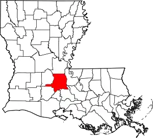 | |
| Towns | ||
| Villages | ||
| CDP | ||
| Other unincorporated communities |
| |
| Footnotes | ‡This populated place also has portions in an adjacent parish or parishes | |
| ||
Municipalities and communities of St. Martin Parish, Louisiana, United States | ||
|---|---|---|
| Cities | 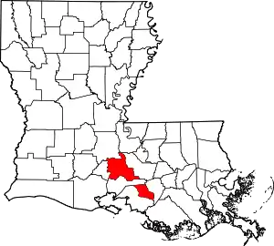 | |
| Towns | ||
| Village | ||
| CDPs | ||
| Other unincorporated communities |
| |
| Ghost town | ||
| Footnotes | ‡This populated place also has portions in an adjacent parish or parishes | |
| ||