Aroania
Aroania (Greek: Αροάνια) is a village and a former municipality in Achaea, West Greece, Greece. Since the 2011 local government reform it is part of the municipality Kalavryta, of which it is a municipal unit.[2] The municipal unit has an area of 173.804 km2.[3] The population is 1,619 (2011 census). The seat of administration was in the town Psofida. The municipality is named after the village and the mountain.
Aroania
Αροάνια | |
|---|---|
 Aroania Location within the regional unit 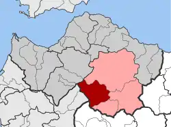 | |
| Coordinates: 37°53′N 22°1′E | |
| Country | Greece |
| Administrative region | West Greece |
| Regional unit | Achaea |
| Municipality | Kalavryta |
| Districts | 11 |
| • Municipal unit | 173.8 km2 (67.1 sq mi) |
| Elevation | 782 m (2,566 ft) |
| Population (2011)[1] | |
| • Municipal unit | 1,619 |
| • Municipal unit density | 9.3/km2 (24/sq mi) |
| Community | |
| • Population | 46 (2011) |
| Time zone | UTC+2 (EET) |
| • Summer (DST) | UTC+3 (EEST) |
| Postal code | 250 16 |
| Vehicle registration | KK |
Subdivisions
The municipal unit Aroania is subdivided into the following communities (constituent villages in brackets):
- Agrampela (Agrampela, Platanitsa)
- Agridi
- Alestaina
- Anastasi (Anastasi, Moni Agion Theodoron)
- Aroania
- Desino
- Kamenianoi (Kamenianoi, Drovolovo)
- Lechouri (Lechouri, Kerasea, Selli)
- Livartzi (Livartzi, Livadi, Livartzino)
- Plaka
- Psofida (Psofida, Ano Psofida, Ano Tripotama, Kato Tripotama, Tripotama, Vasiliki)
- Seires (Seires, Agioi Theodoroi, Agios Georgios, Krini, Thomaiika)
Notable people
- Ioannis Sofianopoulos (1887–1951), politician
Population
| Year | Population |
|---|---|
| 1991 | 2,315 |
| 2001 | 2,551 |
| 2011 | 1,619 |
References
- "Απογραφή Πληθυσμού - Κατοικιών 2011. ΜΟΝΙΜΟΣ Πληθυσμός" (in Greek). Hellenic Statistical Authority.
- Kallikratis law Greece Ministry of Interior (in Greek)
- "Population & housing census 2001 (incl. area and average elevation)" (PDF) (in Greek). National Statistical Service of Greece. Archived from the original (PDF) on 2015-09-21.
External links
This article is issued from Wikipedia. The text is licensed under Creative Commons - Attribution - Sharealike. Additional terms may apply for the media files.
