Aroser Rothorn
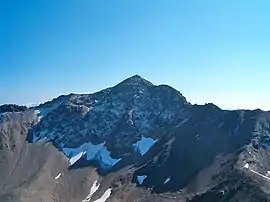
The Aroser Rothorn is the highest mountain of the Plessur Alps. It is located between Arosa and Lenzerheide in the canton of Graubünden and with a summit elevation of 2,980 metres above sea level. The summit lies near the Parpaner Rothorn, which is served by a cable car.
| Aroser Rothorn | |
|---|---|
 Aroser Rothorn | |
| Highest point | |
| Elevation | 2,980 m (9,780 ft) |
| Prominence | 1,349 m (4,426 ft) [1] |
| Isolation | 13.5 km (8.4 mi) [2] |
| Coordinates | 46°44′16.4″N 09°36′50.3″E |
| Geography | |
 Aroser Rothorn Location in Switzerland | |
| Location | Graubünden, Switzerland |
| Parent range | Plessur Alps |
See also
- List of mountains of Graubünden
- List of most isolated mountains of Switzerland
References
- Swisstopo map. The key col is the Wolfgang Pass (1,631 m).
- Retrieved from Google Earth. The nearest point of higher elevation is north of Piz Mitgel.
This article is issued from Wikipedia. The text is licensed under Creative Commons - Attribution - Sharealike. Additional terms may apply for the media files.
