Artesia Pilar
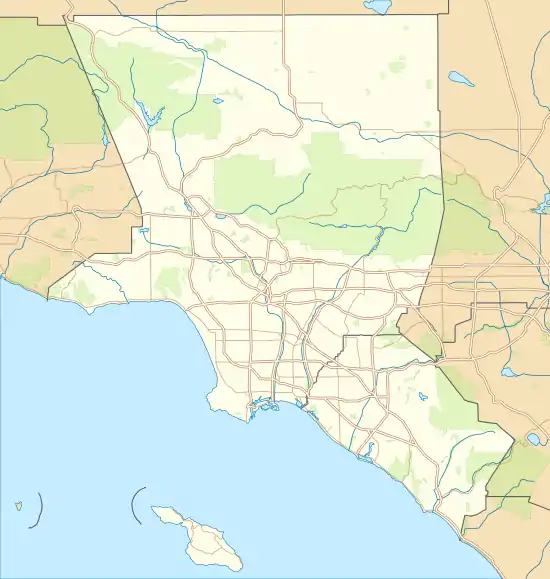
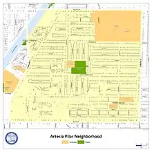
Artesia Pilar is a neighborhood in Santa Ana, California. It is bounded by W. 17th Street to the north, N. Bristol Street to the east, W. 1st Street to the south, N. Fairview Street to the west, and the Santa Ana River to the northwest. The neighborhood is home to Santa Ana College, the major community college of the city. Artesia Pilar is one city block away from the Santa Ana Civic Center and Downtown Santa Ana.
Artesia Pilar | |
|---|---|
Neighborhood | |
 Artesia Pilar  Artesia Pilar | |
| Coordinates: 33°45′05″N 117°53′48″W | |
| Country | |
| State | |
| County | |
| City | |
| Area | |
| • Total | 1 sq mi (3 km2) |
| Population (2018) | |
| • Total | 15,712 |
| Time zone | UTC-8 |
| • Summer (DST) | UTC-7 |
| ZIP | 92703, 92706 |
| Area code(s) | 714 and 657 |
| References: [1] | |
The neighborhood consists of 3,240 households. In 2018, the average household size was 5 people and the median household income was US$60,644. In the same survey, 19% of residents were said to live below the poverty line.[1]
History
Along with the city of Santa Ana, Artesia Pilar was preceded by Rancho Santiago de Santa Ana and was long used for ranching purposes. The area was first settled in an urban capacity in the mid-to-late 1800s due to its proximity to the Old Orange County Courthouse, the effective center of the budding town. Most of the homes that currently stand in the neighborhood were constructed from the 1950s onward.[1]
Demographics
| Historical population | |||
|---|---|---|---|
| Census | Pop. | %± | |
| 2000 | 13,918 | — | |
| 2010 | 13,260 | −4.7% | |
| 2013B (est.) | 13,686 | [2] | 3.2% |
In recent history, Artesia Pilar has been an ethnic enclave of Santa Ana's Hispanic and Latino residents. Most surveys have found that over 90% of the neighborhood's residents had Hispanic ethnicity of any race. Artesia Pilar is home to a large amount of Hispanic-owned businesses, as well as many Hispanic-oriented churches.
2010
Artesia Pilar had a population of 13,260 at the 2010 United States census, a decrease of 658 from the 2000 census population. 6,807 (51.3%) residents were male, while 6,454 (48.7%) residents were female. The racial makeup of the neighborhood was 5,917 (44.6%) White (7.3% Non-Hispanic White), 183 (1.4%) African-American, 173 (1.3%) Native American, 422 (3.2%) Asian, 6,219 (46.9%) of other races, and 346 (2.6%) of two or more races. 12,294 (92.7%) residents had Hispanic ethnicity of any race.
The 2010 census reported 2,550 housing units, 2,462 (96.5%) of which were occupied. 1,373 (55.8%) of housing units were occupied by their owner while 1,088 (44.2%) were occupied by renters.
The reported median household income of the 2010 survey was US$58,225. The per-capita income was US$12,642.
3,491 (36.0%) of eligible residents were married with their spouse present, while 1,080 (11.2%) were married with their spouse absent. 412 (4.3%) of residents were divorced, 330 (3.4%) were widowed, and 4,376 (45.2%) were never married.
2,521 (34.6%) of residents were educated through intermediate school, 1,107 (15.2%) attended high school, and 1,402 (19.2%) graduated high school. 313 (4.3%) residents received a Bachelor's degree. 593 (8.1%) residents never completed any schooling.[2]
2000
Artesia Pilar had a population of 13,918 at the 2000 United States census. 7,215 (51.8%) residents were male, while 6,704 (48.2%) residents were female. The racial makeup of the neighborhood was 5,342 (38.4%) White (9.6% Non-Hispanic White), 291 (2.1%) African-American, 233 (1.7%) Native American, 453 (3.3%) Asian, 6,920 (49.7%) of other races, and 680 (4.9%) of two or more races. 12,589 (90.5%) residents had Hispanic ethnicity of any race.
Housing, income, marriage, and educational statistics were not collected in the 2000 census.[2]
Amenities and facilities
Parks
- 17th Street Triangle
- El Salvador Park
- Fairview Triangle
- Spurgeon Park
Schools
- Santa Ana College
- Middle College High School
- Santa Ana College Child Development Center
- Community Day Intermediate and High School
- Vista Heritage Global Academy
- Carver Elementary School
- Fremont Elementary School
- Romero-Cruz Elementary School
- Romero-Cruz Academy
Congregations
- Community Temple Church
- Comunión De Gracia Internacional
- First Mission Baptist Church
- Johnson Chapel
- New Covenant Church
- New St. Paul Baptist Church
- Our Lady of the Pillar Church
- Prince Hall Masonic Temple
- Santa Ana LDS Institute
- St. Francis Home
- Templo Calvario Church
- Templo Emanuel Church
Governmental services
A USPS post office is located in the northern portion of the neighborhood. Although not directly within the boundaries of the neighborhood, another post office is located on the opposite side of 1st Street, the neighborhood's southern border. The California Department of Motor Vehicles operates a "DMV Now" digital kiosk inside one of the neighborhood's grocery stores.
Law enforcement is operated by the Santa Ana Police Department and the Orange County Sheriff's Department, both of which are headquartered a block away in the Santa Ana Civic Center.
References
- "Artesia Pilar Demographics". Point2. Retrieved January 14, 2021.
- "Demographic Detail Summary Report" (PDF). City of Santa Ana. July 10, 2014. Retrieved January 14, 2021.