As-Suwayda Governorate
As-Suwayda or Al-Suwayda Governorate (Arabic: مُحافظة السويداء / ALA-LC: Muḥāfaẓat as-Suwaydā’) is one of the fourteen governorates (provinces) of Syria. It is the southernmost governorate and has an area of 5,550 km² and forms part of the historic Hawran region. Its capital and major city is al-Suwayda. A large majority of the population are Druze.
Al-Suwayda Governorate
مُحافظة السويداء | |
|---|---|
.svg.png.webp) Map of Syria with al-Suwayda Governorate highlighted | |
| Coordinates (Al-Suwayda): 32.8°N 36.8°E | |
| Country | |
| Capital | Al-Suwayda |
| Manatiq (Districts) | 3 |
| Government | |
| • Governor | Amer Ibrahim Ashi |
| Area | |
| • Total | 5,550 km2 (2,140 sq mi) |
| Population (2011) | |
| • Total | 375,000[1] |
| Time zone | UTC+2 (EET) |
| • Summer (DST) | UTC+3 (EEST) |
| ISO 3166 code | SY-SU |
| Main language(s) | Arabic |
Geographically the governorate comprises almost all of Jabal al-Druze, the eastern part of Lejah, and a part of the arid eastern steppe of Harrat al-Shamah.
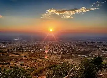
Most of As-Suwayda inhabitants work in agriculture, planting grapes, apple, olive, and wheat in general. In addition, there are four clearly demarcated seasons (winter, spring, summer, and fall) which gives As-Suwayda nice weather and beautiful natural sites. As-Suwayda contains many archaeological sites that related to the civilizations of the Babylonians, Sumerians, Phoenicians and Romans.
Demographics and population
The governorate has a population of about 375,000 inhabitants (est. 2011).[2] It is the only governorate in Syria that has a Druze majority.[3] There is also a sizable Eastern Orthodox minority, and a small Muslim refugee community from mainly Daraa Governorate as well as other parts of Syria.[4]
In the 1980s Druze made up 87.6% of the population, Christians (mostly Greek Orthodox) 11% and Sunni Muslims 2%.[5] In 2010, the As-Suwayda governorate has a population of about 375,000 inhabitants, Druze made up 90%, Christians 7% and Sunni Muslims 3%.[6] Due to low birth and high emigration rates, Christians proportion in As-Suwayda had declined.[7]
Most of the inhabitants live in the western parts of the governorate, especially on the western slopes of Jabal ad-Duruz. Only nomadic Bedouin tribes live in the barren region of Harrat al-Shamah.
Districts
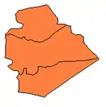
The governorate is divided into three districts (manatiq). The districts are further divided into 12 sub-districts (nawahi):
|
|
|
Cities, towns and villages

The governorate contains 3 cities, 124 villages, and 36 hamlets.[2]
Cities
Villages
- Al-Ajailat
- Al-Ghariyah
- Al-Kefr
- Al-Qurayya
- Ariqah
- Ar-Raha
- Braiki
- Dair Allaban
- Dama
- Hobran
- Kafr Alluhuf
- Lahetha
- Msad
- Murduk
- Qanawat
- Rimet Alluhuf
- Rimet Hazem
- Samma Al-baradan
- Samma Al-hanidat
- Shaniri
- Shbeki
- Walgha
See also
References
- The Druze and Assad: Strategic Bedfellows
- Statistics from "Archived copy". Archived from the original on 2007-03-29. Retrieved 2007-04-05.CS1 maint: archived copy as title (link)
- Country Data Page on Syria
- Shahba provides refuge for displaced Syrians Archived 2014-04-13 at the Wayback Machine. 28 September 2012.
- Pipes, Daniel (1990). Greater Syria: The History of an Ambition. Oxford University Press. p. 151.
- The Druze and Assad: Strategic Bedfellows
- The Druze and Assad: Strategic Bedfellows
