Ashton, Iowa
Ashton is a city in Osceola County, Iowa, United States. The population was 458 at the 2010 census.
Ashton, Iowa | |
|---|---|
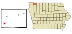 Location of Ashton, Iowa | |
| Coordinates: 43°18′43″N 95°47′30″W | |
| Country | |
| State | |
| County | Osceola |
| Area | |
| • Total | 1.00 sq mi (2.58 km2) |
| • Land | 0.99 sq mi (2.57 km2) |
| • Water | 0.01 sq mi (0.01 km2) |
| Elevation | 1,453 ft (443 m) |
| Population | |
| • Total | 458 |
| • Estimate (2019)[3] | 420 |
| • Density | 423.39/sq mi (163.43/km2) |
| Time zone | UTC-6 (Central (CST)) |
| • Summer (DST) | UTC-5 (CDT) |
| ZIP code | 51232 |
| Area code(s) | 712 |
| FIPS code | 19-03295 |
| GNIS feature ID | 0454259 |
History
Ashton was laid out in 1872 by the Sioux City & St. Paul Railroad.[4] The city was named from a grove of white ash trees near the town site.[5]
Geography
Ashton is located at 43°18′43″N 95°47′30″W (43.311916, -95.791613).[6]
According to the United States Census Bureau, the city has a total area of 1.02 square miles (2.64 km2), of which 1.01 square miles (2.62 km2) is land and 0.01 square miles (0.03 km2) is water.[7]
Demographics
| Historical population | |||
|---|---|---|---|
| Census | Pop. | %± | |
| 1890 | 309 | — | |
| 1900 | 513 | 66.0% | |
| 1910 | 518 | 1.0% | |
| 1920 | 610 | 17.8% | |
| 1930 | 568 | −6.9% | |
| 1940 | 620 | 9.2% | |
| 1950 | 588 | −5.2% | |
| 1960 | 615 | 4.6% | |
| 1970 | 483 | −21.5% | |
| 1980 | 441 | −8.7% | |
| 1990 | 462 | 4.8% | |
| 2000 | 461 | −0.2% | |
| 2010 | 458 | −0.7% | |
| 2019 (est.) | 420 | [3] | −8.3% |
| U.S. Decennial Census[8] | |||
2010 census
As of the census[2] of 2010, there were 458 people, 191 households, and 124 families residing in the city. The population density was 453.5 inhabitants per square mile (175.1/km2). There were 211 housing units at an average density of 208.9 per square mile (80.7/km2). The racial makeup of the city was 95.0% White, 1.3% African American, 0.4% Native American, 0.2% Asian, 0.9% Pacific Islander, 0.7% from other races, and 1.5% from two or more races. Hispanic or Latino of any race were 3.1% of the population.
There were 191 households, of which 32.5% had children under the age of 18 living with them, 53.9% were married couples living together, 6.8% had a female householder with no husband present, 4.2% had a male householder with no wife present, and 35.1% were non-families. 28.8% of all households were made up of individuals, and 14.1% had someone living alone who was 65 years of age or older. The average household size was 2.40 and the average family size was 2.98.
The median age in the city was 37.7 years. 27.5% of residents were under the age of 18; 9.1% were between the ages of 18 and 24; 21.4% were from 25 to 44; 26% were from 45 to 64; and 15.9% were 65 years of age or older. The gender makeup of the city was 48.5% male and 51.5% female.
2000 census
As of the census[9] of 2000, there were 461 people, 192 households, and 126 families residing in the city. The population density was 458.6 people per square mile (176.2/km2). There were 212 housing units at an average density of 210.9 per square mile (81.0/km2). The racial makeup of the city was 99.13% White, 0.22% Native American, 0.22% Asian, and 0.43% from two or more races. Hispanic or Latino of any race were 0.65% of the population.
There were 192 households, out of which 33.3% had children under the age of 18 living with them, 58.3% were married couples living together, 3.6% had a female householder with no husband present, and 33.9% were non-families. 32.8% of all households were made up of individuals, and 18.2% had someone living alone who was 65 years of age or older. The average household size was 2.36 and the average family size was 3.01.
In the city, the population was spread out, with 27.3% under the age of 18, 7.8% from 18 to 24, 28.6% from 25 to 44, 18.4% from 45 to 64, and 17.8% who were 65 years of age or older. The median age was 36 years. For every 100 females, there were 84.4 males. For every 100 females age 18 and over, there were 88.2 males.
The median income for a household in the city was $29,821, and the median income for a family was $35,313. Males had a median income of $28,750 versus $17,045 for females. The per capita income for the city was $15,848. About 5.1% of families and 5.0% of the population were below the poverty line, including 4.7% of those under age 18 and 3.5% of those age 65 or over.
Education
Ashton is served by the Sheldon Community School District.[10]
Notable person
- George F. Veenker, Iowa State football and Michigan basketball coach.
References
- "2019 U.S. Gazetteer Files". United States Census Bureau. Retrieved July 17, 2020.
- "U.S. Census website". United States Census Bureau. Retrieved 2012-05-11.
- "Population and Housing Unit Estimates". United States Census Bureau. May 24, 2020. Retrieved May 27, 2020.
- Past and Present of O'Brien and Osceola Counties, Iowa, Volume 1. B. F. Bowen. 1914. p. 597.
- Chicago and North Western Railway Company (1908). A History of the Origin of the Place Names Connected with the Chicago & North Western and Chicago, St. Paul, Minneapolis & Omaha Railways. p. 167.
- "US Gazetteer files: 2010, 2000, and 1990". United States Census Bureau. 2011-02-12. Retrieved 2011-04-23.
- "US Gazetteer files 2010". United States Census Bureau. Archived from the original on 2012-01-25. Retrieved 2012-05-11.
- "Census of Population and Housing". Census.gov. Retrieved June 4, 2015.
- "U.S. Census website". United States Census Bureau. Retrieved 2008-01-31.
- "Sheldon" (PDF). Iowa Department of Education. Retrieved 2020-08-10.
Municipalities and communities of Osceola County, Iowa, United States | ||
|---|---|---|
| Cities | Map of Iowa highlighting Osceola County | |
| Townships | ||
| Unincorporated communities | ||
| ||