Asnohuañusja
Asnohuañusja (possibly from Quechua asnu donkey (from Spanish asno), wañuy die, -sqa a suffix (wañusqa died, dead)[2]) is a 5,245-metre-high (17,208 ft) mountain in the western part of the Chila mountain range in the Andes of Peru. It lies in the Arequipa Region, Castilla Province, Chachas District. It is situated southwest of Chila and Choquepirhua, and northwest of Yuraccacsa.[1][3]
| Asnohuañusja | |
|---|---|
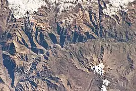 The Colca River and Asnohuañusja northwest of it (upper left) as seen from the ISS | |
| Highest point | |
| Elevation | 5,245 m (17,208 ft) [1] |
| Coordinates | 15°25′40″S 72°11′01″W |
| Geography | |
 Asnohuañusja Peru | |
| Location | Peru, Arequipa Region, Castilla Province |
| Parent range | Andes, Chila |
References
- "Cerro Asnohuañusja". IGN, Peru. Archived from the original on May 27, 2015. Retrieved May 27, 2015.
- Teofilo Laime Ajacopa, Diccionario Bilingüe Iskay simipi yuyayk'ancha, La Paz, 2007 (Quechua-Spanish dictionary)
- escale.minedu.gob.pe - UGEL map of the Caylloma Province 1 (Arequipa Region)
This article is issued from Wikipedia. The text is licensed under Creative Commons - Attribution - Sharealike. Additional terms may apply for the media files.