Ateret
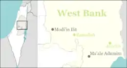
Ateret (Hebrew: עֲטֶרֶת) is an Israeli settlement organized as a community settlement in the Samarian hills of the West Bank located in the municipal jurisdiction of the Mateh Binyamin Regional Council 40 km north-west of Jerusalem on a hilltop at an elevation of 760 metres. To the west, the view is not obstructed from Haifa University in the north to Gaza in the south of Israel. In 2019 it had a population of 900.
Ateret
עֲטֶרֶת | |
|---|---|
 Ateret | |
| Coordinates: 31°59′59″N 35°10′37″E | |
| District | Judea and Samaria Area |
| Council | Mateh Binyamin |
| Region | West Bank |
| Founded | August 1981 |
| Founded by | Residents of Petah Tikva |
| Population (2019)[1] | 900 |
| Name meaning | Crown |
The international community considers Israeli settlements in the West Bank illegal under international law, but the Israeli government disputes this.[2][3][4]
History
The village was one of the first settlement built after the Six-Day War. The name of the village comes from the ancient Jewish village of Ataroth that existed nearby where the current Palestinian village of 'Atara is located. It was founded in August 1981 by a group, led by Tzvi Halamish, of eight families and a few singles.
According to ARIJ, Israel confiscated land from three nearby Palestinian villages in order to construct Ateret:
References
- "Population in the Localities 2019" (XLS). Israel Central Bureau of Statistics. Retrieved 16 August 2020.
- "The Geneva Convention". BBC News. 10 December 2009. Retrieved 27 September 2011.
- McCarthy, Rory. Palestine calls for release of intifada leader in prisoner swap with Israel The Guardian, 29 November 2009
- Valk, Guus. Under construction: utopian city for Palestinian yuppies Archived 2010-04-06 at the Wayback Machine NRC Handelsblad. 2 April 2010
- 'Ajjul Village Profile, ARIJ, p. 17
- Atara Village profile, ARIJ, p. 18
- Umm Safa Village Profile, ARIJ p. 16