Atmakur, Kurnool district
Atmakur is a Municipality and town in the Kurnool district of Andhra Pradesh, India.[2] Atmakur is called as Gateway to Srisailam. Nallamala Forest is located to east of Atmakur. Atmakur is located on Kurnool Guntur Highway, Generally called as KG Road.
Atmakur Municipality
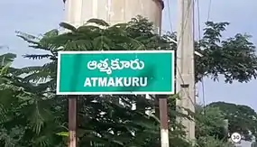
Atmakur | |
|---|---|
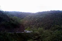 Nallamalla hills near Atmakur | |
.svg.png.webp) Atmakur Location in Andhra Pradesh, India | |
| Coordinates: 15.87791°N 78.58842°E | |
| Country | India |
| State | Andhra Pradesh |
| District | Kurnool |
| Talukas | Atmakur |
| Area | |
| • Total | 43.72 km2 (16.88 sq mi) |
| Population (2011)[2] | |
| • Total | 45,703 |
| • Density | 1,000/km2 (2,700/sq mi) |
| Languages | |
| • Official | Telugu |
| Time zone | UTC+5:30 (IST) |
| PIN | 518422 |
| Telephone code | +91–8517 |
| Vehicle registration | AP |
| Website | Atmakur Municipality |
History
A story about the name of this place is, before starting to srisailam from this place you have to leave all your bad things and start with good soul with faith on God(atma in telugu).This is the place from where you have start with good soul towards the hill forests of Srisailam, thus the name Atmakur came into usage.
Tourist Places
- Srisailam Bhramaramba Mallikarjuna Swamy Temples
- Srisailam Nallamala hills
- Velugodu Balancing Reservoir
- YSR Smruthi vanam
References
- "Municipalities, Municipal Corporations & UDAs" (PDF). Directorate of Town and Country Planning. Government of Andhra Pradesh. Archived from the original (PDF) on 28 January 2016. Retrieved 29 January 2016.
- "Census 2011". The Registrar General & Census Commissioner, India. Retrieved 7 October 2014.
This article is issued from Wikipedia. The text is licensed under Creative Commons - Attribution - Sharealike. Additional terms may apply for the media files.