Atutur Town
Atutur | |
|---|---|
 Atutur Location in Uganda | |
| Coordinates: 01°19′25″N 33°53′18″E | |
| Country | |
| Region | Eastern Uganda |
| Sub-region | Teso sub-region |
| District | Kumi District |
| Elevation | 3,540 ft (1,080 m) |
Atutur is a town in the Eastern Region of Uganda.
Location
The town lies on the Tirinyi–Pallisa–Kamonkoli–Kumi Road, in Atutur Parish, Atutur sub-county, Kumi District, approximately 22 kilometres (14 mi) southeast of Kumi Town, where the district headquarters are located.[1] Atutur is located 48 kilometres (30 mi) northwest of Mbale, the nearest large city.[2] The coordinates of Atutur Town are: 01°19'25.0"N, 33°53'18.0"E (Latitude:1.323605; Longitude:33.888341).[3]
Overview
Atutur General Hospital sits in Atutur sub-county, on the Tororo–Mbale–Soroti Road, about 17 kilometres (11 mi) northeast of Atutur Town.[4]
References
- GFC (13 May 2016). "Distance between Atutur, Eastern Region, Uganda and Kumi, Eastern Region, Uganda". Globefeed.com (GFC). Retrieved 13 May 2016.
- GFC (13 May 2016). "Distance between Mbale, Eastern Region, Uganda and Atutur, Eastern Region, Uganda". Globefeed.com (GFC). Retrieved 13 May 2016.
- Google (13 May 2016). "Location of Atutur Town, Kumi District, Uganda" (Map). Google Maps. Google. Retrieved 13 May 2016.
- GFC (13 May 2016). "Distance between Atutur, Eastern Region, Uganda and Atutur Hospital, Kumi, Eastern Region, Uganda". Globefeed.com (GFC). Retrieved 13 May 2016.
External links
Capital: Kumi | ||
| Towns and villages | 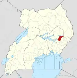 | |
| Economy | ||
| Education | ||
| Transport | ||
| Health | ||
| Notable people | ||
This article is issued from Wikipedia. The text is licensed under Creative Commons - Attribution - Sharealike. Additional terms may apply for the media files.
