Audet, Quebec
Audet is a municipality in the Le Granit Regional County Municipality in the Estrie region of Quebec, Canada. Population is 734 as of the Canada 2016 Census.
Audet | |
|---|---|
 | |
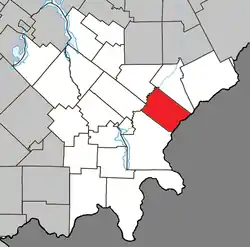 Location within Le Granit RCM | |
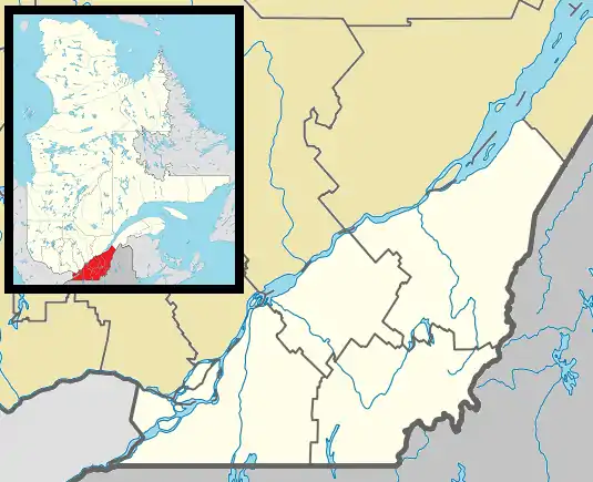 Audet Location in southern Quebec | |
| Coordinates: 45°39′N 70°44′W[1] | |
| Country | |
| Province | |
| Region | Estrie |
| RCM | Le Granit |
| Constituted | November 26, 1903 |
| Government | |
| • Mayor | Jean-Marc Grondin |
| • Federal riding | Mégantic—L'Érable |
| • Prov. riding | Mégantic |
| Area | |
| • Total | 134.00 km2 (51.74 sq mi) |
| • Land | 135.86 km2 (52.46 sq mi) |
| There is an apparent contradiction between two authoritative sources | |
| Population | |
| • Total | 734 |
| • Density | 5.4/km2 (14/sq mi) |
| • Pop 2011-2016 | |
| • Dwellings | 303 |
| Time zone | UTC−5 (EST) |
| • Summer (DST) | UTC−4 (EDT) |
| Postal code(s) | G0Y 1A0 |
| Area code(s) | 819 |
| Highways | |
| Website | www |
Although the post office has been known as Audet since 1894, named after Michel Audet, the first postmaster, the municipality was known as Saint-Hubert-de-Spaulding until 1959, referring to the township of Spaulding, in which it is located.
Audet sits on a plateau at 535 metres in altitude in the Appalachians, making it one of the highest municipalities in Quebec.
Sources
| Wikimedia Commons has media related to Audet, Quebec. |
Places adjacent to Audet, Quebec | |
|---|---|
| Cities | |
|---|---|
| Municipalities | |
| Parishes | |
| Townships | |
| |
| Authority control |
|
|---|
This article is issued from Wikipedia. The text is licensed under Creative Commons - Attribution - Sharealike. Additional terms may apply for the media files.