Aurelle-Verlac
Aurelle-Verlac (Occitan: Aurela Verlac) is a former commune in the Aveyron department in the Occitanie region of southern France. On 1 January 2016, it was merged into the new commune of Saint-Geniez-d'Olt-et-d'Aubrac.[2]
Aurelle-Verlac | |
|---|---|
Part of Saint-Geniez-d'Olt-et-d'Aubrac | |
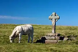 Wayside Cross in Aurelle-Verlac | |
.png.webp) Coat of arms | |
Location of Aurelle-Verlac 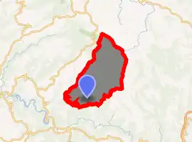
| |
 Aurelle-Verlac  Aurelle-Verlac | |
| Coordinates: 44°30′25″N 3°00′29″E | |
| Country | France |
| Region | Occitanie |
| Department | Aveyron |
| Arrondissement | Rodez |
| Canton | Lot et Palanges |
| Commune | Saint-Geniez-d'Olt-et-d'Aubrac |
| Area 1 | 54.68 km2 (21.11 sq mi) |
| Population (2017)[1] | 159 |
| • Density | 2.9/km2 (7.5/sq mi) |
| Time zone | UTC+01:00 (CET) |
| • Summer (DST) | UTC+02:00 (CEST) |
| Postal code | 12130 |
| Elevation | 500–1,461 m (1,640–4,793 ft) (avg. 1,000 m or 3,300 ft) |
| 1 French Land Register data, which excludes lakes, ponds, glaciers > 1 km2 (0.386 sq mi or 247 acres) and river estuaries. | |
The inhabitants of the commune are known as Aurellacois or Aurellacoises.[3]
Geography
Aurelle-Verlac is located in the Massif Central in Aubrac some 60 km east of Decazeville and 70 km south-east of Aurillac with the eastern border of the commune being the border between Aveyron and Lozère departments. Access to the commune is by road D503 from Saint-Geniez-d'Olt in the south which goes north through the village and most of the length of the commune before going west to join the D219 west of the commune. Apart from the village there are the hamlets of Crespiac, Verelaguet, Les Mazes, La Frassinede, Naves d'Aubrac, La Molière, Moncan, Rieuzens, Bernie, Les Caps, and Les Ginestes. The commune is mainly deep valleys where boraldes flow down to the Lot. The highest point in the department is on the Signal de Mailhe-Biau in the north-east of the commune.[4] It is located in a Natura 2000 zone and is rugged with forests and high country farming.[5]
The Ruisseau de Mardonenque rises in the north and flows south down the centre of the commune gathering tributaries including the Ruisseau de Monette, the Ravin de Placaus, the Ravin des Rives, the Ravin de la Coste, the Ravin de la Ligue, and the Ruisseau de Rioubasset, which forms the south-eastern border, before continuing south to join the Lot near Saint-Geniez-d'Olt. The Ruisseau de Bonance also rises in the north of the commune and flows south towards the eastern side of the commune forming part of the eastern border before continuing south to join the Lot near Pomayrols. On the western side of the commune the Merdanson forms the western border of the commune as it flows south to join the Lot near Cabanac. The Ruisseau de Rioudis and the Ruisseau de Mandialou both rise in the commune and join the Merdanson on the western border.[5]
Neighbouring communes and villages
Places adjacent to Aurelle-Verlac | |
|---|---|
Heraldry
Arms of Aurelle-Verlac |
These arms are Canting arms with the gold referring to the commune name and the silver to silver mines.
Blazon: |
Administration
List of Successive Mayors[6]
| From | To | Name | Party | Position |
|---|---|---|---|---|
| 1793 | 1797 | Pierre Jean Duarn | ||
| 1798 | 1801 | Jean Claude Galdemar | ||
| 1802 | 1816 | Jean Bach | ||
| 1816 | 1822 | Antoine Niel | ||
| 1822 | 1827 | Jean Pierre Auguy | ||
| 1827 | 1831 | François Joseph Rauquayrol | ||
| 1831 | 1849 | Jean Pierre Auguy | ||
| 1849 | 1851 | Jacques Poujol | ||
| 1852 | 1857 | Jean Pierre Auguy | ||
| 1857 | 1864 | Jean Antoine Alazard | ||
| 1864 | 1870 | Baptiste Mounie | ||
| 1870 | 1878 | Jean Pierre Auguy | ||
| 1878 | 1884 | Etienne Marcilhac | ||
| 1884 | 1884 | Louis Alazard | ||
| 1884 | 1902 | Louis Miquel | ||
| 1902 | 1919 | Louis Alazard |
- Mayors from 1919
| From | To | Name | Party | Position |
|---|---|---|---|---|
| 1919 | 1947 | Antoine Alazard | ||
| 1947 | 1965 | Théophile Auguy | ||
| 1965 | 1971 | Jean Foulquier | ||
| 1971 | 1983 | Jean Vialard | ||
| 1983 | 2008 | Paul Garces | ||
| 2008 | 2016 | Jean-Pierre Niel |
Demography
In 2012 the commune had 164 inhabitants.
|
| ||||||||||||||||||||||||||||||||||||||||||||||||||||||||||||||||||||||||||||||||||||||||||||||||
| Source: EHESS[7] and INSEE[8] | |||||||||||||||||||||||||||||||||||||||||||||||||||||||||||||||||||||||||||||||||||||||||||||||||
Culture and heritage
Civil heritage
- The Fortified Farm of Aubignac[9]
Religious heritage
The commune has two religious buildings that are registered as historical monuments:
- The Church of Saint-Jacques de Verlac (11th century)
 [10] is Romanesque and depended on the abbey of La Chaise-Dieu. It is located in the village centre surrounded by a small cemetery and built from local materials: schist for the walls, basalt, tuff, and sandstone for the cut stones. Its plan consists of a single nave with pointed columns terminated by an apse in a cul-de-four design. Two chapels, built later, act as transepts. The church contains a Bronze Bell (16th century)
 [11] which is registered as a historical object.
 - The Church of Saint-Pierre d'Aurelle (1384)[12] is the smallest Romanesque church in France. It has a unique history. In 1382, on the pretext of the arrival of the English, the Marquis of Beaufort, Baron of Aurelle, destroyed the church. On being excommunicated, he was obliged by the bishop to rebuild the church in a year. The new church was rebuilt inside the village in 1384 with the old materials.
- The Church of Saint-Martin-de-Montbon contains a Bronze Bell (1762)[13] which is registered as a historical object.
- Other religious structures of interest
- The Rode Cross was erected by the lord of Peyre in 1377.
- The Berque Cross[14] is located at Les Mazes rising from the Vergnes Cross. It was built in 1531 and marked the boundary of the barony of Aurelle between the dom[Note 1] lands of Aubrac and those of the Marquis of Canilhac. On one of its faces it has an expressive though stylized virgin with child.
Bibliography
- Christian-Pierre Bedel, Sent-Ginièis, Aurela-Verlac, Pèira-Ficha, Pomairòls, Pradas, Senta-Aularia / Christian-Pierre Bedel and the inhabitants of the commune of Sent-Ginièis, Rodez, Mission départementale de la culture, 1991, Al canton collection, 230 pages, ill., cov. ill., 28 cm, ISBN 2-907279-07-6, ISSN 1151-8375, BnF 36653864f (in Occitan and French)
See also
Notes
- A name given to certain religious, particularly in the Benedictine, Carthusian, and Trappist orders.
References
- Téléchargement du fichier d'ensemble des populations légales en 2017, INSEE
- Arrêté préfectoral 6 November 2015
- Inhabitants of Aurelle-Verlac (in French)
- Aurelle-Verlac on Géoportail, National Geographic Institute (IGN) website (in French)
- Google Maps
- List of Mayors of France (in French)
- Données Cassini, EHESS
- Populations légales 2012, INSEE
- The fortified farm of Aubignac (in French)
- Ministry of Culture, Mérimée PA00093959 Church of Saint-Jacques de Verlac (in French)
- Ministry of Culture, Palissy PM12000009 Bronze bell (in French)
- Ministry of Culture, Mérimée PA00093958 Church of Saint-Pierre d'Aurelle (in French)
- Ministry of Culture, Palissy PM12000010 Bronze bell (in French)
- Berque Cross (in French)
External links
- Non-official Aurelle-Verlac website (in French)
- Aurelle-Verlac on Géoportail, National Geographic Institute (IGN) website (in French)
- Aurelle and Verlac on the 1750 Cassini Map
| Wikimedia Commons has media related to Aurelle-Verlac. |
| Authority control |
|---|
