Auxvasse, Missouri
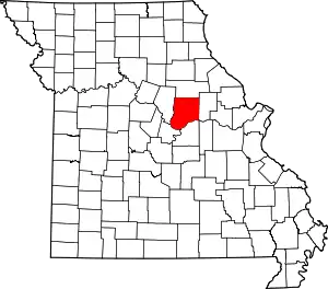
Auxvasse is a city in northern Callaway County, Missouri, United States. It is part of the Jefferson City, Missouri Metropolitan Statistical Area. The population was 983 at the 2010 census.[6]
Auxvasse, Missouri | |
|---|---|
| City of Auxvasse | |
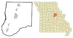
 Location of Auxvasse, Missouri | |
| Coordinates: 39°01′05″N 91°53′50″W[1] | |
| Country | United States |
| State | Missouri |
| County | Callaway |
| Area | |
| • Total | 0.76 sq mi (1.96 km2) |
| • Land | 0.76 sq mi (1.96 km2) |
| • Water | 0.00 sq mi (0.00 km2) |
| Elevation | 869 ft (265 m) |
| Population | |
| • Total | 983 |
| • Estimate (2019)[4] | 978 |
| • Density | 1,295.36/sq mi (500.13/km2) |
| Time zone | UTC-6 (Central (CST)) |
| • Summer (DST) | UTC-5 (CDT) |
| ZIP code | 65231 |
| Area code(s) | 573 |
| FIPS code | 29-02638[5] |
| GNIS feature ID | 713496[1] |
History
Auxvasse was originally called Clinton City, and under the latter name was platted in 1873.[7] The present name is after nearby Auxvasse Creek.[7] A post office called Auxvasse has been in operation since 1874.[8] Auxvasse has been claimed by at least 3 Callaway County townships since they were first delineated in 1821, when Auxvasse was located at the far northeast corner of the original boundaries of the then far-larger Cote Sans Dessein township for a period of only a few months. New townships (Fulton, Round Prairie, Nine Mile Prairie) were formed 1821–1838 in northern Callaway County, and a study of historical references should clarify which township Auxvasse was claimed by during that period. In February 1838, the newly formed Liberty Township included Auxvasse as a key town in its eastern sector for nearly 40 years; but when the newer Jackson Township was created in December 1875, Auxvasse was included instead in its western half, where it remains to this day as its largest population center.
Geography
Auxvasse is located in the northern part of the county on US Route 54 between Mexico to the north and Kingdom City to the south.[9]
According to the United States Census Bureau, the city has a total area of 0.76 square miles (1.97 km2), all land.[10]
Demographics
| Historical population | |||
|---|---|---|---|
| Census | Pop. | %± | |
| 1890 | 348 | — | |
| 1900 | 337 | −3.2% | |
| 1910 | 411 | 22.0% | |
| 1920 | 484 | 17.8% | |
| 1930 | 438 | −9.5% | |
| 1940 | 490 | 11.9% | |
| 1950 | 507 | 3.5% | |
| 1960 | 534 | 5.3% | |
| 1970 | 808 | 51.3% | |
| 1980 | 858 | 6.2% | |
| 1990 | 821 | −4.3% | |
| 2000 | 901 | 9.7% | |
| 2010 | 983 | 9.1% | |
| 2019 (est.) | 978 | [4] | −0.5% |
| U.S. Decennial Census[11] | |||
2010 census
As of the census[3] of 2010, there were 983 people, 405 households, and 261 families living in the city. The population density was 1,293.4 inhabitants per square mile (499.4/km2). There were 472 housing units at an average density of 621.1 per square mile (239.8/km2). The racial makeup of the city was 94.1% White, 3.2% African American, 1.3% Native American, 0.5% Asian, 0.3% from other races, and 0.6% from two or more races. Hispanic or Latino of any race were 1.1% of the population.
There were 405 households, of which 37.5% had children under the age of 18 living with them, 45.9% were married couples living together, 12.6% had a female householder with no husband present, 5.9% had a male householder with no wife present, and 35.6% were non-families. 29.9% of all households were made up of individuals, and 12.6% had someone living alone who was 65 years of age or older. The average household size was 2.43 and the average family size was 3.03.
The median age in the city was 36.5 years. 28.4% of residents were under the age of 18; 8.7% were between the ages of 18 and 24; 24.9% were from 25 to 44; 24.8% were from 45 to 64; and 13.2% were 65 years of age or older. The gender makeup of the city was 47.4% male and 52.6% female.
2000 census
As of the census[5] of 2000, there were 901 people, 381 households, and 240 families living in the city. The population density was 1,356.6 people per square mile (527.1/km2). There were 400 housing units at an average density of 602.3 per square mile (234.0/km2). The racial makeup of the city was 95.01% White, 3.22% African American, 0.44% Native American, 0.11% Asian, 0.11% from other races, and 1.11% from two or more races. Hispanic or Latino of any race were 0.44% of the population.
There were 381 households, out of which 31.8% had children under the age of 18 living with them, 48.0% were married couples living together, 11.3% had a female householder with no husband present, and 37.0% were non-families. 31.2% of all households were made up of individuals, and 18.4% had someone living alone who was 65 years of age or older. The average household size was 2.34 and the average family size was 2.91.
In the city, the population was spread out, with 26.4% under the age of 18, 7.1% from 18 to 24, 29.4% from 25 to 44, 20.0% from 45 to 64, and 17.1% who were 65 years of age or older. The median age was 37 years. For every 100 females, there were 88.1 males. For every 100 females age 18 and over, there were 85.2 males.
The median income for a household in the city was $33,875, and the median income for a family was $42,700. Males had a median income of $28,214 versus $21,250 for females. The per capita income for the city was $15,785. About 6.7% of families and 11.4% of the population were below the poverty line, including 9.6% of those under age 18 and 18.1% of those age 65 or over.
References
- U.S. Geological Survey Geographic Names Information System: Auxvasse, Missouri
- "2019 U.S. Gazetteer Files". United States Census Bureau. Retrieved July 26, 2020.
- "U.S. Census website". United States Census Bureau. Retrieved 2012-07-08.
- "Population and Housing Unit Estimates". United States Census Bureau. May 24, 2020. Retrieved May 27, 2020.
- "U.S. Census website". United States Census Bureau. Retrieved 2008-01-31.
- "Race, Hispanic or Latino, Age, and Housing Occupancy: 2010 Census Redistricting Data (Public Law 94-171) Summary File (QT-PL), Auxvasse city, Missouri". United States Census Bureau. Retrieved October 28, 2011.
- "Callaway County Place Names, 1928–1945 (archived)". The State Historical Society of Missouri. Archived from the original on 24 June 2016. Retrieved 7 September 2016.CS1 maint: bot: original URL status unknown (link)
- "Post Offices". Jim Forte Postal History. Archived from the original on 6 March 2016. Retrieved 7 September 2016.
- Missouri Atlas & Gazetteer, DeLorme, 2007, Third edition, p. 38, ISBN 0-89933-353-2
- "US Gazetteer files 2010". United States Census Bureau. Archived from the original on 2012-01-25. Retrieved 2012-07-08.
- "Census of Population and Housing". Census.gov. Retrieved June 4, 2015.
External links
- Historic maps of Auxvasse in the Sanborn Maps of Missouri Collection at the University of Missouri
