Babai Rural Municipality
Babai Rural Municipality (Nepali :बबई गाउँपालिका) is a Gaunpalika in Dang District in Province No. 5 of Nepal. On 12 March 2017, the government of Nepal implemented a new local administrative structure, with the implementation of the new local administrative structure, VDCs have been replaced with municipal and Village Councils. Babai is one of these 753 local units.[1][2] Babai Rural Municipality has area of 257.48 sq. km.[3] Babai RM is surrounded by Shantinagar Rural Municipality and Dangisharan Rural Municipality in the east, Banke district in the west, Salyan district in the north and in south there is Dangisharan Rural Municipality and Banke district.
Babai Rural Municipality
बबई गाउँपालिका | |
|---|---|
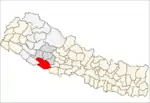
 Babai Rural Municipality Location in Nepal | |
| Coordinates: 28.351851°N 81.718791°E | |
| Country | |
| Province | Province No. 5 |
| District | Dang District |
| Area | |
| • Total | 257.48 km2 (99.41 sq mi) |
| Elevation | 520 m (1,710 ft) |
| Population | |
| • Total | 27,469 |
| • Density | 110/km2 (280/sq mi) |
| Time zone | UTC+5:45 (Nepal Time) |
| Website | http://babaimun.gov.np/ |
References
- "Babai" (PDF).
- "बबई गाउँपालिका | प्रदेश नं ५". babaimun.gov.np. Retrieved 2020-07-08.
- "बबई गाउँपालिकाको श्रोत नक्सा | बबई गाउँपालिका". babaimun.gov.np. Retrieved 2020-09-11.
This article is issued from Wikipedia. The text is licensed under Creative Commons - Attribution - Sharealike. Additional terms may apply for the media files.