Babušnica
Babušnica (Serbian Cyrillic: Бабушница) is a town and municipality located in the Pirot District of south|eastern Serbia. According to 2011 census, the population of the town is 4,601, while population of the municipality is 12,307.
Babušnica
Бабушница | |
|---|---|
Town and municipality | |
.jpg.webp) | |
 Coat of arms | |
 Location of the municipality of Babušnica within Serbia | |
| Coordinates: 43°04′N 22°25′E | |
| Country | |
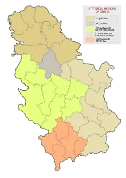
| Region | Southern and Eastern Serbia |
| District | Pirot |
| Settlements | 53 |
| Government | |
| • Mayor | Slađana Nikolić |
| Area | |
| • Town | 3.95 km2 (1.53 sq mi) |
| • Municipality | 529 km2 (204 sq mi) |
| Elevation | 470 m (1,540 ft) |
| Population (2011 census)[2] | |
| • Town | 4,601 |
| • Town density | 1,200/km2 (3,000/sq mi) |
| • Municipality | 12,307 |
| • Municipality density | 23/km2 (60/sq mi) |
| Time zone | UTC+1 (CET) |
| • Summer (DST) | UTC+2 (CEST) |
| Postal code | 18330 |
| Area code | +381(0)10 |
| Car plates | PI |
| Website | www |
Geography
The municipality borders Gadžin Han municipality in the north-west, Bela Palanka municipality in the north, Pirot and Dimitrovgrad municipalities in the east, Bulgaria in the south, and Crna Trava and Vlasotince municipalities in the west.
History
From 1929 to 1941, Babušnica was part of the Morava Banovina of the Kingdom of Yugoslavia.
Settlements
Aside from the town of Babušnica, the municipality has the following villages:
Demographics
| Year | Pop. | ±% p.a. |
|---|---|---|
| 1948 | 37,532 | — |
| 1953 | 37,312 | −0.12% |
| 1961 | 34,316 | −1.04% |
| 1971 | 29,033 | −1.66% |
| 1981 | 23,872 | −1.94% |
| 1991 | 19,333 | −2.09% |
| 2002 | 15,734 | −1.86% |
| 2011 | 12,307 | −2.69% |
| Source: [3] | ||
According to the last official census done in 2011, the municipality of Babušnica has 12,307 inhabitants.
Ethnic groups
Ethnic composition of the municipality of Babušnica:[4]
| Ethnic group | Population | % |
|---|---|---|
| Serbs | 10,933 | 88.84% |
| Bulgarians | 633 | 5.14% |
| Romani | 244 | 1.98% |
| Yugoslavs | 9 | 0.07% |
| Macedonians | 5 | 0.04% |
| Others | 483 | 3.92% |
| Total | 12,307 |
Economy
The following table gives a preview of total number of registered people employed in legal entities per their core activity (as of 2018):[5]
| Activity | Total |
|---|---|
| Agriculture, forestry and fishing | 20 |
| Mining and quarrying | 20 |
| Manufacturing | 1,142 |
| Electricity, gas, steam and air conditioning supply | 19 |
| Water supply; sewerage, waste management and remediation activities | 61 |
| Construction | 55 |
| Wholesale and retail trade, repair of motor vehicles and motorcycles | 225 |
| Transportation and storage | 58 |
| Accommodation and food services | 38 |
| Information and communication | 5 |
| Financial and insurance activities | 4 |
| Real estate activities | - |
| Professional, scientific and technical activities | 44 |
| Administrative and support service activities | 22 |
| Public administration and defense; compulsory social security | 149 |
| Education | 174 |
| Human health and social work activities | 122 |
| Arts, entertainment and recreation | 13 |
| Other service activities | 34 |
| Individual agricultural workers | 35 |
| Total | 2,242 |
Gallery
 Town center square
 Street in Babušnica
 Church in Zvonce village
 Zavidnice village
See also
References
- "Municipalities of Serbia, 2006". Statistical Office of Serbia. Retrieved 2010-11-28.
- "2011 Census of Population, Households and Dwellings in the Republic of Serbia: Comparative Overview of the Number of Population in 1948, 1953, 1961, 1971, 1981, 1991, 2002 and 2011, Data by settlements" (PDF). Statistical Office of Republic Of Serbia, Belgrade. 2014. ISBN 978-86-6161-109-4. Retrieved 2014-06-27.
- "2011 Census of Population, Households and Dwellings in the Republic of Serbia" (PDF). stat.gov.rs. Statistical Office of the Republic of Serbia. Archived from the original (PDF) on 14 July 2014. Retrieved 13 January 2017.
- "Попис становништва, домаћинстава и станова 2011. у Републици Србији" (PDF). stat.gov.rs (in Serbian). Republički zavod za statistiku. Archived from the original (PDF) on 11 August 2014. Retrieved 13 January 2017.
- "MUNICIPALITIES AND REGIONS OF THE REPUBLIC OF SERBIA, 2019" (PDF). stat.gov.rs. Statistical Office of the Republic of Serbia. 25 December 2019. Retrieved 28 December 2019.
External links
| Wikimedia Commons has media related to Babušnica. |