Baca Formation
The Baca Formation is a geologic formation in southern New Mexico and Arizona.[1] It preserves fossils dating back to the Eocene period.[2]
| Baca Formation Stratigraphic range: Eocene | |
|---|---|
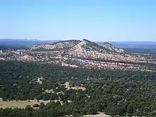 Red beds of the Baca Formation in the Sawtooth Mountains of New Mexico | |
| Type | Formation |
| Underlies | Spears Formation |
| Overlies | Mesaverde Group |
| Thickness | 694 feet (212 m) |
| Lithology | |
| Primary | Conglomerate |
| Other | Sandstone, claystone |
| Location | |
| Coordinates | 34.332°N 107.272°W |
| Region | New Mexico |
| Country | United States |
| Type section | |
| Named for | Baca Canyon |
| Named by | R.H. Wilpolt et al. |
| Year defined | 1946 |
 Baca Formation (the United States) 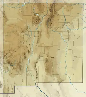 Baca Formation (New Mexico) | |
Description
The formation consists of coarse conglomerate, red and white sandstone, and red clay. Its total thickness is 694 feet (212 m), of which 80–140 feet (24–43 m) is conglomerate.[1] The formation rests unconformably on the Mesaverde Group and is overlain by the Oligocene Spears Formation.[2]
Fossils
The formation is relatively poor in vertebrate fossils, and only six of biostratigraphic significance have been found. These are the titanotheres Paleosyops and Manteoceras, an artiodactyl fossil trackway and Protoreodon fossil, and a small mammalian fauna at Mariano Mesa. The titanotheres are characteristic of the Bridgerian age while the trackways indicate a late Eocene age or younger.[2]
History of investigation
The formation was first described by R.H. Wilpolt and his coinvestigators in 1946 and named for exposures in Baca Canyon in the Sacramento Mountains.[1]
Footnotes
References
- Lucas, Spencer G.; Schoch, Robert M.; Manning, Earl; Tsentas, Costgas (1981). "The Eocene biostratigraphy of New Mexico". Geological Society of America Bulletin. 92 (12): 951. doi:10.1130/0016-7606(1981)92<951:TEBONM>2.0.CO;2.
- Wilpolt, R.H.; MacAlpin, A.J.; Bates, R.L.; Vorbe, George (1946). "Geologic map and stratigraphic sections of Paleozoic rocks of Joyita Hills, Los Pinos Mountains, and northern Chupadera Mesa, Valencia, Torrance, and Socorro Counties, New Mexico". U.S. Geological Survey Oil and Gas Investigations Preliminary Map. OM-61. Retrieved 31 July 2020.
