Bacton, Herefordshire
Bacton Welsh: Bactwn is a small village in the rural area of south-west Herefordshire, England, 14 miles (23 km) from Hereford.[1]
| Bacton | |
|---|---|
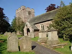
 Saint Faith's church, Bacton | |
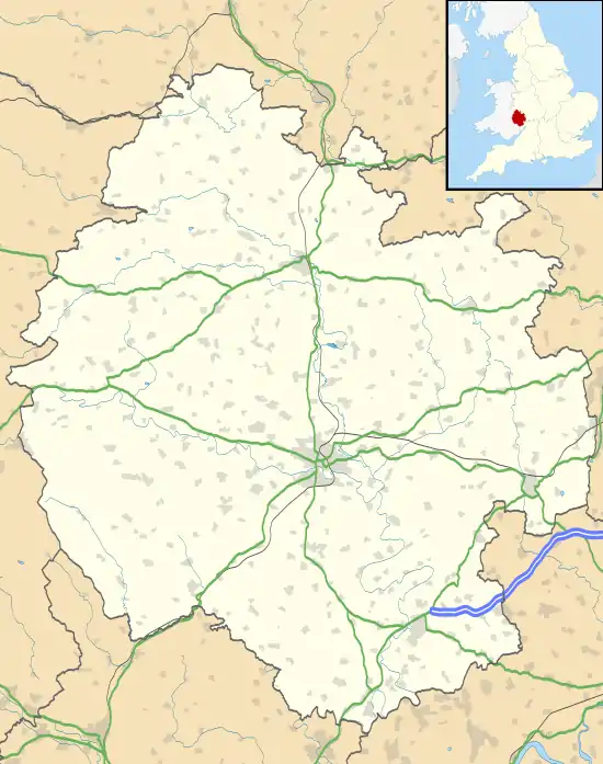
 Bacton Location within Herefordshire | |
| OS grid reference | SO369324 |
| Shire county | |
| Region | |
| Country | England |
| Sovereign state | United Kingdom |
| Post town | HEREFORD |
| Postcode district | HR2 |
| Police | West Mercia |
| Fire | Hereford and Worcester |
| Ambulance | West Midlands |
History

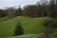
One mile to the north of the village are some earthwork remains of a small motte and bailey castle known as Newcourt Tump. ("Tump" is a dialect word for a rounded hill or tumulus.)[2] The castle seems to have fallen out of use by the 14th century.[3]
According to Domesday Book in 1086, Bacton, then in the hundred of Stradel, had a mere two households. The Lord of the Manor was Gilbert of Eskecot, whose tenant-in-chief was Roger of Lacy.[4][5] The history of the manor is relatively clear from the 13th century onwards.[6]
Parish church
The parish church of St Faith's dates from 13th century and has a lengthy entry in Pevsner's survey of the county's buildings.
Inside the church is Blanche Parry's memorial. It is possible that an altar cloth belonging to the parish church was made from a dress once worn by Queen Elizabeth I of England and given to Blanche Parry. The material of the cloth appears to form part of the clothing of the Queen in the early 17th-century "Rainbow Portrait", attributed to Marcus Gheeraerts the Younger.[7][8]
The church is now part of the Ewyas Harold group of parishes. It has a service about once a month.[9] Next to the church there is a village hall.[10]
Listed buildings
Bacton parish church is listed Grade II*. A further 16 buildings, barns and monuments dating from the 17th to 20th centuries are listed as Grade II, several of them in the churchyard.[11]
Transport
Bacton has only a single, daytime bus service to Hereford on Wednesdays.[12] The nearest railway station is at Hereford (14 miles, 23 km). Bacton is 4 miles (6.5 km) on the secondary B4347 road from the main A465 road between Hereford and Abergavenny.
References
- Ordnance Survey: Landranger map sheet 149 Hereford & Leominster (Bromyard & Ledbury) (Map). Ordnance Survey. 2009. ISBN 9780319229538.
- OUP site. Retrieved 20 October 2019.
- Historic England. "Monument No. 105885". PastScape. Retrieved 19 January 2017.
- Domesday entry: Retrieved 19 January 2017.
- More on Gilbert. Retrieved 20 October 2019.
- History site. Retrieved 20 October 2019.
- Smithsonian Magazine, 17 January 2017
- Bacton Church on Explore Churches site. Retrieved 20 October 2019.
- A Church Near You Retrieved 19 January 2017.
- Herefordshire Council Retrieved 19 January 2017.
- Listed Buildings in Bacton Retrieved 19 January 2017.
- Bus times. Retrieved 20 October 2019.
External links
 Media related to Bacton, Herefordshire at Wikimedia Commons
- Map sources for Bacton, Herefordshire
- Bacton in the Domesday Book