Bad Feilnbach
Bad Feilnbach is a municipality in the Upper Bavarian district of Rosenheim at the foot of Wendelstein Mountain in Germany. As a famous 'Moorheilbad' (moor healing spa) the municipality was awarded in 1973 the title "Bad". Since the 19th century the peat deposits were the basis for a continued expansion of the spa and health facilities. The recognized healing success of "black gold" on a variety of diseases were the basis for the development of a well-known spa and tourist community. Due to its wooded surroundings and the mild climate Feilnbach is called the "Bavarian Meran". The entire municipality is recognized as a healing spa resort except for parts of the former municipality Dettendorf.
Bad Feilnbach | |
|---|---|
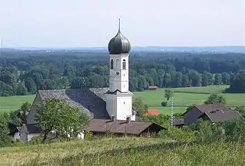
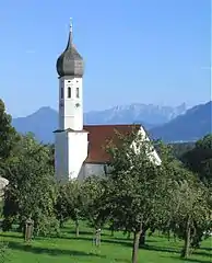
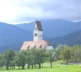 Church in the village of Lippertskirchen, part of Bad Feilnbach municipality | |
 Coat of arms | |
Location of Bad Feilnbach within Rosenheim district 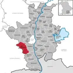 | |
 Bad Feilnbach  Bad Feilnbach | |
| Coordinates: 47°47′N 12°1′E | |
| Country | Germany |
| State | Bavaria |
| Admin. region | Oberbayern |
| District | Rosenheim |
| Government | |
| • Mayor | Anton Wallner (CSU) |
| Area | |
| • Total | 57.48 km2 (22.19 sq mi) |
| Elevation | 512 m (1,680 ft) |
| Population (2019-12-31)[1] | |
| • Total | 8,233 |
| • Density | 140/km2 (370/sq mi) |
| Time zone | UTC+01:00 (CET) |
| • Summer (DST) | UTC+02:00 (CEST) |
| Postal codes | 83075 |
| Dialling codes | 08066, 08064 (Au b. Bad Aibling) |
| Vehicle registration | RO |
| Website | Bad Feilnbach |
Geography
Bad Feilnbach is located directly on the northern edge of the Bavarian Alps, at the foot of the 1,838 m high Wendelstein. The village is located 17 km east of Miesbach, 10 km south of Bad Aibling, 15 km southwest of Rosenheim and 33 km from Kufstein. The Autobahn A8 (junction Bad Aibling) is 5 km away, German federal highway B93 (exit Reischenhart) 9 km, and the nearest railway stations in Bad Aibling and Raubling are 10 km.
Constituent communities
The municipality Bad Feilnbach has 77 officially designated districts:[2]
| 77 Designated Districts |
|---|
|
History
Feilnbach became an independent municipality in 1818, following administrative reform in Bavaria.
From 27 May 1897 until 1973 Feilnbach was at the end of the local railway Bad Aibling-Feilnbach.
On 1 January 1966, the municipalities Feilnbach and Wiechs were merged to form the new community Feilnbach-Wiechs whose name was changed on 28 December 1971 in Feilnbach.[3] Following municipal reform, on 1 January 1972 Bad Aibling was incorporated into the municipality. Dettendorf followed on 1 February 1972.[3] On October 22, 1973, the community received the additional title Bad (bath). Finally, the community Litzldorf was incorporated into Bad Feilnbach on May 1, 1978.[4]
On July 1, 1972, Bad Feilnbach, which was previously part of the district of Bad Aibling, was made part of the Rosenheim district.
The individual settlements were probably formed in Roman times and Feilnbach is first mentioned in 980 as "Fulinpah", which is derived from the name for a sluggish or slow flowing brook (Bach). The municipality extends from the foothills of Wendelstein far into the moorland of Rosenheim Basin, covering approximately 5,800 ha.
Crest History
The silver wave bar is a symbol of Bach (brook) and represents the main town Feilnbach, whose name was derived from "Faulenbach" (Fulinpah). The Silver Church was originally taken from the coat of arms of the nobles of Diepertskirchen. These gentlemen held the seat in Lippertskirchen from the beginning of the 11th to the late 15th century. The coat of arms was adopted in 1957 by Feilnbach and amended in 1966. In 1973 the town was awarded the title "Bad" and since then bears the name of Bad Feilnbach. Thus the place underlines its importance as a mud spa and natural healing village. (See. House of Bavarian History)
Population development (at December 31)
|
|
Source: Municipality Bad Feilnbach
Business, tourism and infrastructure
Several large spa and rehabilitation facilities are located in Bad Feilnbach. The treatments in these facilities are based on "Badetorf" traditional spa therapy. As the town of Bad Feilnbach has been a recognised Spa since 1973, several alternative healing method 'bathing' doctors and medical practitioners have settled in Bad Feilnbach. (TCM, homeopathy, herbal medicine, Ayurveda, Naturopathy...). The 4 star Bad Feilnbach Imperial Camping Outdoor Resort, with 800 parking spaces, is an integral part of the tourist offer of Bad Feilnbach since 1968.
Education and social services
- Primary and Secondary School Bad Feilnbach
- Elementary School Au
- four municipal nursery schools and two Catholic kindergartens
- Nursing home St. Martin
- Nursing, therapy and wellness center St. Luke
- Ecumenical Nachbarschaftshilfe Bad Feilnbach eV
- German religious rehabilitation center
Public institutions
- Municipality with spa and guest information
- Travel service the spa and guest information
- Volkshochschule Bad Feilnbach
- Swimming pool in Bad Feilnbach (heated)
- Swimming in Au
- Adventure playground "Burgaltendorf Waldeck" in Au
- Adventure playground "Alter Bahnhof" in Bad Feilnbach
- Religious and communal library
Spa and Health
- There are several spa and rehabilitation clinics and health clinics in the city:
- Clinic + more Reithofpark
- Clinic + more Blumenhof
- Outpatient therapy center Bad Feilnbach
Nature experiences and leisure experience facilities
- Jenbachtal and Jenbachwasserfälle
- Nature reserve Auer Weitenmoos
- Moorerlebnis station "Sterntaler felts"
- Theme "On Traces of God"
- Water experience "Jenbachparadies"
- Horses Region Upper Bavaria / Tyrol with remote bridleways
- Industrial monument "Old cement plant" in Litzldorf
 Jenbach waterfall
 Historic cement works
Parks
Bad Feilnbach has several "nature" parks in the municipal area and along the Jenbachtal. In the upper part of the Jenbachtal, an adventure trail, the "Jenbachwasser", follows the waterfalls and cataracts from the upper car park and the mountain pastures in Jenbachtal to the outskirts of the town. Later the adventure trail leads to the nature park along the lower Jenbach. There is the theme "On Traces of God" and the water experience "Jenbachparadies" with the water playground. Next to the City Hall and "Haus des Gastes" is a small spa with pavilion for spa concerts and events as well as a natural pool. The theme trails "On Traces of God", the "Moorerlebnis Sterntaler felts" and the "Jenbachparadies" were all funded by the EU LEADER program.
Politics
Council
Election of March 16, 2014 : Tenure from 1 May 2014 to 30 April 2020
- CSU : 10 seats
- SPD : 3 seats
- FW : 7 seats
Mayor
Mayor of Bad Feilnbach are:
- Mayor: Hans Hofer (FW)
- Deputy Mayor: Vitus Gasteiger (CSU)
- Third Mayor Sebastian Obermaier (CSU)
Sports
- SV Bad Feilnbach eV
- Tennis Club Bad Feilnbach eV
- SG Wendelstein eV (shooting club)
- Mini Golf Club Bad Feilnbach eV - 18 holes minigolf (concrete paths)
- ASV Au
- Au Ski Club eV
- EC Bad Feilnbach curling
Regular events
- Weibamarkt (April and November)
- Wendelstein tour in Au (August)
- Rossererfest (third weekend in August)
- Baths run (September)
- Bavaria's largest apple market with Gewerbeschau three days (second Friday, Saturday and Sunday in October)
- Plum Festival (September 3 to Sunday, Aumanwirt, Altofing)
- Leonhardiritt in Lippert churches (first or second Sunday in November)
- Grama-Schupfenfest in Lengenfeld village, Koal Schupf, second weekend in June
- Moss Prost in Dette village, every year at Pentecost
- Night flea market and street fair of volunteer firefighters Bad Feilnbach (June)
- Chor des Bayerischen week Sängerbund
- Spa concerts and cultural evenings
- Sommerfest in the Natural Park (June)
- Christmas Market in the Natural Park (December)
- Christmas Cup / indoor tournament of the SV Bad Feilnbach
Sons and daughters of the town
- Wolfgang Dientzenhofer (1648–1706), baroque architect
- Georg Dientzenhofer (1643–1689), baroque architect
- Abraham Millauer (around 1680-1758), architect, church builder
- Franz Xaver Gernstl (born 1951), filmmaker
Bad Feilnbacher churches
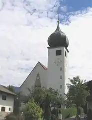 Kirche in Bad Feilnbach
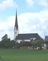 Au bei Bad Aibling
 Lippertskirchen bei Bad Feilnbach
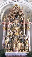 Altar in der Kirche von Lippertskirchen
 Kirche in Litzldorf
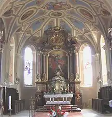 Kirche in Litzldorf
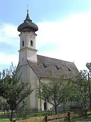 Kirche in Wiechs
 Kirche in Wiechs
References
- "Tabellenblatt "Daten 2", Statistischer Bericht A1200C 202041 Einwohnerzahlen der Gemeinden, Kreise und Regierungsbezirke". Bayerisches Landesamt für Statistik und Datenverarbeitung (in German). July 2020.
- http://www.bayerische-landesbibliothek-online.de/orte/ortssuche_action.html?anzeige=voll&modus=automat&tempus=+20111022/172115&attr=OBJ&val=503
- Wilhelm Volkert (Hrsg.) (1983), Handbuch der bayerischen Ämter, Gemeinden und Gerichte 1799–1980 (in German), München: C.H.Beck’sche Verlagsbuchhandlung, p. 425, ISBN 3-406-09669-7
- Statistisches Bundesamt, ed. (1983), Historisches Gemeindeverzeichnis für die Bundesrepublik Deutschland. Namens-, Grenz- und Schlüsselnummernänderungen bei Gemeinden, Kreisen und Regierungsbezirken vom 27. 5. 1970 bis 31. 12. 1982 (in German), Stuttgart und Mainz: Kohlhammer Verlag, p. 588, ISBN 3-17-003263-1
External links
| Wikimedia Commons has media related to Bad Feilnbach. |
- "Bad Feilnbach: History of the coat-of-arms" (in German). Haus der Bayerischen Geschichte.
- Website der Gemeinde Bad Feilnbach
- Bad Feilnbach: Amtliche Statistik des Bayerisches Landesamt für Statistik