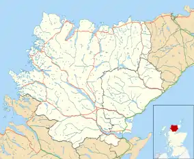
Badcall, Scourie
Badcall comprises two remote hamlets, called Lower Badcall[1] and Upper Badcall.[2] Upper Badcall, a crofting township, is a larger of the two and is situated on the western shore of Badcall Bay. Lower Badcall is located less than 1 mile to the east on the eastern shore of Badcall Bay. Badcall is on the west coast of Sutherland, Scottish Highlands and is in the Scottish council area of Highland.[3] [4]
Badcall
| |
|---|---|
 Badcall Location within the Sutherland area | |
| OS grid reference | NC153418 |
| Council area | |
| Country | Scotland |
| Sovereign state | United Kingdom |
| Post town | Lairg |
| Postcode district | IV27 4 |
| Police | Scotland |
| Fire | Scottish |
| Ambulance | Scottish |
Badcall Bay is reached by the A894, the west coast route to the very north of Scotland. The village of Scourie lies 2 miles northwest.
The bay is located in a remote area of outstanding natural beauty in a region designed as Scotland's first ‘Global Geopark’.
This beautiful region is studded with small islands and is home to The Eddrachilles Hotel and The Salmon House, HQ of Loch Duart Ltd, an independent salmon farm. Badcall Bay Holiday Caravans – a small family-owned site is nearby, on the outskirts of Scourie.
The Badcall area offers a wide range of opportunities has for walking, fishing, kayaking, climbing and hill walking throughout the area.
Gallery
 Badcall Bay.
 Badcall Bay from Upper Badcall.
 Badcall and Loch Inchard. These cottages enjoy one of the best views anywhere.
 Clar Loch Cnoc Thormaid The distant loch is Clar Loch Mor.
 Cliffs near Scourie Climbing cliffs near Loch a' Mhill Dheirg.
 End of the Badcall road. The end of the single track road to Badcall. From here on it is a grass strip down the middle of road to the last crofts around the corner.
 Fields below Badcall This is the view below the road as you enter Badcall from the west.
 Fish farming in Calbha Bay.
 Gate on Track North of Loch a' Mhinidh.
 Loch an Daimh Mor.
 Loch an Obain.
 Lochan near Loch nan Uidh
 Looking out towards Badcall Bay.
 The track above Geisgeil
 Towards Ceannamhor.
 Shallow Lochan
References
- Gittings, B.M. "The Gazetteer for Scotland:Lower Badcall". www.scottish-places.info. Retrieved 15 March 2016.
- Gittings, B.M. "The Gazetteer for Scotland:Upper Badcall". www.scottish-places.info. Retrieved 15 March 2016.
- Ordnance Survey: Landranger map sheet 9 Cape Wrath (Durness & Scourie) (Map). Ordnance Survey. 2008. ISBN 9780319231234.
- "Ordnance Survey: 1:50,000 Scale Gazetteer" (csv (download)). www.ordnancesurvey.co.uk. Ordnance Survey. 1 January 2016. Retrieved 18 February 2016.