Baima, Baxoi County
Baima (Tibetan: པད་མ།, Wylie: pad ma, ZYPY: Baima ; Chinese: 白玛; pinyin: Báimǎ) is a town in Baxoi County, Chamdo Prefecture of the Tibet Autonomous Region of the People's Republic of China.[1][2] It lies at an altitude of 3,772 metres (12,378 ft). As of 2020, it administers Baima Residential Community and the following eight villages:[3][4]
- Yoiba Village (ཡོལ་པ, 约巴村)
- Zhubba Village (སྒྲུབ་པ, 珠巴村)
- Nairab Village (གནས་རབ, 乃然村)
- Rixi Village (རི་གཞི, 日吉村)
- Wanbêb Village (ཝ་འབེབས, 旺比村)
- Samar Village (ས་དམར, 沙木村)
- Dêngka Village (སྟེང་ཁ, 丁卡村)
- Xaiba Village (གཤས་པ, 西巴村)
Baima | |
|---|---|
| Chinese transcription(s) | |
| • Traditional | 白瑪 |
| • Simplified | 白玛 |
| • Pinyin | Báimǎ |
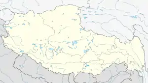 Baima Location within Tibet Autonomous Region | |
| Coordinates: 30°3′N 96°54′E | |
| Country | People's Republic of China |
| Region | Tibet Autonomous Region |
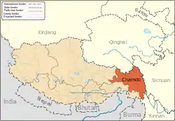
| Prefecture | Chamdo Prefecture |
| County | Baxoi County |
| Nearby settlements (distance) | Bamda 20.5 mi (33 km) Chongsar 29.4 mi (47 km) |
| Elevation | 3,772 m (12,378 ft) |
| Population | |
| • Total | 378 |
| • Major Nationalities | Tibetan |
| • Regional dialect | Tibetan language |
| Time zone | +8 |
| Climate | Cwb |
See also
- List of towns and villages in Tibet
Notes
- Wu Zhenhua (武振华), Xizang Diming (西藏地名; Place Names in Tibet), p.27, Chinese Zangxue Press (中国藏学出版社) 1996, ISBN 7-80057-284-6
- 2020年统计用区划代码和城乡划分代码:八宿县 (in Chinese). National Bureau of Statistics of the People's Republic of China. Retrieved 7 January 2021.
- 2020年统计用区划代码和城乡划分代码:白玛镇 (in Chinese). National Bureau of Statistics of the People's Republic of China. Retrieved 7 January 2021.
- "Geographical Names of Qamdo Prefecture-Level City". Institute of the Estonian Language. Retrieved 7 January 2021.
This article is issued from Wikipedia. The text is licensed under Creative Commons - Attribution - Sharealike. Additional terms may apply for the media files.