Bakura, Nigeria
Bakura is a Local Government Area in Zamfara State, Nigeria. Its headquarters are in the town of Bakura at12°42′37″N 5°52′23″E in the north-east of the LGA.
Bakura
baraden bakura Ibrahim muazu | |
|---|---|
relatedLGA and town | |
| Nickname(s): ima | |
| Motto(s): bakura garin burmi | |
 Bakura Location in Nigeria | |
| Coordinates: 12°09′N 5°54′E | |
| Country | |
| State | Zamfara State |
| Area | |
| • Total | 1,366 km2 (527 sq mi) |
| Population (2006 census) | |
| • Total | 186,905 |
| Time zone | UTC+1 (WAT) |
| 3-digit postal code prefix | 892 |
| ISO 3166 code | NG.ZA.BA |
It has an area of 1,366 km2 and a population of 186,905 at the 2006 census.
The postal code of the area is 892.[1]
References
- "Post Offices- with map of LGA". NIPOST. Archived from the original on 7 October 2009. Retrieved 2009-10-20.
State capital: Gusau | ||
| Local Government Areas | 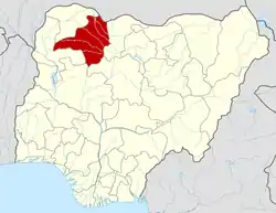 | |
This article is issued from Wikipedia. The text is licensed under Creative Commons - Attribution - Sharealike. Additional terms may apply for the media files.
