Ban Khai District
Ban Khai (Thai: บ้านค่าย, pronounced [bâːn kʰâːj]) is a district (amphoe) in the central or heart part of Rayong Province, eastern Thailand.
Ban Khai
บ้านค่าย | |
|---|---|
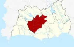 District location in Rayong Province | |
| Coordinates: 12°47′1″N 101°17′48″E | |
| Country | Thailand |
| Province | Rayong |
| Seat | Ban Khai |
| Area | |
| • Total | 489.6 km2 (189.0 sq mi) |
| Population (2005) | |
| • Total | 58,914 |
| • Density | 120.3/km2 (312/sq mi) |
| Time zone | UTC+7 (ICT) |
| Postal code | 21120 |
| Geocode | 2105 |
History
In 1767 after Ayutthaya was destroyed by the Burmese, King Taksin the Great lead his troops to build a Siamese military base at Chanthaburi. On the way to Chanthaburi, the troops had their night camp (Thai: khai ค่าย) in the area of modern-day Ban Khai District. Assumed that Ban Khai and the area called Ban Kao at that time was the center of Rayong.[1]
Ban Khai was created as a district of Rayong Province in 1902.
Geography
Neighboring districts are (from the west clockwise) Nikhom Phatthana, Pluak Daeng, Wang Chan and Mueang Rayong.
Administration
The district is divided into seven sub-districts (tambons), which are further subdivided into 66 villages (mubans). Ban Khai itself is a township (thesaban tambon) and covers parts of tambons Ban Khai and Nong Lalok. There are a further seven tambon administrative organizations (TAO).
| No. | Name | Thai name | Villages | Pop. | |
|---|---|---|---|---|---|
| 1. | Ban Khai | บ้านค่าย | 7 | 7,340 | |
| 2. | Nong Lalok | หนองละลอก | 11 | 11,470 | |
| 3. | Nong Taphan | หนองตะพาน | 6 | 3,504 | |
| 4. | Ta Khan | ตาขัน | 9 | 7,237 | |
| 5. | Bang But | บางบุตร | 12 | 9,666 | |
| 6. | Nong Bua | หนองบัว | 11 | 12,040 | |
| 7. | Chak Bok | ชากบก | 10 | 7,657 |