Wang Chan District
Wang Chan (Thai: วังจันทร์, pronounced [wāŋ t͡ɕān]) is a district (amphoe) in the northern part of Rayong Province, eastern Thailand.
Wang Chan
วังจันทร์ | |
|---|---|
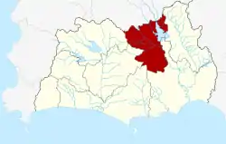 District location in Rayong Province | |
| Coordinates: 12°56′5″N 101°31′13″E | |
| Country | Thailand |
| Province | Rayong |
| Seat | Chum Saeng |
| Area | |
| • Total | 395.245 km2 (152.605 sq mi) |
| Population (2005) | |
| • Total | 24,481 |
| • Density | 61.9/km2 (160/sq mi) |
| Time zone | UTC+7 (ICT) |
| Postal code | 21210 |
| Geocode | 2104 |
History
The minor district (king amphoe) Wang Chan was created on 16 November 1977 by splitting off the two tambons Chum Saeng and Wang Chan from Klaeng District.[1] It was upgraded to a full district on 19 July 1991.[2]
Geography
Neighboring districts are (from the east clockwise) Khao Chamao, Klaeng, Mueang Rayong, Ban Khai and Pluak Daeng of Rayong Province, and Nong Yai and Bo Thong of Chonburi Province.
Administration
The district is divided into four sub-districts (tambons), which are further subdivided into 30 villages (mubans). Chum Saeng is a township (thesaban tambon) which covers parts of tambons Chum Saeng and Phlong Ta Iam. There are a further four tambon administrative organizations (TAO).
| No. | Name | Thai name | Villages | Pop. | |
|---|---|---|---|---|---|
| 1. | Wang Chan | วังจันทร์ | 6 | 3,959 | |
| 2. | Chum Saeng | ชุมแสง | 8 | 8,463 | |
| 3. | Pa Yup Nai | ป่ายุบใน | 8 | 6,855 | |
| 4. | Phlong Ta Iam | พลงตาเอี่ยม | 8 | 5,204 |
Gallery
.jpg.webp) Chum Saeng, Wang Chan District, Rayong 21210, Thailand
Chum Saeng, Wang Chan District, Rayong 21210, Thailand.jpg.webp) Chum Saeng, Wang Chan District, Rayong 21210, Thailand
Chum Saeng, Wang Chan District, Rayong 21210, Thailand
References
- ประกาศกระทรวงมหาดไทย เรื่อง แบ่งท้องที่อำเภอแกลง จังหวัดระยอง ตั้งเป็นกิ่งอำเภอวังจันทร์ (PDF). Royal Gazette (in Thai). 94 (116 ง): 4749. November 22, 1977.
- พระราชกฤษฎีกาตั้งอำเภอทุ่งตะโก อำเภอพะโต๊ะ อำเภอเขาค้อ อำเภอน้ำหนาว อำเภอวังจันทร์ อำเภอนาด้วง อำเภอเต่างอย อำเภอสิงหนคร อำเภอพระสมุทรเจดีย์ และอำเภอลำดวน พ.ศ. ๒๕๓๔ (PDF). Royal Gazette (in Thai). 108 (107 ก Special): 29–33. June 19, 1991.